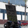
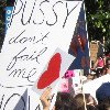
Can you spot the theme here?
 |
 |
 |
 |
 |
 |
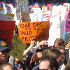 |
As I tell everyone, we’re really quite appalled by what’s happening in our country now. So we joined up with a few hundred thousand of our best friends and went to downtown L.A. to yell about it.
 |
 |
 |
 |
 |
 |
 |
As I tell everyone, we’re really quite appalled by what’s happening in our country now. So we joined up with a few hundred thousand of our best friends and went to downtown L.A. to yell about it.
 |
 |
 |
 |
 |
 |
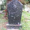 |
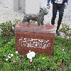
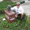
I recently read that there was a memorial monument at Hollywood Forever in memory of the dog who played Toto in “The Wizard of Oz”. So of course I figured it would have to be a sightseeing destination for the Sunday bike ride.
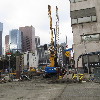
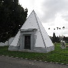
We started out heading into downtown L.A., and then out of downtown on 7th St. Along the way, we got to see how construction of the Regional Connector was coming along. The plan was to get to Larchmont Village for bagels at Noah’s, and then to go the short distance to the cemetery. When we got there, we asked the guy at the information booth, and he gave us directions to where the monument was. On our way there, we passed yet another pyramid crypt. I’d read some years ago that there were only three of these in Los Angeles County, and this one makes four. And we’ve been to see all of them now.
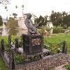
The bronze statue of Toto is life-sized, and I’m surprised I’d not seen it before, since it’s basically right across from the monument to Johnny Ramone. And while we were there, I stopped off to look at Dee Dee Ramone’s grave, which was covered with a larger-than-usual number of lipstick kisses.
For our route home, we began by taking the advice offered by Bette Davis, and we took Fountain. Then we crossed the L.A. River and headed up Eagle Rock Blvd, and then home across Highland Park and South Pasadena. It was a pleasant ride.
39 miles.
 |
 |
 |
 |
 |
 |
 |
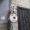
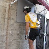
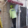
A few weeks ago, we went to an event at the Museum of Broken Relationships in Hollywood. Part of the event was a brief presentation by the Atlas Obscura people about a few odd things they know about in Los Angeles. One of the slides showed a person peering into a little hole in a wall in an alley behind a building. They said it was a miniature cinema that is continuously showing a few short films made by local artists. And GPS coordinates for it were in the footer of the email reminder about the event. So that night, I looked up where it was, and it turned out to be in an alley in Chinatown. So I figured that was going to be a bike ride one day. And today was the day.
We started out across Eagle Rock and Glendale, and then down the L.A. River bike path to Elysian Park. We rode up and over the hill to get to Echo Park and Chango Coffee. And after the stop there, we went back over the hill to get to Chinatown. Then we went in to Chung King Way to get to the little alleyway where we saw the small sign for the Peephole Cinema. We took turns standing up on the little step stool to be able to peer into the hole. It’s an odd little art project.
The route home took us back by way of Huntington Drive. This is usually our route to go into downtown, but this time we were riding the other direction, which felt a little odd.
36 miles.
Route map and elevation profile
 |
 |
 |
It rained all day on Saturday, and the forecast was for clearing, but still a small chance of rain on Sunday. So today we did the Metro Rail tour again. This was the original Metro tour, going through downtown and then west to Larchmont, with a return by way of downtown again. As it turned out, there was literally not a cloud in the sky. So it was cold, but we didn’t get rained on.
On the way home, we made a point to ride down Colorado Blvd in Pasadena to see all the people camping out to wait for the Rose Parade tomorrow.
44 miles.
 |
 |
 |
 |
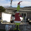 |
Christmas fell on Sunday this year, so we had a smaller-than-usual turnout for the Sunday bike ride. We did the old Whittier ride. We’ve done this one many times before. It’s a fairly easy route, and there was very little traffic out this morning, so that made for a pleasant ride.
43 miles.
 |
 |
 |
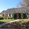 |
It’s the Sunday before Christmas, and time for our “It’s a Wonderful Life” theme ride. There’s not much to go see around this theme, since the movie was mostly shot on soundstages in Culver City and at a long-gone backlot in Encino. There was only one scene shot on location, and that was the Martini family moving into their new house in Bailey Park, and the house was played by a house in La Cañada that is still there, and still looks the same as it did in the movie. So we go see that, and pay a visit to James Stewart at Forest Lawn in Glendale.
A few years ago, we had a run-in with the security guard at Forest Lawn. Because of that, we now make a point of checking in at the front gate so that they know why we’re there, and then it’s not a problem. And this time, when we got to the top of the steep hill where James Stewart is buried, we were thinking that it wasn’t such a bad hill after all. This is largely because of our trip to Whittier last year to see Eazy-E from NWA. He’s at the top of a mile-long, fairly steep hill. That one was a hard hill to climb.
After Forest Lawn, we went and had coffee and eclairs at Paradise Bakery in Glendale. Then it was time for the long slog up Verdugo into La Cañada. The good side of that is that once we’re there, it’s nearly all downhill back home to Pasdena.
So yes, it was a Wonderful Ride.
36 miles.
 |
 |
 |
 |
This past week I saw an item on Curbed L.A. about the house that was the location for Jack Horner’s home in the 1997 movie, “Boogie Nights”. Apparently, it’s up for sale now, so I thought we should go and have a look at it.
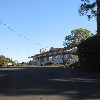
The house is on Cameron Ave in West Covina. We were very near there a few weeks ago when we went to see Rainbow Donuts. It was a bit chilly this morning, but still a nice day for riding.
The route was relatively flat, with a gradual downhill trend all the way there, and gradual uphill coming home. On the way back I saw signs offering to buy diabetic test strips. I had no idea that was even a thing.
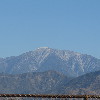
We got a nice view of Mt Baldy with a tiny little snowcap on top. I guess that’s there because we had a little rain last weekend.
41 miles.
I found out this past week that one of the people on the earthquake tour is a writer for the Los Angeles Times travel section. And she wrote a short article about our tour, and about how Atlas Obscura does tours of all sorts of odd things.
 |
 |
 |
 |
 |
 |
 |
 |
 |
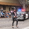 |
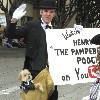
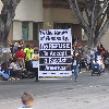
Today’s bike club ride was our old Mt Washington route, but cut a little bit short to end up at the Doo Dah Parade route right about when the parade was scheduled to start. I went to see the parade on my own in 2012, and the Sunday Ride went to see it in 2008.
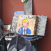
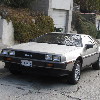
It was cool and overcast, and it even rained on us for a few minutes just as we were starting out. We headed up into Altadena and then to La Cañada. Then we had about seven miles downhill through Glendale all the way to Eagle Rock Blvd in Cypress Park. We made a loop around, and then headed up Mt. Washington. That was where we saw the garage sale with the “Fuck Trump” painting, and also the DeLorean with the “STAYNLS” vanity plate.
After going over the hill, we headed back home, ending up at the Doo Dah parade on Colorado Blvd. We watched the parade for a while before it started to rain. At that point, we bailed out and headed home.
32 miles.
Route map and elevation profile
 |
 |
 |
 |
 |
 |
 |
 |
Last year, I helped put on the San Andreas Scavenger Hunt with Atlas Obscura. It was pretty popular, and people have been asking when we’d do it again, so today was the day.
We met up at the Seismo Lab at Caltech for a quick tour. I brought everyone in to the first floor exhibit, where our geologist guide Kate explained the peel from Pallet Creek and told a bit of the history of trenching studies and how they tell us about the history of earthquakes at a site. Kate was a good guide for this, since she does trenches as part of her research at the USGS.
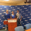
Next, we went upstairs to the Media Room, largely so everyone could see the room where the TV people go after an earthquake. Jen is the new staff seismologist at Caltech, and she spoke for a bit about how the displays work and how they are used after an earthquake.
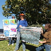
Then we all got on the bus for our first stop at the McDonald’s in San Fernando. This is the small fault scarp from the 1971 earthquake that they just sort of smoothed over and planted grass on. Kate brought along a poster that showed a map of surface ruptures from the 1971 earthquake.
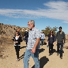
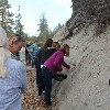
Our next stop was the overlook off the 14 freeway in Palmdale. That was a long ride from San Fernando. But it also meant we got to pass by Vasquez Rocks. I made sure to point out the famous spot where Captain Kirk faced off with the Gorn in the original series episode, “Arena”. When we got to the overlook, Kate explained what we were looking at and how we could see the trace of the fault stretching off into the distance. Then we got back on the bus for the short ride to Avenue S, where we walked up the hill to look at the famous road cut where the 14 freeway goes through a small hill that was pushed up by motion on the San Andreas.
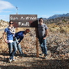
Our lunch stop was at Charlie Brown Farms, which is a weird little place in Littlerock. And after that, we went to our photo-op stop at the signs marking the fault line on Pallet Creek Road. We took a group photo, and make sure to point out that from that side, we could see the trace of the fault going off into the distance in both directions.
Then we went just a short distance down the road to the Pallet Creek site. This was where Kerry Sieh did his original trenching studies back in the ’70s and established a timeline of past earthquakes going back several hundred years. Kate does trench studies, so she was able to point out lots of details in the face where the fault trace was exposed.
The next stop was a road cut near Big Pine. One side of the cut is a hill of sandy fault gouge. I showed everyone how you can dig out seemingly-solid chunks of rock from the sand and crush them in your hands. That’s always a hit.
After a short stop in Wrightwood, we headed down the other side of the mountains. Then we turned off to go to the last stop of the tour at Lost Lake. As we got to the railroad crossing, there was a train slowly making its way up the mountain. And then it stopped. We sat there for a few minutes, and then a very long train came by, going down the mountain. We figured that the stopped train might be waiting for the downhill train to pass, so we waited it out. When the downhill train finished passing, the stopped train still sat there. And then another downhill train came by. We waited again until it had passed. Then the uphill train started moving again and finally cleared the crossing. And we finally made it to Lost Lake. Sadly, the drought has taken its toll, and the lake was no more. The bottom was soft mud, which shows that there is still a bit of water there, but not much. Also, there had been a fire there recently, and the parking lot gate was closed. This presented a problem for turning the bus around. We ended up having to back up about 1/4 mile to a turnout to get the bus turned around.
By the time we got moving again for the trip home, it was dark. And the traffic on the 210 freeway was very heavy. So we ended up getting back to Caltech about 1 1/2 hours later than planned. But it still seemed like everyone liked the tour.
Powered by WordPress