Stan’s Obligatory Blog

3/11/2018

The Metro Tour East

Filed under: — stan @ 12:41 pm

It rained all day Saturday, and there were still supposed to be scattered showers on Sunday, so the bike club ride for today was the Metro Rail Tour East. This is a ride to Glendora and back, and the route is designed to always be within two miles of the nearest Metro Rail station. That way, we have a quick bailout option available if it starts raining. We’ve done this ride many times before, so there wasn’t anything to take pictures of.

37 miles.

Route map and elevation profile

3/8/2018

ME72 Tank Wars

Filed under: — stan @ 5:44 pm

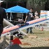
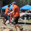
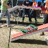
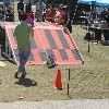
Today was the ME72 robot contest at Caltech. I’ve been going to see these things for over 20 years, and it’s always entertaining. The theme this year was “Tank Wars”. Each team had to build three tanks, and the tanks had to fight for control of three bases on the playing field. Each base had two buttons on it, and to take control of a base, one team’s machine had to push the button corresponding to the color of that team. One base was on the ground in the middle of the playing field. One of on a see-saw, and the third one was on top of a platform with ramps leading up to it from both sides. The ground base was worth one point for each second of control. The see-saw was worth 1.375, and the platform base was worth 1.75 points per second. As a result, most of the time, machines from both teams would go up to the platform, and a lot of times they ended up just alternating control of it for the duration of the match. So the point advantage of the platform wasn’t that much of a factor in most matches.

One funny thing was that they had a fire extinguisher handy by the playing field. This was because of the incident two years ago when one of the machines caught fire in the middle of a match.

The first match was won by the Riveters team. They had a clever strategy. In each match, they had one machine go and take control of the see-saw base. Then the machine would drive to the center of the see-saw and balance there, so no other team’s machine could even get on the see-saw. This worked well for them, and in the end, the Riveters were the only undefeated team of the day. And that included the final. Very well-done. They deserve both ears and the tail.


3/4/2018

Biddy Mason Memorial Park

Filed under: — stan @ 2:51 pm

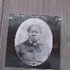
Last week, I saw an article on Atlas Obscura about Biddy Mason. who was born a slave in Mississippi in the early 1800s, and won her freedom after being brought to California. It was really a remarkable story, and it said there is a small park in downtown L.A. that tells her story. From the address, I knew we’d been by there a hundred times, but we’d never noticed it. So that was our destination for today.

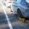
The ride was basically to downtown L.A., then home via Echo Park and the Arroyo Seco. We rode down Huntington Drive, and then Mission Rd. There is one stretch along Mission where there are always several cars with Denver boots on them.

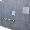
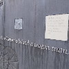
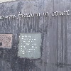
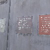
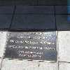
When we got downtown, we went looking for the park. It turned out to be in the alley behind the buildings there, which explains why we’d never noticed it before. The panels on the wall told her story. She really did have a remarkable life.

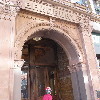
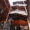
After looking at the park, we noticed that the alley we were in was right behind the Bradbury Building, which is an ornate old building that was J.F. Sebastian’s home in “Blade Runner”, as well as appearing in lots of other movies over the years. We had a look into the lobby there before continuing on our ride.

From downtown, we rode out 7th St to Westlake, and then up into Echo Park and our snack stop at Chango Coffee. As always, there were lots of Echo Park people with their absurdly-well-behaved dogs. I got a sort of artisanal version of an Egg McMuffin there.

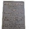
On the way home, we took one more short side trip. I’d heard recently that the city of Pasadena had put a plaque in front of the apartment building where President Obama lived when he was a student at Occidental College. So we had to go see it.

39 miles.

Route map and elevation profile

2/18/2018

Twin Pines Mall

Filed under: — stan @ 6:07 pm

Today’s bike ride was a visit to the Puente Hills Mall, which was the location used in “Back to the Future”, where Doc Brown first shows Marty the DeLorean time machine. It was kind of chilly this morning, but promised to warm up some and be nice later.

The route was planned to try and be as direct as possible, while avoiding a few major streets that I knew would be bad for riding. Still, the route was a bit longer than our usual rides. Fortunately, it didn’t have any major hills.

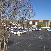
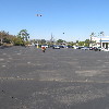
When we got to the mall, I found the spot that matched up with the screenshot from the movie. Then I rode down to the spot in the parking lot where Doc’s truck was parked. Fortunately, the parking lot was pretty empty, so I took a run across it, just to see if I could get up to 88mph. Sadly, not today. Then we all rode over to the corner of the parking lot, where there was a Panera Bread for drinks and snacks.

The route back was slightly different from the route going out. The underpass they are building to run Puente Rd under the railroad tracks still isn’t finished, so we had to take a bit of a detour. I guess I’ll have to figure out a different way to get through there.

49 miles.

Route map and elevation profile

2/11/2018

The Whittier Greenway

Filed under: — stan @ 3:02 pm

Today’s ride was the Whittier Greenway Trail ride. We’ve done this before, once to see the googie bowling alley sign, another time just to ride the whole length of the trail, yet another time to see the antique streetlights with the swastikas on them, and even one time to visit the site of a 1975 airplane crash.

Along the way, we also took a short side trip to the mall in Montebello. This mall overlooks the Pomona Freeway, and I had remembered that the scene from “Back to the Future” where Doc Brown first shows Marty the DeLorean time machine was filmed at a mall next to that freeway. But after riding around the parking lot once, it didn’t look quite right, and when I looked it up, it was filmed at the other mall next to that freeway. So I know where we’re going next week. Still, it was a nice day, and good for riding.

46 miles.

Route map and elevation profile

2/10/2018

The Museum of Failure

Filed under: — stan @ 8:21 pm

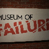
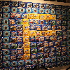
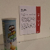
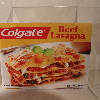
A few months ago, I saw an item in the L.A. Times about the Museum of Failure, which was a temporary exhibit of products and ideas that were complete and abject failures. It sounded funny. Of course, then I forgot about, and when I looked at the article again, it said that the exhibit was only until February 4th. Crap. But on the off chance something had changed, I had a look at their web site, and it said something to the effect of, “we’re such failures that we failed to close on the 4th, and we’re here for two more weeks”. So we had a second chance.

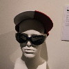
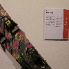
There were lots of things that were just kind of silly, some were weird ideas that left us wondering, “what were they thinking?”, and some were downright horrifying. They also had a few video monitors up, playing commercials for weird failed products. Like who thought that orange-juice flavored cereal was a good idea?

They had one fairly large exhibit devoted to Donald Trump, who has presided over numerous failed products, a failed airline, and even a few failed casinos.

The lobotomy tools definitely fell into the ‘horrifying’ category. The stories of movies made for budgets in the millions, but total box office gross under $1,000 were just funny. And of course, they had one bit about Olestra, the failed fat-substitute that added the term ‘anal leakage’ to our vocabulary.

All told, this exhibit was hilarious.


2/4/2018

The Cafe at Park La Brea

Filed under: — stan @ 2:52 pm

Today’s bike club ride was a trip out to Park La Brea and the little cafe inside. We went there once last summer, and it was a nice setting. The route went through Highland Park and Silverlake on the way out, and then back home by way of downtown L.A. All ground we’ve covered before. There wasn’t really any sightseeing along this route. But it was a nice day, so it was just pleasant to be out riding.

45 miles.

Route map and elevation profile

1/28/2018

Cookies L.A.

Filed under: — stan @ 4:58 pm

This past week, I saw an item in the L.A. Times about another cannabis store opening up, making it the third one in Los Angeles County. I looked it up, and it turned out to be in Maywood, which is just the other side of Vernon, and about two miles south of the Farmer John hog mural. So that was our destination for today.

We got a late start today. John had just put new tires on his bike, and they were very hard to put on. So he had two pinch flats. I ended up putting two new tubes in the tires, and then we were able to get going. We took our regular route to downtown L.A., down Huntington Drive. Along the way, I realized that it was the 28th, making today the 32nd anniversary of the Space Shuttle Challenger disaster. So we made a short detour to go through Little Tokyo to see the monument to Ellison Onizuka there.

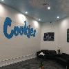
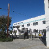
Leaving Little Tokyo, we took Santa Fe Ave south to get to Vernon. We turned off to pass by the Farmer John plant, and then continued on to get to Maywood. When we got to Cookies L.A., we were surprised at how big it was. The one we went to see in West Hollywood a few weeks ago was just a little storefront. But this one was a big industrial building. We didn’t think it would be open yet, but there were a couple of security guards by the door. It turned out that John’s flat tires had slowed us down just enough that the store had just opened. So we had to take a look inside.

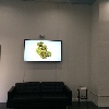
The lobby area looks like a fancy doctor’s office waiting area. Apparently, since cannabis is still illegal on the Federal level, the shop has to be a cash-only business, so there was a little ATM in the waiting area. And that was also why there were three guards outside. They had a little booth with a guy who checked our IDs. Then he opened the door so we could go into the actual store. There were a pair of doors, almost like an airlock to get inside. The actual store area looked like a big, fancy department store cosmetics counter. There were probably seven or eight people working there. I talked to one, and she showed me around the counter, explaining what different things they had available. It seemed like a very well-run operation. The guards outside told us that they had only opened last Tuesday, and that they had had lines out the door since then. We managed to not wait in line just because we happened along just when they first opened.

Leaving the pot shop, we headed back across Vernon. We saw the Southland Box Company. I thought there ought to be a whole herd of cats hanging around outside there. We also passed by the six or so houses there. Vernon is famous for being an industrial city with a ridiculously small population of only 113 people.

We rode back into downtown Los Angeles, and then out on 7th St to Bonnie Brae St, which brought us up to Echo Park. Out snack stop was at Chango Coffee there. I got a little artisanal breakfast sandwich there. And of course, there were several absurdly well-behaved dogs there.

At this point, my GPS hiccuped, and for some reason, it took no data on the trip from the coffee shop to Riverside Dr. Then it started up again, and recorded the rest of the ride. The route home took us through Highland Park, and then South Pasadena. It had turned into a very nice day, and it was a nice ride.

46 miles. Would have been maybe one mile more if the GPS hadn’t gone south.

Route map and elevation profile

1/21/2018

Airplanes

Filed under: — stan @ 4:15 pm

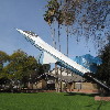
This week’s ride was the airplane-theme route to Burbank to see the F-104 on a stick in the park, and then to the airplane topiary at the entrance to Burbank Airport.

At the beginning, we had to take a little detour, since the Pasadena Half Marathon was today, and the Colorado Bridge was part of the course. The detour ended up taking us through the San Rafael Hills, and we were reminded of why we don’t usually go that way. Then we headed across Eagle Rock and Glendale to Burbank. When we got to Olive Ave, we turned off to the park where the F-104 is on display.

The topiary at Burbank Airport has filled out nicely. The bush inside it had died in 2013, and they replaced it with a new bush in 2014. After that, we headed south to our snack stop at Priscilla’s.

The route back send down the L.A. River, and then up the Arroyo Seco bike path. When we got to South Pasadena, I bailed out. We were running late, due to the detour at the start, and I needed to get home a little early. So I ended up taking the train back from South Pasadena.

40 miles, plus 2 more coming back from the Metro station

Route map and elevation profile
1/14/2018

West Covina

Filed under: — stan @ 2:55 pm

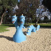
Today’s bike club ride was yet another visit to a filming location. In this case, it was The Lakes at West Covina, which was the little plaza and fountain that was the setting for the climax of the big “West Covina” musical number from the first episode of “Crazy Ex-Girlfriend”.

We took a kind-of roundabout route to get there, since the terrain out there is mostly flat. So this ended up being slightly on the long side for a regular Sunday ride. But that was all right.

47 miles.

Route mape and elevation profile
Powered by WordPress