Stan’s Obligatory Blog

12/28/2014

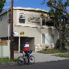
The Crapi Apartments

Filed under: — stan @ 2:53 pm

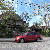
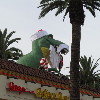
A few months ago, I saw an article about housing in Los Angeles that was illustrated with a picture of the “Crapi Apartments“. Like many people, I figured the picture was a photoshop gag, but Debbie from my office said that it’s a real building, and right across the street from where she lives in West L.A. So I knew we’d have to take a ride out there to see it. As a bonus, she also said that the Chee Zee Apartments are right around the corner. And then last week, I found out about the Hobbit House in Culver City, and we had a trifecta of oddness to go see. So today was the day.

It was kind of chilly starting out. And it’s 14 miles of steady downhill to get to downtown Los Angeles, so the first hour or so of the ride was pretty cold. But it got better, and by the time we were cruising on West Adams, it was pretty pleasant. When we got to Culver City, we turned north and took Venice Blvd west to Motor Ave. Then we headed north into the Palms section of L.A. The Crapi Apartments are on Overland Ave, just off Woodbine. So we had quick photo-ops at the Crapi and Chee Zee Apartments. Then we headed back to Venice, and turned east to head for home. The Hobbit House was about 100 feet off Venice on Dunn Ave.

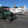
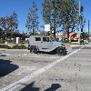
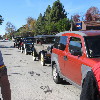
We stopped at Noah’s Bagels for snacks. Then we continued on home by way of Venice Blvd and 4th St. We ended up on Benton Way in Silver Lake, and then crossed the L.A. River and headed up to Eagle Rock. We took York Blvd across to South Pasadena. There was some sort of old-car-meetup going on, and there were several restored old cars out on the road. By then, it had turned into a very nice and sunny day. Perfect for riding.

53 miles.

12/7/2014

Another Neutra Tour

Filed under: — stan @ 2:03 pm

A few weeks ago, the L.A. Times Saturday section had an article about the Kun House in Hollywood. It’s a 1936 Neutra design, being restored to its original look. We’ve been on other architecture tours with Neutra houses, so I was curious to see this one, too. And the clincher for this one was that the house is now owned by Gerry Casale from DEVO.

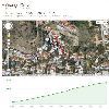
We rode over to Hollywood by our usual route, coming out on Hollywood Boulevard. We stopped off at the Chinese Theater to see if they’d put Mel Brooks’ handprints out yet, but they had not. So we kept going for another mile or so to just past Nicholls Canyon. We turned and went up one block into the hills, to a cul-de-sac just below the house. We looked up, but it was hard to see. We could only see a little bit of the house. So Jeff and I decided to ride up the hill another block to see it from the street up there. And wow, that was an adventure. According to Jeff’s Garmin thingy, it was a 23% grade:


We made it up the hill, and we got to see the front, and bit of the side of the house. So it was worth the effort.

Coming back down, we rode back across Hollywood and down to Larchmont Village. We stopped at the Noah’s Bagels there, and just in time. A sign on the counter said they were closing for renovation at 2:00 that afternoon.

Leaving Noah’s, we headed east across Hancock Park and Koreatown. Then north through Silver Lake on Benton Way. And finally, home by way of Eagle Rock. Along the way, I was telling Jeff about Nolden St in Eagle Rock, so we took a one-block side trip to go see it. Of course, Jeff had to have a go at riding it. As I guessed, he was able to ride up the hill, but he said it was very hard. I didn’t try this time, since the last time I tried that particular street, I slipped and fell on some wet pavement.

It was a nice ride.

44 miles.

11/30/2014

Rail transit – Old and new

Filed under: — stan @ 1:59 pm

Today’s bike club ride was a trip to Silver Lake to see the Corralitas Red Car Property, which is a little strip of vacant land where the old Pacific Electric Glendale Line used to run. The line was shut down in the mid ’50s, and the Glendale Freeway was built on part of the old right-of-way, but there is a little piece of it running from next to the freeway over to Fletcher Dr that has been sitting empty for decades.

We rode down there across Glendale, and then back down the L.A. River bike path. Then we took a short side trip off Riverside Dr to get to the old right-of-way. At that point, Carla turned off, since she didn’t want to ride up the steep hill, and she also thought it looked like it was about to rain. The rest of us rode up India St to where the old India St stop was. Here’s a photo from 1952 that shows a train passing right by where we were standing.

Leaving there, we headed south on Riverside. The plan was to go up through Elysian Park to go to Chango Coffee in Echo Park. At that point, Michael turned off. He had to go to work. The rest of us turned up Stadium Way. And then it started to rain. We stopped for a moment to consider what to do next. Robert and Pat wanted to just head home by the shortest route. I looked at the map, and I decided that my shortest route home was about 1 1/2 miles away at the Lincoln/Cypress Metro station. So I headed that way.

On the way there, I got a message from Michael. It said, “Got screwed on Fig” and had a picture of his tire with a screw head sticking out of it. I rode across the river, and there he was, standing on the sidewalk fixing the tire. The screw was so long that it went through both sides of the tube, and the point broke off in there. And then green tire-sealing goop leaked out all over it. Yick. But he managed to get the tire back together, and he continued on to work. I went around the corner and found the Metro station. They had a handicap ramp there, so I was able to ride all the way up to the platform. Then I took the train home. I got off at Allen, and I saw what looked like wet-bike-tire tracks going in to the elevator. I found out later that Carla had been on the train just a few minutes ahead of me, so those were her tracks. At that point, it was still raining lightly, and I rode the two miles home from the station. So yick. We got rained out. But at least the modern Metro Rail system allows us to have a bail-out plan for times like these.

25 miles.

11/29/2014

Sightseeing downtown San Diego

Filed under: — stan @ 9:17 pm

On Friday and Saturday this week, Lucinda and I went to San Diego to visit my father. He was sick for a while recently, and it’s only in the last month that he’s been feeling better. Since it’s a holiday weekend, the only Residence Inn that had suites available was the one in downtown San Diego. So we stayed there on Friday night, and on Saturday morning, I went out for a little sightseeing walk.

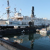
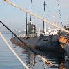
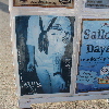
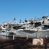
I’d seen the Star of India there before, but I hadn’t realized that it’s part of a larger maritime museum, and that they have both a Russian and a U.S. submarine on display there. All that, and an exhibit about sailors and tattoos. I think we will have to go there the next time we go.

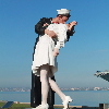
A little farther down, I passed the Midway Museum. We went to see that some years ago. Next to that was the “Unconditional Surrender” statue. I’d heard about this, but not been to see it before.

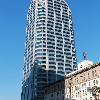
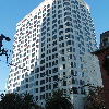
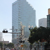
Heading back to the hotel, I went through part of downtown to see the buildings I’ve climbed in past stair races. The One America Plaza building is the tallest in San Diego, and we all climbed it last March. The 550 Corporate Center building is only 20 stories, but it was the location for the 2014 Towerthon. I climbed that building 20 times in two hours that day.

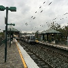
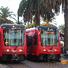
I walked through the San Diego Trolley station, where I saw the Orange and Green Line trains. Again, I think that San Diego MTS is channeling Magritte. The trains say Orange and Green on them, but they are clearly Red.

The last building I looked at was Columbia Center. This was the setting for the 2012 and 2013 Towerthon. Both times, I climbed the building 17 times in two hours.

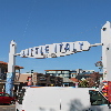
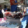
Back at the hotel, I got Lucinda up for breakfast, and afterward, we took a walk through Little Italy. They had a big farmer’s market going there. We got some fresh juices, looked around, and we were both a bit disturbed by the fresh sea urchins. Still, it was a fun time. And afterward, we went to visit with Grandpa.

11/23/2014

Update on the backyard boat

Filed under: — stan @ 1:15 pm

I’m still kind of tired and a little sore from yesterday’s hike up Cucamonga Peak, so today’s bike club ride is a relatively flat one, riding out to Sun Valley to get an update on the backyard boat.

It was kind of windy when we got out to The Valley. They were running Burbank Airport backwards, taking off to the north instead of the south, so that meant we had a headwind for the last part of the trip up Tujunga Blvd to Sun Valley. And when we got there, we were all a bit sad to see that the boat was still in the back yard. When we visited in May, Mr Griffith said that he thought it would be finished and launched by September of this year. But here it is November, and the boat is still on the rack in the back yard.

Heading back south into Burbank, we came to the weird five-way intersection on Whitnall. This is always a problem, since the detectors there never could pick up bikes, and there is no crosswalk, so there’s no button to push for a walk signal. But the city has installed a button for bikes to change the light. So that was nice.

Our snack stop was at Priscilla’s. And from there, we headed back across Glendale, and then up and over the Chevy Chase and Linda Vista hill to come out by the Rose Bowl. All in all, it was a nice ride.

46 miles.

11/22/2014

Cucamonga Peak

Filed under: — stan @ 10:38 pm

Last month, when we climbed Mt Baldy, Karina had mentioned that she thought that the hike up Cucamonga Peak was actually a bit harder than the Baldy hike. Given how hard Baldy is, I was a bit skeptical. Still, I’d always wanted to try Cucamonga Peak, since it’s one of the highest mountains in the front part of the San Gabriels.

We started up the trail at 9:23 in the morning. It was promising to be a nice day, although we thought that there might be a bit of snow up high, since it had rained a tiny bit a couple nights ago. Starting out up Ice House Canyon, we passed by several cabins, and several more ruins of former cabins. Judging by the size of the boulders in the canyon that had pretty obviously fallen from high up, it was not surprising to see that some of the cabins had been destroyed. As we got a little higher up the canyon, we could see that there was a thin layer of snow on the south wall of the canyon. The north wall was in sunlight, and the snow there had melted. There were just some small patches in the shade of trees or rocks.

At that point, the trail got steep, and we went up a series of big switchbacks to climb up out of the canyon. And then we came out in Ice house Saddle. At that point, there were trails going off in different directions to climb various nearby peaks. It was here that I realized how cold it really was, and I put on my sweatshirt and sweatpants.

The trail to Cucamonga Peak goes around the side of Bighorn Peak, and the first part of the trail is across the north side of the mountain. There was quite a bit of snow there. The side of the mountain there is very steep, and the trail is just a narrow path carved into the steep slope. With snow on it, it was really kind of scary. I got out both my poles to use for balance and stability.

As we came around to the saddle between Bighorn Peak and Cucamonga Peak, the snow went away, although the trail was still crossing some intimidatingly-steep slopes. When we got to the saddle, we stopped and had lunch. From the sounds we were hearing, it sounded like the wind was blowing pretty hard higher up, so we figured that it was probably better to stop in the relatively-sheltered saddle for lunch. While we were there, another group of three hikers passed us. We had passed them on the way up Ice House Canyon, so I said we should make it our goal to catch them before the summit.

Leaving the saddle, the trail started up some more steep switchbacks, including a couple of crossings across a big scree slope that kind of gave me the willies. Fortunately, it was on the west side of the peak, so there was no snow there. There was more snow farther up the trail, but the north-facing slopes there had a fair number of big trees on them, so it didn’t feel so exposed. We caught up with the other group just a short distance below the summit.

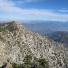
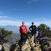
At the top, I made a point to climb up and stand on top of the highest rock, just, you know, because. We had a look at the view down into Cajon Pass, where we’d been on the office field trip last week. I was particularly impressed by how steep and rugged the south face of Etiwanda Peak was. After a few minutes, the other group came up to the summit, and we got them to take our souvenir picture with the view. I also gave them some of my water, since I wasn’t going to use all that I’d brought along.

When we started back down, we made much better time than on the way up. It first, I thought we’d make it back before sundown, but we really missed that extra hour of sunlight that we had for Baldy last month. And sunset came when we were still about a mile from the end. At that point, i was glad that I’d thought to put a flashlight in my pack. It wasn’t a particularly bright one, but it helped. And we made it back to the end. On the way home, we wondered what had become of the group we’d seen at the top, since we didn’t see them at all on the way down, so they must have come down much later than us. Anyway, it was a fun hike, and yes, I agree now that it’s harder than Mt Baldy. I also think that a hike this long was perhaps a bit over-ambitious for this time of year. We really didn’t like walking that last mile in the dark. Still, it was a good time.
11/16/2014

In-N-Out Museum

Filed under: — stan @ 2:34 pm

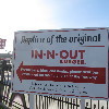
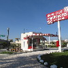
Today’s bike club ride was a trip to Huntington Park to see the world headquarters of In-N-Out Burger, as well as the site of the original In-N-Out. We’ve been to see it before, back when I read that the original location was being demolished. At the time, they didn’t say what was going to happen with the site, but today, we found out that they built an exact replica of the original In-N-Out Burger on the site. So we can see what it looked like when they first opened in 1948.

It was a nice day for riding. We headed out from the park, first with a little jog to the west to pass by the Pasadena In-N-Out, which has the distinction of being the oldest In-N-Out Burger location still operating. Then we headed south and east, going through a bit of West Covina to get to Huntington Park, and the location of the original In-N-Out. The replica is pretty small. I guess that when they first opened, they had no idea just how much business they’d be doing. But the little booth-style building looks a lot like the one in Pasadena, although it looks like the Pasadena one has added more building behind the booth, I guess to be able to sling more burgers.

Our snack stop was at Panera in West Covina. Inside, I saw that they’d installed little touch-screen kiosks to order from. The sign said that if I ordered there, I’d get a free cookie with my order. So I used the little screen to order, and then I took the table locator back outside. And when I got my order, I got a cookie! So that was nice.

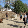
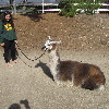
The route home went through Santa Fe Dam and up the bike path. Then back across Monrovia. That was where I saw the three women out walking three llamas on leashes. These were the first llamas I’ve seen since we went to see Lorenzo the Llama, back in 2009. And I certainly didn’t know that llamas could be walked like big dogs. But there they were, and one of them was even lying down and rolling in the dirt like a big dog. So that was a novel thing to see on a Sunday morning.

46 miles.

11/15/2014

CFF Climb, 2014 Edition

Filed under: — stan @ 3:00 pm

It’s time for the last race of the year here in Los Angeles. The 54-story climb up the Wilshire-Figueroa building. It’s 1,245 steps to the roof. I know, because I counted them. This year marks the fifth time the Cystic Fibrosis Foundation has held this event, and the fifth time I’ve done it.

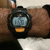
I’ve not been going especially fast on the stair this year. But after the sciatica and other issues I had last winter, I’m glad to be able to do stairs at all. So my goal for the day was to try and do a decent pace, and I was hoping to make it to the roof in under 10 minutes. My target pace was 5 1/2 floors per minute. The staircase is very consistent all the way up to 49, so my plan was to check my watch at 12, 23, 34, and 45. At each of those points, I should be at 2, 4, 6, and 8 minutes. Last year, when I was in somewhat better shape, I did it in 9:29.

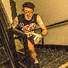
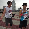
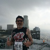
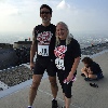
I went up in the first group. I went behind the really fast guys, and I was alone for most of the climb. I think one person passed me. The first photo was taken by a photographer in the stairwell. I don’t know what floor it is, but because of where my feet are, I know it’s above the 21st floor. And because I have no memory of seeing a photographer, I’m guessing it was probably above the 40th floor. At the roof, I stumbled out of the stairs and collapsed as soon as I’d crossed the timing mat. And as it turned out, I was perfectly placed to photobomb Mark and Lisa’s picture. After a few minutes, I was recovered and able to stand up for a picture before heading back down.
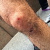
At the bottom, I found Kathleen, and we got in line for her climb. I was going to climb with her to keep her company. While we were waiting in line, Madeleine came up and took a picture of my knee. I’d gotten a bloody scrape from the concrete helipad on the roof, and I hadn’t even noticed it.

Kathleen and I walked up the building. At the top, we took a picture, and then we came back down for the post-race party. It was a fun little outing.

11/12/2014

Last practice

Filed under: — stan @ 9:44 pm

Tonight was the last practice on the stairs before Saturday’s CFF Climb. I was sick last weekend, so I missed the practice on Monday. I’m only just now recovered, so wanted to go tonight, but not to try and go fast.

I ended up going up three times tonight. For some unknown reason that I won’t complain about, my knee that has been giving me problems has decided to go back to feeling normal. So I was able to climb the 51 floors three times tonight, and I didn’t even take any ibuprofen or anything else beforehand. So I guess that means I’m as ready as I’m going to be for the race Saturday.

Field Trip!

Filed under: — stan @ 8:50 pm

A few weeks ago, Sue Hough sent an email out to the office to see who would be interested in a field trip to tour the San Andreas Fault in the Antelope Valley, a bit north of Los Angeles. The sights would be taken from her book, Finding Fault in California. As it turned out, there was quite a bit of interest. In the end, it was enough interest that we rented a 24-passenger bus and driver for the day so we could take the trip.

We met at the office early Wednesday morning, and then we headed out. We went past JPL, which is located right on the trace of the Sierra Madre Fault, and has a very nice, steep scarp right behind it. Our first real stop was the small fault scarp next to the McDonald’s at 1955 Glenoaks Blvd in San Fernando. This scarp was formed in the 1971 San Fernando Earthquake. I took the bike club there to see the scarp last June.

Continuing on up the freeway, we went through the 5/14 freeway interchange. This interchange fell down in the 1971 earthquake. It was rebuilt, and then fell down again in the 1994 Northridge Earthquake. Then we went up the 14 freeway, through the mountains, coming out in Palmdale. We went one exit farther up the freeway than we needed to, since that let us go through a somewhat-famous road cut on the freeway. It’s where the freeway crosses the trace of the San Andreas Fault, and in that cut, the rock layers look particularly jumbled and twisted from the motion of the fault.

Heading east out of Palmdale, we went along the northern edge of the San Gabriel Mountains. We stopped for a photo-op at a place where some people put up signs on the road to mark the trace of the fault. Makes it really easy to find, when there’s a big sign pointing it out. This site was very near where Kerry Sieh did his first trenching studies on the fault, back in the ’70s.

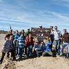
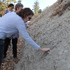
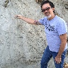
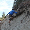
A little while later, the road started to climb into the mountains, still following the trace of the fault. We stopped at another road cut where the cut went right through the fault gouge. The side of the cut was basically packed sand and pulverized rock. Digging into it with our hands, there were some solid pieces of rock buried in there, but as Sue showed us, those solid pieces were actually shattered, and we could crumble them to sand in our hands. We also saw a tree there that was kind of bent at the top. There has been some research done on trees in that area that grow along the fault line. There are trees that show signs of having been broken off in past earthquakes.

In Wrightwood, we took one small side trip to look at some recent debris flows, and how the town has attempted to guide future debris flows to minimize damage to the town.

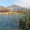
Coming down the east side of the mountain from Wrightwood, we ended up coming out by the 15 freeway in Cajon Pass. We took one more side trip to see Lost Lake, which is a small sag pond on the fault there.

This made for an interesting day of sightseeing. Have I mentioned lately that I really like my job?

Powered by WordPress