Stan’s Obligatory Blog

3/15/2015

The Wistaria Vine

Filed under: — stan @ 4:18 pm

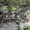
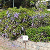
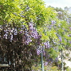
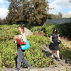
Years ago, I saw an episode of Huell Howser’s show where he visited the giant wisteria vine in Sierra Madre. And now that I’ve been living two miles away from it for 20 years, I figured it was time to go see it. So today was the “Wistaria Festival” in Sierra Madre. They deliberately spell it that way, although I have no idea why. But they have a big street festival in the center of town, and the yard where the vine is growing is open for tours.

The story is that the vine came in a 1-gallon pot, and it was planted about 120 years ago. It grew up and over the original house, crushing it. A new house was built off to the side, and the owners constructed a steel trellis for the vine to grow on, and it now takes up two whole lots. The festival is timed to coincide with the relatively short time it spends blooming every spring. So we went to the festival and had lunch before heading up the hill to see the vine. And yes, it’s big. It covers most of the space between two houses. It’s not obvious from the street, since I’d ridden my bike down the street by the vine a few weeks ago, when I was scouting out where the trail to Jones Peak started. After taking in the vine, we walked back down the hill and browsed around the festival a bit more before heading home.

Update on the NoHo Barrel

Filed under: — stan @ 1:17 pm

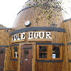
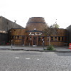
Today’s bike club ride was another trip to North Hollywood to check out the barrel-shaped restaurant. We’d gone to see this in January when it was being renovated, but I’d read recently that it was finished and open for business. So it was time to go see it again.

There’s a spot on Riverside Drive where businesses park their trucks as advertising while they’re not being used. There’s the “Hot Topless Maids” van, and today there was also a junk-hauling truck. And thanks to reality TV, apparently now “Extreme Hoarding” is a thing.

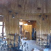
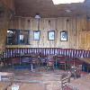
When we got to NoHo, the barrel was all out in the open and nicely refinished. We were able to peek in the windows and see the inside, and it really looked pretty good.

After looking at the barrel, we continued on up Vineland Ave to Chandler, where we stopped for snacks at the Panera across the street from the Metro Red Line station. That was where we’d caught the train home three weeks ago when the ride was rained out.

Heading back on the Chandler bikeway, we came across a big group of people running around in circles carrying medicine balls. I guess that’s one of those fitness boot camp things. I think riding the bike is just more fun. And we get to cover a lot of ground. And today, I finally got my photo-op riding the shaggy dog sculpture in Burbank. That makes for a companion to the time I got to ride the rattlesnake sculpture in Rattlesnake Park or when Lucinda was a little kid and like to ride the little fox sculptures in the park downtown.

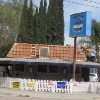
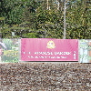
On the way back on Riverside Drive, we saw that apparently Rene Magritte has a hamburger stand now. It must be, because the sign clearly says “Not a Burger Stand”.

44 miles.

Here’s the route map and elevation profile.

3/13/2015

The view from Mt Hollywood

Filed under: — stan @ 11:10 pm

A couple days ago, I ran across this article:

http://la.curbed.com/archives/2015/03/spotlights_los_angeles_marathon_route.php

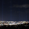
The plan was to put up 27 powerful searchlights along the Los Angeles Marathon route from Dodger Stadium to Santa Monica, and have them turned on for about 90 minutes on Friday night. Of course, in their artist’s conception, it looked pretty cool. While it remained to be seen how good it would look in person, I was curious.

I figured that any suitably high overlook would be mobbed with people trying to see, so I thought that hiking up Mt. Hollywood in Griffith Park might be a good alternative. There’s usually a small crowd up there on any normal night, but regardless, I figured the fact of having to hike several miles to get there would ‘thin the herd’ a bit. So in the end, I went there with Karina, Morgan, and Jason from my office, and we hiked up the back side of the mountain.

This was my first time hiking this mountain since 2011. We went by way of the ‘anklebreaker trail’. I don’t know why they call it that, since it’s not a bad trail by any means. In any event, it was a fine way to get up the mountain, and we were at the top in just about one hour. At the top, there were a lot of people. More than on a regular evening, but still nothing like the crowds that had to be down below at the observatory. Looking down, I could see the road up to the observatory, and it was packed solid with cars, and nobody was moving. So I was glad not to be there.

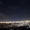
We broke out some snacks while we were waiting for the 8:40 to come around. I put my camera on the tripod and took some test photos of the city lights, just to get a feel for how different exposure times would come out. I started at 1/30 and went up to a full second, and I figured that the longer exposure would give the best results. Fortunately, between the tripod and the remote shutter release, I was able to keep the camera very still for the shots.

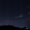
When they turned on the searchlights, it wasn’t as spectacular as the artist’s conception. If there had been more haze, it would have been better. But I started taking pictures, and with some more experimenting, I found that by pushing the exposure time up to 6-8 seconds, I could get the lights to show up pretty nicely. So I took several photos looking toward the marathon start near downtown, and several more looking toward Santa Monica.

We looked at the lights for a little while before we had to head back down so we could be out of the park before the closed the gates at 10:30. On the way down, I stopped and took one more picture of the lights, this time with the mountain blocking the city lights. For that shot, I put the exposure up to 15 seconds, since I didn’t have to worry about city lights being overexposed.

On the way down, we took the fire roads most of the way. It was a little longer, but very easy to follow in the dark. And I got to try out the uber-powerful little flashlight I got last November, after Karina and I got caught in the dark on the way back from Cucamonga Peak. It worked quite well, so I was happy. This was a pretty fun little adventure.
3/8/2015

Another ride to Glendora

Filed under: — stan @ 12:50 pm

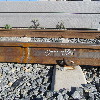
This Sunday’s bike club ride was our old route to Glendora. The main reason I wanted to do this was so we could stop in at the Gold Line station under construction in downtown Azusa and see the spot where Carla and I got to watch them thermite-welding the rails together last month. I was curious to see what the weld looks like now that it’s cooled and finished.

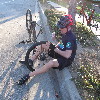
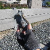
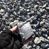
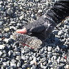
Right away, Michael got a flat before we’d even gone one mile. So we stopped and fixed that. A little while later, when we got on the San Gabriel River bike trail. There, I ran over something and I got a flat, too. After fixing that, we headed into Azusa and rode to the train station. We found the weld, nicely finished, and with writing on the side of the rail, recording who did it and when it was done. Rooting around in the ballast around there, we found some small chunks of slag from the ceramic mold and casting sand they used to make the form around the weld. We also found some chunks of what was essentially cast iron, from the excess molten metal that came out the sides of the mold during the welding process.

Continuing on, we rode into Glendora, where we stopped for coffee and snacks at Classic Coffee. Then we headed back by way of Cypress Ave, passing the Huy Fong Foods hot sauce factory in Irwindale, before riding over Santa Fe Dam to get back to the bike trail. And at that point, Michael got yet another flat. After fixing that, we figured it was probably best to just head home by the most direct route possible.

3/7/2015

Mt Lowe

Filed under: — stan @ 4:17 pm

I’ve been wanting to hike to the actual summit of Mt. Lowe for some time. I did it once, back in about 1985 or so, but that time, we started at Eaton Saddle, over by Mt. Wilson, so it was a very easy hike. This time, we were going to do it the harder way, starting at Lake Ave in Pasadena. Still, it turned out to be quite a bit harder than I’d anticipated.

The hike up to Echo Mountain was pretty easy. We’ve done that plenty of times before, and there’s not much to it. From there, we headed up the Castle Canyon trail to Inspiration Point. I’ve only done that once before, so I didn’t remember much about it. I didn’t remember that the hike from Echo Mountain to Inspiration Point is actually a bit harder than the hike to Echo Mountain. And it’s really quite steep at the end. But we made it just fine, and spent a few minutes looking at the view from up there before continuing on to Mt Lowe.

According to the map, it’s about 1 3/4 miles from Inspiration Point to the top of Mt Lowe. And as it turned out, it was reasonably steep, too. The trail wraps around the north side of the mountain, and there was even some snow on the trail there. But when we got to the top, there was a bench to sit on, and a very nice view in all directions. Looking down into the valley, I could see the Caltech campus, so the net time I’m stair-climbing at Millikan Library, I’ll have to take a minute to look up and see which peak is Mt Lowe.
On the way down, I fell once. It was the usual thing of slipping on some sand on a steep part of the trail. But this time, after slipping just about a foot, my foot caught on a rock, and I ended up rolling forwards. For a brief moment, I thought I might end up rolling down the hill, but I was able to stop the roll and avoid going over the edge of the steep slope. Still, my hat came off and rolled down the slope, where it ended up impaled on a yucca plant. I had to walk down to the next switchback, which was below the yucca plant, and then I was able to climb up on a tree and rescue my hat by knocking it loose with one of the hiking poles. Sheesh. But I figured that Indiana Jones never left his hat behind, either.
When we got back down, we had 12 1/2 miles, and I know I’m going to be sore from this. Here’s the route map and the elevation profile.

http://1134.ddns.net/routemap.php?xmlfile=MtLowe

2/28/2015

The St Francis Dam Disaster

Filed under: — stan @ 5:32 pm

Back in 1978, I rode in the Bouquet Canyon Road Race, which was a bicycle race that went up Francisquito Canyon, across through Green Valley, and back down Bouquet Canyon. And at the time, I remember us riding up the canyon, and then, where the road went through a narrow spot, I saw great chunks of concrete next to the road. It was obviously the rubble from some great structure that had met an untimely end. So, years later, I looked it up and read about the St Francis dam and its collapse in 1928. And today, the Obscura Society was doing a tour of the site.

We met up at the fire station that is below the dam site, and next to DWP Power Plant #2. They had a small exhibit with photos of the dam both before and after the collapse. Our guide for the tour was Ann Stansell, who has studied the disaster, and who wrote her thesis about it. After looking at the photos and at the power plant, we all headed up the road to just above the dam site.

The old road through the canyon that I remembered riding on had been washed away in about 2005, and a new road was built around the washed-out section. So we met up at the top of the abandoned section of the road, and then we walked back down the canyon to the actual dam site. Along the way, we saw the foundations of a small hotel that had stood in the canyon before being flooded out when they started filling the reservoir.

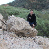
When we got to the dam site, we could see the big piles of concrete rubble that I’d seen in 1978. It was all more overgrown now, but still an impressive pile of rubble. While we were standing there, I had a look at the west wall of the canyon. That was the rock that was implicated in the collapse, as it is a soft rock that I was able to break apart with my hands. In the final report on the collapse, it was described as “a reddish conglomerate which, even when dry, was of decidedly inferior strength and which, when wet, became so soft that most of it lost almost all rock characteristics.”

The group was going to climb up to the remains of the wing dike on the hillside above the west wall of the canyon, but before doing that, I followed Sandi down into the rubble field to see the big chunks of concrete.

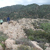
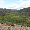
After looking at the rubble close-up, I headed up the hillside to catch up with the group. They’d said that it was steep, and kind of a hard climb. But I figured it couldn’t be much worse than climbing skyscraper stairs, and I was able to catch up with them. And at the top, we got to see the remains of the wing dike. We walked out to the end of it, and from there, we could look across the canyon and visualize what the dam looked like when it was still standing. It was really pretty large. Ann also pointed out that the trees growing in the part of the canyon that used to be the reservoir are much greener and thicker than the ones below the dam site. She said that during the few years that there was a reservoir there silt collected on the bottom, and apparently the trees like that.

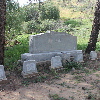
Leaving the dam site, we headed downstream a few miles to see the Ruiz family cemetery. A large number of the Ruiz family members were killed in the flood, and they were all buried there. The cemetery itself is on a small hill, so it was just above the level of the flood waters.

2/23/2015

The Garden of Water and Fragrance – Heh…

Filed under: — stan @ 4:37 pm

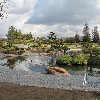
Last March, we had a chance to take a tour of the Hyperion sewage treatment plant. When we were there, they mentioned that there is another plant in Van Nuys that treats some tens of millions of gallons of wastewater every day, and it’s the reason why the Los Angeles River has water in it year-round now. And this week, the Obscura Society people set up a tour of it. The Tillman plant is quite a bit smaller than Hyperion, but it has the distinction of having a nice artificial lake and a Japanese garden outside, and the main building was used as the exterior shot of Starfleet Academy in several episodes of “Star Trek: The Next Generation”.

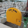
When we got there, they put us in hard hats for the tour of the plant. Just as at Hyperion, the headworks building was pretty smelly. From there, the water went to the aeration tanks, which had big brown frothy mats of bacteria floating on top. Yick. We were all a bit horrified by the life preserver rings they had next to each tank. But I guess the only thing worse than falling into a tank of sewage would be to fall into a tank of sewage and drown. That would be worse than being a drummer for Spinal Tap. After that, the water went to skimmers that skimmed off the floating material and whatever settled to the bottom. And finally, the relatively clear water was chlorinated to kill bacteria, and then de-chlorinated before being released into the lake, to Lake Balboa across the street, and into the L.A. River.

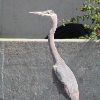
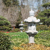
After the plant tour, a second docent took us on the tour of the Japanese Garden. And yes, he said that the choice of the garden’s name as “The Garden of Water and Fragrance” was deliberate. He took us around, pointing out the various birds, and the rocks and plants, with some attention to the aesthetic goals of how things were set up there. Along the way, we stopped in at the Tea House, which was used for filming a scene from “Austin Powers: International Man of Mystery“. Apparently, the garden gets filmed a fair bit. Finally, we walked around the outside of the lake and over the zig-zag bridge.

It was an interesting and entertaining tour. And hey! Starfleet!

2/21/2015

More odd things I see when I’m riding my bike

Filed under: — stan @ 1:00 pm

I went out for a little ride today. Mostly because I needed to stop by my office and water the plants, but also just because it was a nice day. So after leaving the office, I kept riding. When I was near the Rose Bowl, I saw signs for “Air and Style”. I had no idea what that was, but when I was crossing the bridge that’s just up the hill from the Bowl, I looked over and immediately stopped. I saw a giant ski-jump ramp, covered in what I guess is shaved-ice fake snow, and guys on snowboards going down it and flying through the air. This was sufficiently bizarre that I had to alter course and go down the hill to see it better. I watched for a bit, just marveling at how big the thing was, and how the guys going down it seemed to treat it like it was nothing special. So there’s always something weird going on around here. I like that.

2/16/2015

Jones Peak

Filed under: — stan @ 3:53 pm

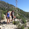
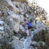
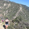
Since it’s a government holiday, we have the day off, so I went hiking with Karina and Erin from my office. Our destination was Jones Peak, which is just a little mountain in the front range of the San Gabriels, just above Sierra Madre. The trail is not very long, but it is reputed to be much harder than it seems like it should be.

Like the trail up Mount Lukens, this trail didn’t fool around. It was steep from the start. There was just a short walk up into Bailey Canyon before it turned and started switchbacking up the side of the canyon, before coming out at the top of the ridge connecting Jones Peak and the main mass of Mount Wilson. From there, it was just a short, but very steep climb up to the actual top of the mountain. There wasn’t anything much on top, but the view was very nice.

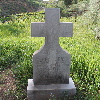
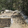
On the way down, we took a look down a little side trail. It went to the ruins of a small cabin. Since it’s in Bailey Canyon, someone had taken the trouble to make a up a plaque proclaiming that the cabin had belonged to George Bailey from “It’s a Wonderful Life”.

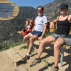
A bit farther down the trail, we stopped at a scenic overlook with a couple of benches. One of the benches was very tall, and our feet didn’t reach the ground below it. That was when I noticed the small plaque on the bench saying that it “…meets or exceeds All NBA standards”. Heh. It was a nice hike.

2/15/2015

Studio City for Gelato

Filed under: — stan @ 3:31 pm

This week’s bike club ride was a trip out to Studio City to get gelato at Gelato Bar and Espresso Caffe. It’s a destination, and it was a nice warm day, so it seemed like a good place to go.

On the way there, Jeff wanted to take a little side trip to try riding up Eldred St. This is a short dead-end street that ends in one of the steepest hills in Los Angeles. In the end, his Garmin said the grade averaged 23%, but that the final pitch to the top hit 44%. And the fact that it’s broken and rough concrete just made it even harder.

The rest of the ride was pretty straightforward. It was a nice fast trip up the L.A. River bike path, and then a straight shot out across Toluca Lake to Studio City. The trip back was flat across Glendale, and then a trip up and over Linda Vista and Lida St to get back to Pasadena.

44 miles.

Powered by WordPress