Stan’s Obligatory Blog

12/25/2016

Christmas Day on the Bike

Filed under: — stan @ 5:56 pm

Christmas fell on Sunday this year, so we had a smaller-than-usual turnout for the Sunday bike ride. We did the old Whittier ride. We’ve done this one many times before. It’s a fairly easy route, and there was very little traffic out this morning, so that made for a pleasant ride.

43 miles.

Route map and elevation profile

12/18/2016

It’s a Wonderful Ride – 2016

Filed under: — stan @ 2:54 pm

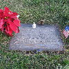
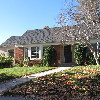
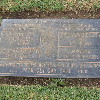
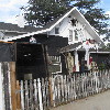
It’s the Sunday before Christmas, and time for our “It’s a Wonderful Life” theme ride. There’s not much to go see around this theme, since the movie was mostly shot on soundstages in Culver City and at a long-gone backlot in Encino. There was only one scene shot on location, and that was the Martini family moving into their new house in Bailey Park, and the house was played by a house in La Cañada that is still there, and still looks the same as it did in the movie. So we go see that, and pay a visit to James Stewart at Forest Lawn in Glendale.

A few years ago, we had a run-in with the security guard at Forest Lawn. Because of that, we now make a point of checking in at the front gate so that they know why we’re there, and then it’s not a problem. And this time, when we got to the top of the steep hill where James Stewart is buried, we were thinking that it wasn’t such a bad hill after all. This is largely because of our trip to Whittier last year to see Eazy-E from NWA. He’s at the top of a mile-long, fairly steep hill. That one was a hard hill to climb.

After Forest Lawn, we went and had coffee and eclairs at Paradise Bakery in Glendale. Then it was time for the long slog up Verdugo into La Cañada. The good side of that is that once we’re there, it’s nearly all downhill back home to Pasdena.

So yes, it was a Wonderful Ride.

36 miles.

Route map and elevation profile

12/4/2016

Boogie Nights

Filed under: — stan @ 2:56 pm

This past week I saw an item on Curbed L.A. about the house that was the location for Jack Horner’s home in the 1997 movie, “Boogie Nights”. Apparently, it’s up for sale now, so I thought we should go and have a look at it.

The house is on Cameron Ave in West Covina. We were very near there a few weeks ago when we went to see Rainbow Donuts. It was a bit chilly this morning, but still a nice day for riding.

The route was relatively flat, with a gradual downhill trend all the way there, and gradual uphill coming home. On the way back I saw signs offering to buy diabetic test strips. I had no idea that was even a thing.

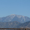
We got a nice view of Mt Baldy with a tiny little snowcap on top. I guess that’s there because we had a little rain last weekend.

41 miles.

Route map and elevation profile

12/1/2016

More on the earthquake tour

Filed under: — stan @ 10:01 pm

I found out this past week that one of the people on the earthquake tour is a writer for the Los Angeles Times travel section. And she wrote a short article about our tour, and about how Atlas Obscura does tours of all sorts of odd things.

http://www.latimes.com/travel/deals/la-tr-southern-california-atlas-obscura-tours-20161129-story.html

11/20/2016

Mt Washington and Doo Dah

Filed under: — stan @ 1:52 pm

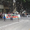
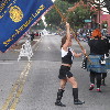
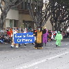
Today’s bike club ride was our old Mt Washington route, but cut a little bit short to end up at the Doo Dah Parade route right about when the parade was scheduled to start. I went to see the parade on my own in 2012, and the Sunday Ride went to see it in 2008.

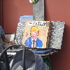
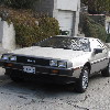
It was cool and overcast, and it even rained on us for a few minutes just as we were starting out. We headed up into Altadena and then to La Cañada. Then we had about seven miles downhill through Glendale all the way to Eagle Rock Blvd in Cypress Park. We made a loop around, and then headed up Mt. Washington. That was where we saw the garage sale with the “Fuck Trump” painting, and also the DeLorean with the “STAYNLS” vanity plate.

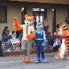
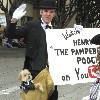
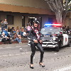
After going over the hill, we headed back home, ending up at the Doo Dah parade on Colorado Blvd. We watched the parade for a while before it started to rain. At that point, we bailed out and headed home.

32 miles.

Route map and elevation profile


11/13/2016

The Wall of (Un)Fame

Filed under: — stan @ 2:01 pm

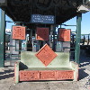
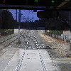
Today’s bike club ride was yet another art tour. We’ve been to Downey to see the Columbia Space Center, and also to see the Carpenters, but I recently heard about the Wall of (Un)Fame.

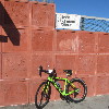
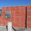
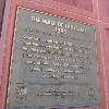
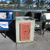
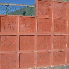
Every Metro Rail station has some sort of art in it. And it turns out the Green Line station in Downey is home to a piece called the Wall of (Un)Fame. The piece features something like 650 concrete panels, each with hand and footprints and names, much like the Walk of Fame at the Chinese Theater in Hollywood, but each is a random, not-famous local person who was chosen in a lottery.

So we started out going south, and we went through the part of Downey that has the oldest operating McDonald’s. Then we went a bit farther south and came do the Green Line station and the Wall of (Un)Fame. We go to see a lot of public artworks, and this one was very entertaining. It’s a funny idea, and it’s a bit of social commentary at the same time.

Leaving the Metro station, we headed back into Downey and our snack stop at 3rd Street Coffee. Then it was back up the Rio Hondo bike path to Temple City, and then home through Arcadia.

47 miles.

Route map and elevation profile

11/6/2016

Wrigley Field

Filed under: — stan @ 2:21 pm

In honor of the Chicago Cubs winning the World Series, the Sunday morning bike ride did what is our first, and probably only baseball-themed ride ever today. The destination was Gilbert Lindsay Park, which was the former site of the original Wrigley Field. The stadium was there from 1925 until 1969, and for many years was home to a the Los Angeles Angels, who were a farm team for the Cubs.

We started out with our standard route into downtown Los Angeles. This time we didn’t make good enough time to be at tracks where Main St crosses the L.A. River in time to see the Metrolink 261 train to Lancaster that crosses Main St at about 8:51.

Coming in to downtown, we saw that Spring St in front of City Hall was closed off to traffic. We’ve seen this before when there were events going on on there, so we figured it was something like that, and like we usually do, we just rode down the sidewalk across the street. Playing tourist, I pulled out my camera, but one of the guards said something about “you can’t take pictures of the set”. That was when we realized it was all a set for filming something. The fake news trucks for fictitious L.A. TV stations were another giveaway.

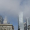
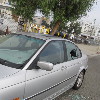
Continuing south, we saw that the clouds were very low today. So the tops of the Bunker Hill skyscrapers were in the clouds. We rode Main St all the way down through downtown. When we got south of the 10 freeway, we saw the L.A. Sports Museum. I never knew there was such a place. And across the street from it was another aspect of L.A. life. A BMW with a broken-out window. And then behind that was an art installation in the form of a giant chair. It was all a bit surreal.

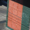
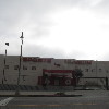
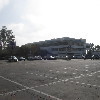
At 41st St, we came to the park. The far corner of the park is where the former stadium was, so I went and took a picture of the building that occupies the site now.

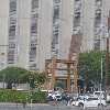
After leaving the park, we came back up into downtown, passing by the steel origami horse and the apartment building on Olive St that we visited back in 2006 on the Tour de Oozing Oil. Then we turned left on 7th St and rode that out to Westlake, and then Bonnie Brae up to Echo Park and our snack stop at Chango Coffee.

The route back was our regular route up the Arroyo Seco. It was a nice ride.

40 miles.

Route map and elevation profile
10/30/2016

Down for the Count 2016

Filed under: — stan @ 2:46 pm

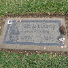
This year marks the tenth time we’ve done our traditional “Down for the Count” Halloween ride to Culver City to visit Bela Lugosi’s grave. The weather today was looking threatening, but most of the route was very close to one or another Metro Rail line.

We rode through downtown L.A. I thought we’d see the Rock-‘n’-Roll Half Marathon, and we did see a few runners, but it seemed like it was all over by the time we got there. Streets that I thought were supposed to be closed for the course were open to traffic. That seemed a bit odd.

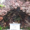
South of downtown, we picked up the bike lane built on Exposition, next to the Metro Expo line. We rode that all the way to La Cienega, where we got on the Ballona Creek bike path. We took that to Overland, and then rode to Holy Cross Cemtery. We came in the back entrance, and then rode up and over the hill to The Grotto, where there are a lot of famous people buried. As usual, someone had come by and left a set of vampire fangs on Bela Lugosi’s grave. And we were all a little surprised when Jen perked up when someone mentioned that Bing Crosby was buried nearby.

Leaving the cemetery, we rode back into Culver City to our snack stop at La Dijonaise in the old Helms Bakery complex. Just as we got there, it started raining. We got a table inside and had some snacks. When it was time to leave, it looked like the rain had stopped. But once we started up Venice Boulevard, it started raining again. It wasn’t pouring down, but it was raining hard enough that it really was not fun to ride in. So we turned off on La Cienega and rode over to the Metro station there.

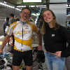
When we got up on the platform to wait for the train, there was a young girl there who started talking to us. It turned out she’s a bike racer. So I got to talk to her for most of the ride back to downtown. She told me stories about what racing is like now, and I told her some of my old-school racing stories from the ’70s. She said her dad used to race, so it’s possible we might have even been in some of the same races way back when.

33 miles

Route map and elevation profile

10/23/2016

Rainbow Donuts

Filed under: — stan @ 2:36 pm

Some months ago, I read an article about a small family-owned donut shop in West Covina. It’s owned by a family of Cambodian immigrants, and they have been a fixture in the neighborhood for almost 30 years. And now Dunkin’ Donuts is talking about opening a store in the same shopping center next year. So today’s ride was just to go see the shop and the center it’s in.

It was a cool and overcast morning. The forecast was for light rain later in the day, but it was pretty pleasant in the morning. We headed out east, and then south to get to West Covina. Along the way, we passed a house where the owners had really gone all-out decorating for Halloween. This was the same house that had the basketball-sized Christmas ornaments on the big tree next to it a few years ago. We were at the south end of the town, right up against the hills when we arrived. The donut shop is fairly unassuming. The sign was partially obscured by a tree. But there was a police car parked outside, so I guess that means the donuts are good.

Heading home, we rode through a little residential area to get to Lark Ellen Ave. That was the one real hill of the ride. Short, but pretty steep. Then we headed north. The plan was to take the little bike path next to the drainage channel north of Cameron. But when we got there, it was closed. There wasn’t a sign or anything indicating why, but that meant we had to double back and go around. Then we stopped for snacks at Panera in West Covina.

Heading home, we must have had a tail wind when we got on Arrow Highway by Santa Fe Dam. Without really trying, we were averaging over 20mph for no apparent reason. But then Silvio got a flat, so we had to stop for a bit. But once that was fixed, we headed home by our usual route. It was a pleasant ride.

40 miles.

Route map and elevation profile
10/16/2016

Metro Rail Tour and Ciclavia

Filed under: — stan @ 5:10 pm

The weather forecast for today called for a slight chance of rain, so that meant it was time to bring out the classic Metro Rail Tour. This is about 40 miles around L.A., but with the route never being more than two miles or so from the nearest Metro Rail station. We’ve done this before, and having the quick bailout option has come in handy in the past. Also, today was the Ciclavia downtown event, so we figured we could ride at least part of that route.

It feels like fall now, and we headed into downtown Los Angeles by our usual route. There were a few times when it started sort of just barely misting rain, but it wasn’t bad, and it stopped quickly. We made good time, and we got to the bridge across the river just in time to see the 8:50-or-so Metrolink train go by. Then we went to Chinatown and picked up the Ciclavia route. It had just opened, so it wasn’t crowded yet, and we rode the route to 7th and Flower, where we turned south.

We made the usual loop through Koreatown and Hancock Park, ending up at Noah’s Bagels in Larchmont Village. After the snack stop, we rode west, picking up the Ciclavia route again on 7th St near MacArthur Park.

Coming back into downtown, it started getting a bit crowded, so we turned off and rode up Main St instead of the Ciclavia route on Broadway. We took that to Chinatown, were we got back on Broadway to cross the river. Then we headed home by way of the Arroyo Seco bike trail

43 miles.

Route map and elevation profile
Powered by WordPress