Stan’s Obligatory Blog

11/18/2018

Armistice Day

Filed under: — stan @ 8:38 pm

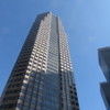
Last Sunday was the 11th, which we know as Veteran’s Day, but was originally Armistice Day, commemorating the end of the First World War. But the smoke from the Woolsey Fire was blowing east that day, so we ended up cancelling the ride. So this Sunday we did our Armistice Day ride. The theme was to go see a pair of memorials to the war here in Los Angeles. The first was in Pershing Square in downtown L.A. General Pershing was the commander of the U.S. forces on the Western Front in the war. The second was a grove of trees near Dodger Stadium that were planted in the 1920s in memory of the dead from the war. Aside from that, the route was just a meander around central Los Angeles.

47 miles.

Route map and elevation profile

11/17/2018

Earthquake Tour with Atlas Obscura

Filed under: — stan @ 8:38 pm

Today was the latest version of the San Andreas Fault tour with Atlas Obscura. This is about the fifth time we’ve done this tour, which is based on Sue Hough’s book, Finding Fault in California: An Earthquake Tourist’s Guide. Back in 2014, Sue took our office on a tour based on her book, and I knew immediately that this tour would be a hit with the Atlas Obscura crowd.

The first stop was the McDonald’s in San Fernando, which has a nice little fault scarp between the drive-through and the parking lot. This is a remnant from the 1971 San Fernando Earthquake. After that, we headed up the 14 Freeway, passing over the famous interchange that fell down in 1971, and then again in 1994, and then on to the Antelope Valley. We stopped at the scenic overlook by Lake Palmdale, and then took a short walk up the hill to see the famous road cut where the freeway cuts through a hill that was pushed up by motion on the fault.

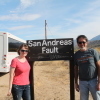
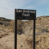
WE stopped for lunch at Charlie Brown Farms in Littlerock, and then we went on to Pearblossom. We stopped for a photo-op at the signs marking where the fault crosses the road. There was a pair of signs there that someone installed decades ago, but those signs were vandalized some time in the last year or so. So Morgan and I had made a new pair of signs, which we took a field trip to go and install back in May. The new signs are still there, and still look nice and clean and new. After that, we went just a short distance down the road to go see the Pallett Creek trench site, which was the birthplace of the relatively new science of paleoseismology.

Heading up into the mountains, we stopped to dig a bit in some fault gouge in a road cut near Big Pines. Then we went through Wrightwood, and on down into Cajon Pass. That was the final stop, at Lost Lake, which is a small sag pond. It’s a pretty unlikely place for a lake, which is the charm of it. After that, we headed back to Pasadena.
11/4/2018

Another In-N-Out Burger Tour

Filed under: — stan @ 8:45 pm

After our visit to the In-N-Out Burger museum a few weeks ago, I was looking at the In-N-Out Burger web site, and in particular, their page about the history of the company. And from that, I put together another little In-N-Out-themed tour.

The first sight is the In-N-Out on Foothill in Pasadena. It turns out that that’s the oldest In-N-Out still operating in its original building.
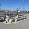
They currently have 335 locations in six states, and of those, only five do not have a drive-through window. And it turns out that one of them is in Glendale. So that was the second sight.

Another tidbit about the company was the the founder, Harry Snyder, was a big fan of the movie, “It’s a Mad, Mad, Mad, Mad World”. So beginning in 1972, he started having a pair of crossed palm trees planted in front of new In-N-Out restaurants. He said that In-N-Out was his treasure, so the trees were his nod to the “Big ‘W'” where the treasure was buried in the movie.

So that was our theme for today.

45 miles.

Route map and elevation profile

10/28/2018

Down for the Count – 2018

Filed under: — stan @ 8:43 pm

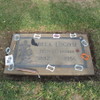
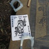
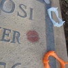
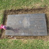
It’s the Sunday before Halloween, so it’s time for the annual “Down for the Count” ride to Culver City to visit Bela Lugosi’s grave. Someone comes and decorates for Halloween every year.

Our route out there is pretty straightforward. We head downtown, and then pick up the bike lane along the Metro Expo line out to La Cienega, and then the Ballona Creek bike path to Culver City. On the way back, we stopped at La Dijonaise in the old Helms Bakery building for snacks and drinks. I liked the signs they had outside the bathrooms. They truly were all-inclusive for men, women, and those in-between.

After snacks, we took Venice Blvd and 7th St back to downtown L.A. Then the Arroyo Seco bike trail to South Pasadena. At that point, I bailed out and took Metro Rail just to get home a little earlier, since I was planning on going back downtown to go see the Hapa.Me exhibit at the Japanese museum in Little Tokyo.
50 miles.

Route map and elevation profile

10/21/2018

Michael Myers

Filed under: — stan @ 2:15 pm

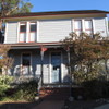
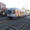
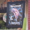
Today was the first of two planned Halloween-themed rides. I recently read that the 1978 film “Halloween” was largely filmed in South Pasadena, and in particular, the house that Michael Myers lived in is a designated historical landmark, and had been moved to a location right next to the Metro Station in South Pasadena. So that was our sightseeing for today.
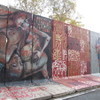
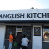
South Pasadena isn’t very far away, to the actual sightseeing was early in the ride, but that’s all right. We rode down there and saw the house. Then we continued on and made a big loop down to Montebello, and then up the San Gabriel River to Duarte. Along the way, we passed the Spanglish Kitchen in Alhambra. From the reviews, it sounds pretty good. After riding up the river bike trail, we rode into Monrovia to have snacks at Merengue.

Coming home, we rode through Sierra Madre for the first time in a while.

44 miles.

Route map and elevation profile


10/14/2018

The Berlin Wall

Filed under: — stan @ 2:24 pm

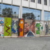
Today’s bike club ride was visit to the Berlin Wall on Wilshire Blvd, across from Hancock Park and the Tar Pits. It’s reputed to be the largest piece of the Wall outside of Berlin. We’ve been to see it before, but the last time we were there, we got rained out on the way home. Today was much nicer. No rain, and snacks at the Curson Cafe in Park La Brea.

45 miles.

Route map and elevation profile

10/7/2018

In-N-Out Burger

Filed under: — stan @ 8:30 pm

Today’s bike club ride was a trip to Baldwin Park to see the In-N-Out Burger museum and replica of the original In-N-Out. We’ve been there before, and we planned the route so that we would arrive there when the museum opens at 11:00. We took the little tour, and some photos, and then rode home.

43 miles.

Route map and elevation profile

9/30/2018

CicLAvia – L.A.Phil

Filed under: — stan @ 1:35 pm

Today’s bike ride was a visit to L.A. for yet another Ciclavia. This time, the theme was the 100th anniversary of the L.A. Philharmonic. The route went between the Hollywood Bowl and the Disney Concert Hall downtown.

On the way into Hollywood, we stopped off to see the Chandelier Tree. We’d all heard this past week that the city had ordered it shut down recently.

When we got to Hollywood, we turned south and joined the Ciclavia route. We took that all the way into downtown. Then we headed up to Chinatown and rode through the park around Dodger Stadium to get to the L.A. River. We had snacks at Spoke in Frogtown before heading home.

43 miles.

Route map and elevation profile

9/16/2018

The F-86

Filed under: — stan @ 1:05 pm

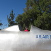
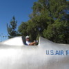
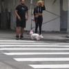
Today’s ride was a visit to yet another “Open Streets” event, this time in Irwindale and Baldwin Park. And as with the Vernon event a few weeks ago, there are only about two dozen people who actually live in Irwindale, so I guessed that it might not be too crowded, either. And along the way there, we went to see the F-86 in the park in West Covina. It’s made of solid concrete, but Roadside America still insists that it’s a real F-86 airplane.
We stopped for snacks at Panera in West Covina, and then we continued on to Baldwin Park to pick up the beginning of the Open Streets route. We rode that all the way to Santa Fe Dam, and then took the bike trail back up to Duarte. And then home by way of Sierra Madre.

41 miles.

Route map and elevation profile

9/9/2018

The Blacklist

Filed under: — stan @ 1:58 pm

Today’s bike ride was a visit to USC and the Fisher Museum to see the art project in front of the museum commemorating the Hollywood Blacklist of the 1950s. We did this before, but it was several years ago. Besides, it seems that people doing un-American things is more in the news again lately for some reason…

It had been long enough since we did this ride that I had to make a few adjustments to the route, but that wasn’t a bad thing. We rode the usual route into downtown, and then south to USC. Along the way, we stopped to see the old Parker Center, which was the long-time headquarters for the Los Angeles Police. It’s slated to be torn down soon, so I wanted to see the building again before it’s gone. Besides, I still remember going to the Street Scene in downtown L.A. back in the ’80s. They had stages set up all over the Civic Center area, and I always wanted to know what rocket scientist thought it was a good idea to put the hardcore punk stage on the street in front of Parker Center. And of course, everyone was shocked – shocked, I tell you – that a riot broke out.

Riding through downtown, it was a misty sort of morning, which made for some nice sunlight reflecting off the buildings. We haven’t seen that since we did “Down for the Count” in 2009.

We stopped at USC to see the garden and the art installation there, and then continued on to Larchmont Village and bagels at Noah’s. Then we rode home through Silver Lake, and up Benton Way, which we haven’t done in a while.

44 miles.

Route map and elevation profile.

Powered by WordPress