Stan’s Obligatory Blog

6/30/2019

Ciclavia Pico-Union

Filed under: — stan @ 1:42 pm

Today’s bike club ride was a visit to the Pico-Union area of Los Angeles. There is a Ciclavia going on there today. And besides that, the start of the Ciclavia route is just a block or two from Powers Place, which has the distinction of being the shortest street in Los Angeles.

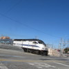
Riding downtown, we made good time, and for the first time in a long time, we made it to the L.A. River in time to see the Metrolink 8:46 train to Lancaster go by. Then we rode through downtown L.A., where we saw that the north end of the Metro Blue and Expo lines is shut down for maintenance. The Pico station had signs warning us that there were no trains running there right now.

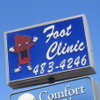
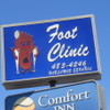
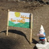
The Ciclavia route was like the time they did the Ciclavia to the Sea in 2013. We rode the length of the route, and then headed north to get to Hancock Park and our snack stop at Noah’s Bagels. After that, we headed back by our usual route through Silver Lake, pausing briefly to check out the Happy Foot/Sad Foot sign on Sunset. Apparently, it’s going to be moving away soon.

44 miles.
Route map and elevation profile.

6/23/2019

The Stonehurst Cottages

Filed under: — stan @ 2:18 pm

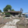
Today’s bike club ride was a trip to Sun Valley to see the Stonehurst Cottages. There are a collection of stone houses, all built by one man in the 1920s. It’s a testament to what can happen when you have one man with a vision, as well as a lot of time on his hands.

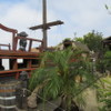
The ride up there was pretty straightforward. Across Eagle Rock, Glendale, and Burbank. We did one short side trip in Burbank to see the house with the backyard playhouse in the shape of a pirate galleon. Then we continued on up into the auto-wrecking-ghetto of Sun Valley, and then turned off on Sheldon St to get to the Stonehurst neighborhood. We rode around randomly on some of the streets there to see a few of the stone houses. Then we continued on through the horse neighborhood around there. Seeing and smelling horses, it felt like we were out in the country, not inside the city limits of Los Angeles. This was the same neighborhood we visited once to see a llama named Lorenzo.

44 miles.

Route map and elevation profile.

6/2/2019

Twin Pines Mall

Filed under: — stan @ 3:56 pm

The Sunday bike club ride was rained out the last two Sundays. This is almost unheard-of here in SoCal. Usually, we can tell the weather by looking at the calendar, and if it’s after May 1st, we don’t have to worry about rain until October. But we were rained out.

So this week’s ride was a trip to Puente Hills Mall, which played the Twin Pines Mall in “Back to the Future”. It appears at the beginning and the end of the movie. It was where Doc Brown first showed Marty the DeLorean time machine. So that was our sightseeing for today.

On the way out there, we passed by the In-N-Out Burger museum in Baldwin Park. We’ve been there before for the tour.

The route was very flat almost the whole way. It turned out to be a bit longer than I’d expected, but that wasn’t a problem. And it was a nice day for riding, even if we couldn’t get our bikes to 88 mph to travel through time.

50 miles.

Route map and elevation profile.

5/12/2019

The Wall of (Un)-Fame

Filed under: — stan @ 6:10 pm

Today’s bike ride was a trip to Downey to see the Wall of (Un)-Fame at the Downey Metro Rail station, and also to see the two apartment buildings in Downey that the Carpenters bought with the profits of their first two big hit songs back in 1970.

It’s a very flat route, and basically goes straight south to Downey, and then straight north back home. We stopped for a few minutes at the Wall, and then went to 3rd St Coffee in downtown Downey. After that, we went to see the Carpenters’ apartment buildings, and then over to the Rio Hondo bike path for the trip home.

47 miles.

Route map and elevation profile.

5/5/2019

Obama Boulevard

Filed under: — stan @ 2:49 pm

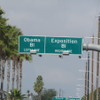
This past week, I saw an item in the L.A. Times that the city was going to have a street fair and party to celebrate renaming Rodeo Road in Leimert Park to be Obama Boulevard. So I thought that this would make for a good destination for the Sunday bike ride.

We rode our usual route to downtown L.A. Along the way, I got a flat, which caused a little delay. But aside from that it was fine. While I was fixing my flat, part of the group kept going. I figured we’d find them later on the route. We rode down past USC and out Exposition Blvd. Just after Western Ave, we saw the signs for the fork in the road where Obama Blvd begins. We rode on it for about a mile to just past Crenshaw, and then turned north to get to Noah’s Bagels. When we got to the bagel shop, the rest of the group wasn’t there. I was just wondering what could have happened to them when they rolled up. They had taken a wrong turn due to the fact that the city has only changed a few of the street signs so far, and most of the signs still say Rodeo Rd. Still, it was a fun ride.

44 miles.

Route map and elevation profile.

4/28/2019

Reservoir Dogs

Filed under: — stan @ 10:22 pm

Today’s bike club ride was a tour of filming locations from “Reservoir Dogs“.

Here is the site with screenshots showing the locations as seen in the film: https://www.itsfilmedthere.com/2010/02/reservoir-dogs.html

A lot of the locations were in Highland Park and Eagle Rock, so we started there. We visited the site of the warehouse, which is no longer there, but we got to see the alley where the characters parked their cars. From there, we went to see a few other sites nearby, including the coffee shop from the beginning of the movie, and the bowling alley where they filmed the sequence of the characters walking past a wall in the opening titles.

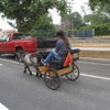
From there, we went down to the L.A. River, and rode the bike path north. Turning through Griffith Park, we made our way to Burbank to the building that was Karina’s Diamonds in the movie. And that was our movie location tour. Then we rode to Priscilla’s for snacks, and then home. And when we were riding through the equestrian neighborhood, we saw a miniature horse pulling a tiny cart.

42 miles.

Route map and elevation profile.

4/21/2019

The Right Stuff

Filed under: — stan @ 3:47 pm

There is a small trailer park out in Covina where the streets are all named for astronauts from the original Mercury 7 group. Since I’ve been reading American Moonshot, I thought we should go and visit it again.

The ride is basically a straight shot to San Dimas, and then back by way of the Santa Fe Dam nature center. The bagel place we used to stop at out there apparently is no more, so we went to Merengue in Monrovia on the way back.

43 miles.

Route map and elevation profile

4/14/2019

The Maywood Pot Shop

Filed under: — stan @ 4:08 pm

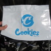
Today’s bike club ride was down to Vernon to see the Farmer John hog mural, and then on to Maywood to visit Cookies L.A. That’s the pot shop there. We’ve visited there before, and I was curious if the security guys there would remember us. And as it turned out, they did remember us. We also passed the Southland Box Company. I always think there should be thousands of cats meowing all around the box factory.

We tried a new coffee shop today. I got a flat right when we got there, so all I did there was sit on the patio and fix my tire. But after that, we saw that there is a new deli in the storefront that used to be Chango Coffee. We may try it the next time we’re over there.

46 miles.

Route map and elevation profile

3/31/2019

Nat King Cole

Filed under: — stan @ 4:17 pm

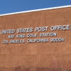
Today’s ride was another urban ride through Los Angeles. The two sightseeing points were related to Nat King Cole. The first was his former house in Hancock Park. Apparently, he was the first black homeowner in that neighborhood. The second sight was the post office nearby in Koreatown that was named for Nat King Cole.

44 miles.

Route map and elevation profile

3/24/2019

Pugsley Addams

Filed under: — stan @ 4:21 pm

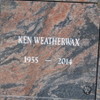
Yesterday, I took Lucinda on the Dearly Departed Black Dahlia tour. When we were at their office before the tour, I saw a little display case with a small box in it. A sign said it was a portion of the remains of Ken Weatherwax, who played Pugsley Addams. It also said that the rest of his remains are at Pierce Brothers Valhalla in North Hollywood. And so that’s how I decided where we were going today.

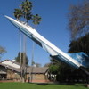
It was kind of chilly this morning, but it was supposed to warm up, so I went with shorts, and just added one layer of bubble wrap as a blanket to stay warm. We rode out by the usual route to get to Burbank, where we stopped to see the F-104-on-a-stick in the park there. Then we continued on to NoHo and Valhalla. I’d used the Google Maps aerial photos to know where the small mausoleum was, so we were able to locate his space pretty quickly. Then we went and took a few minutes to see the Portal of the Folded Wings.

We stopped for snacks at Priscilla’s, and then headed home by way of Griffith Park and the L.A. River bike path. Along the way back, we lost track of one rider, so I rode back a couple miles to look for him. But he seemed to have disappeared. Maybe he took a different route home.

49 miles.


Powered by WordPress