Stan’s Obligatory Blog

Page 27 of 35« First...1020«2526272829»30...Last »

5/27/2007

No Tuna For Me

Filed under: — stan @ 8:14 pm

Route map

Today’s ride was a new route that Gene called “No Tuna For Me”. It went up to Sunland, but then came back by a different route, completely avoiding La Tuna Canyon. I was a little skeptical about this, since I like La Tuna Canyon, but this turned out to be a pretty nice route.

We started out straight west, across Pasadena and Eagle Rock to Glendale. Then we took Kenneth across Glendale, which was nice. It has a lot less traffic than Glenoaks. When that ended, we got on Glenoaks and rode up into Sunland. That’s where we saw the hot rod roadster.

In Sunland, we took a right on Peoria and rode along the edge of the big landfill there. Fortunately, the wind was blowing the right way so we didn’t have to smell it. Then we took several small streets up through the hills. The area there has a very rural feel. Most of the houses had horses, and one had geese in the yard. Finally, we came out on Sunland Blvd by the 210 freeway.

Crossing the freeway, we turned off Sunland and took some small streets through Tujunga. That’s where Gaurav got a flat. We stopped to fix it, and while we were fixing it, a guy from across the street came out of his house carrying a floor pump. He said that he’s had to fix flats on the side of the road many times before, so he thought the pump could help us. And he was right. It was a very nice thing and helped us a lot.

We came out on Foothill Blvd, which we took for a short distance through the middle of Tujunga, and then we turned down Tujunga Canyon Road and from there it was all downhill into Montrose and our snack stop at Oven Fresh Bakery. We saw the Pasadena Triathlon Club across the street while we were there. They were in the middle of a long ride of their own.

After the snack stop, we headed back through La Cañada into Pasadena. Then we went down Arroyo and Lincoln to get back to Orange Grove, which brought us back to the park. At that point, I had 44 miles, so I rode out to Sierra Madre with Newton before turning around and heading home with my Magic 50 Miles for the day.

50 miles.
cycling

5/23/2007

Wednesday noontime bike ride

Filed under: — stan @ 9:34 pm

Route map

Today’s lunchtime ride was the flat one out to Arcadia and back. I went with Eric and Vikki, and it was a perfect day for riding.

There’s not much to be said about this ride. It was pleasant, but we didn’t see anything particularly amusing this time, aside from the guy with one leg who rode past us going the other way. It looked extremely odd, since he didn’t have a prosthetic, and he was just pedaling with one leg. He was going pretty fast, too. But I’d guess he probably still has some trouble going up hills.

18 miles at lunch, 26 for the day.
cycling

5/20/2007

Race Day!

Filed under: — stan @ 8:19 pm

Route map – going out
Route map – coming back

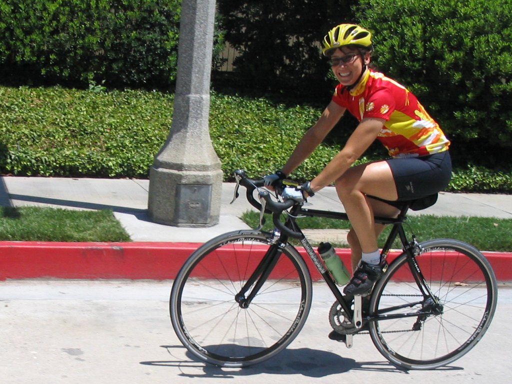
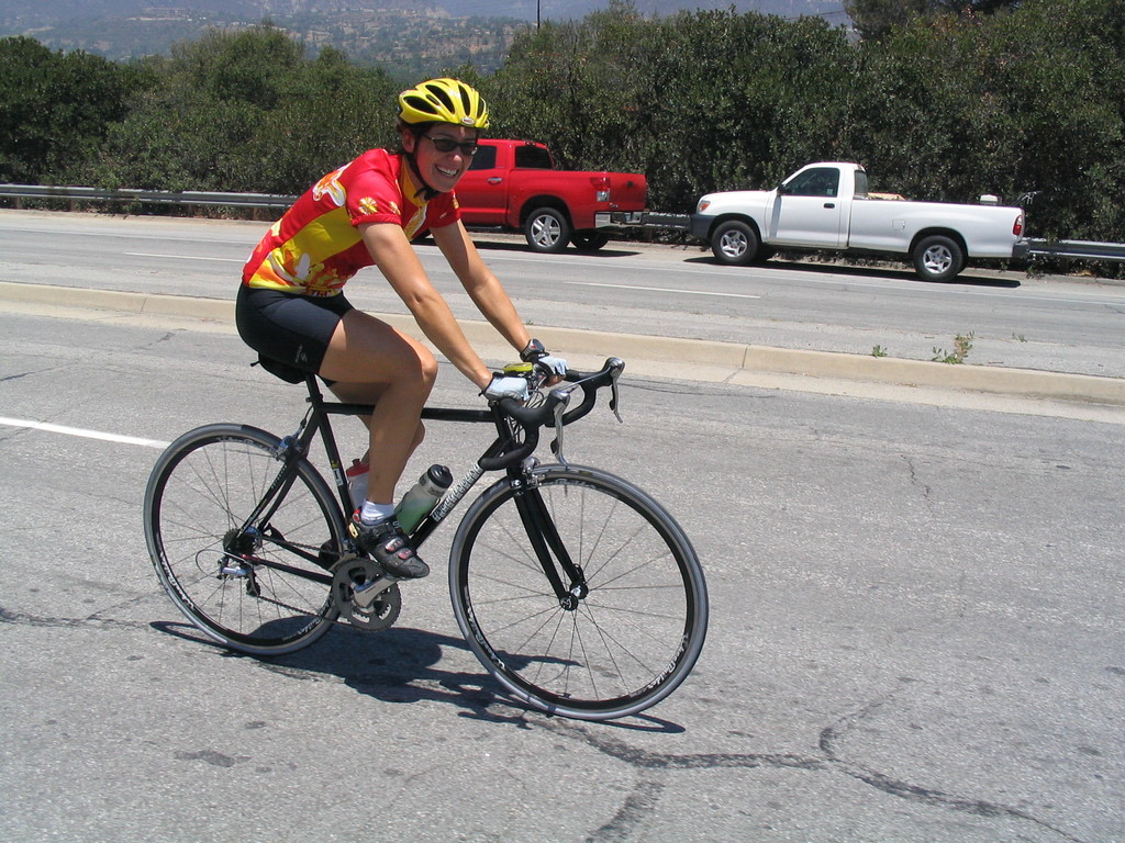
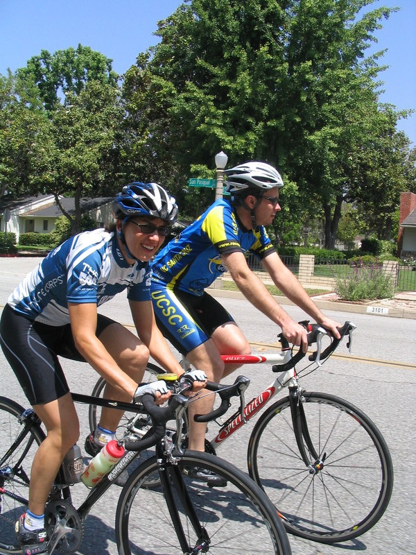
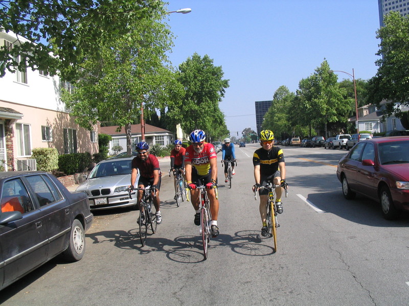
Today’s ride was out to Culver City to see the West L.A. Grand Prix bicycle race. Philippe, who usually rides with us, was going to be racing.

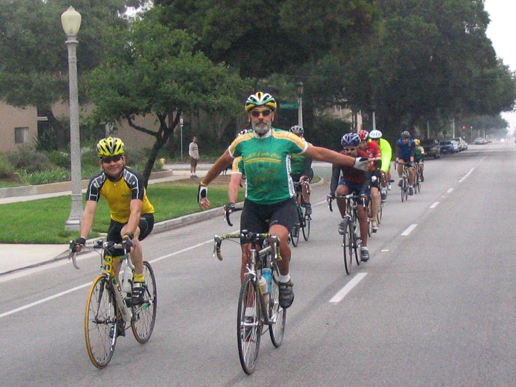
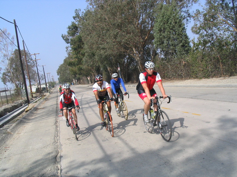
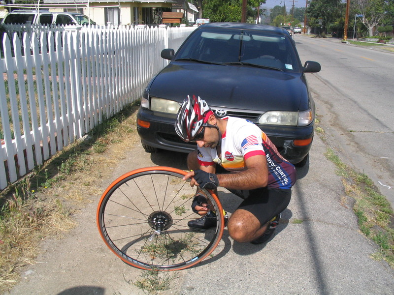
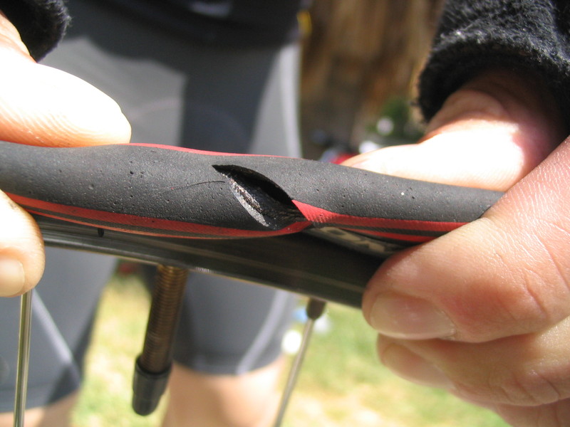
We headed downtown by way of Huntington Drive and Mission Road. Along the way, Ben got a flat. Because we were on a strict timetable, we had to work fast. Like a NASCAR pit crew. Steve held the bike, Ben took off the tire, Gene got the new tube ready, and I took pictures. We got that flat fixed in just a few minutes and we were on our way again. Then we rode straight through downtown L.A. on Main St all the way down to Adams Ave.

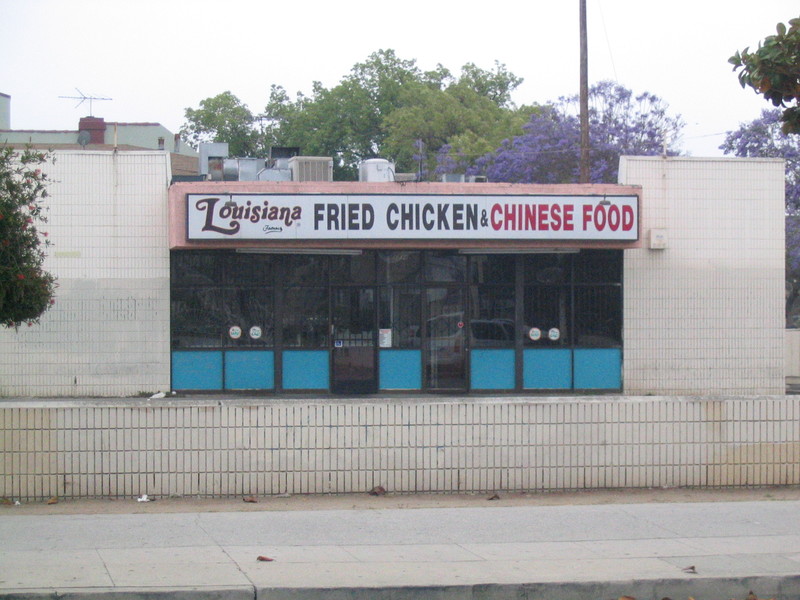
After a right turn on Adams, we were heading west. Back in the late ’80s, we used to read about how the West Adams neighborhood was an up-and-coming hip area for people to buy and renovate the decrepit old mansions there. We didn’t see any evidence of this today, but we weren’t really looking around. The only picture I took there was the “Louisiana Fried Chicken and Chinese Food” place. That was an odd combination.

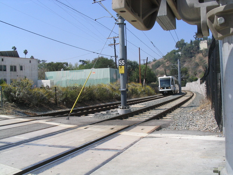
We took a left on Vineyard Ave, which took us to Farmdale, which is one of the few non-major streets that cross the old railroad tracks there. Those tracks had obviously not been used in a long time, but they are planned as the route of the new Metro Expo Line. Then we took a right on Rodeo Road, which later merged into Jefferson for the last few miles into Culver City.

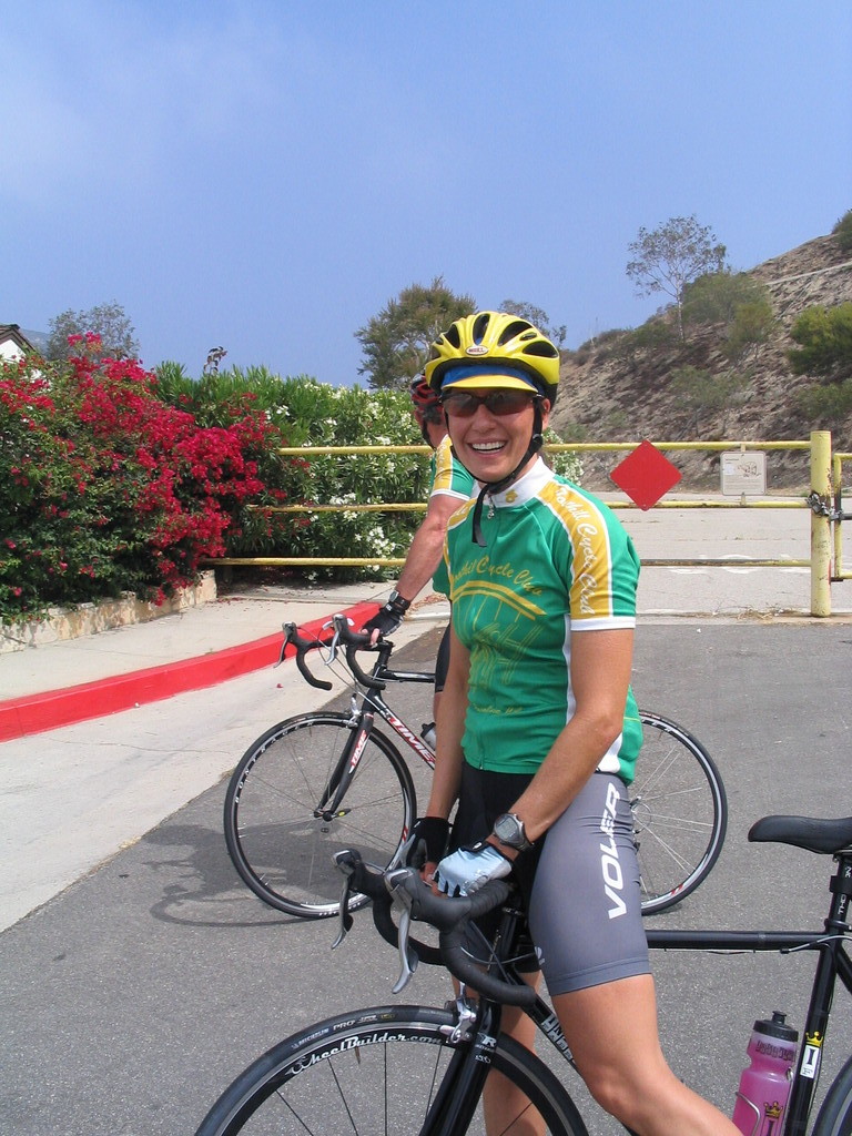
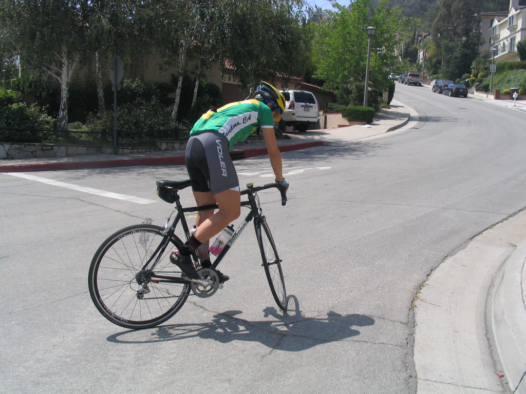
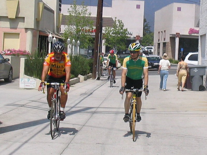
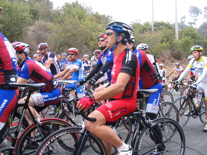
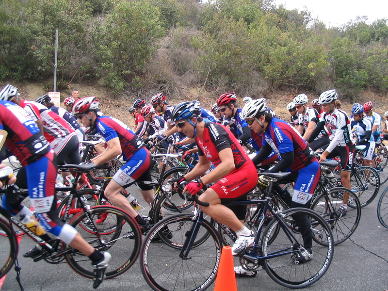
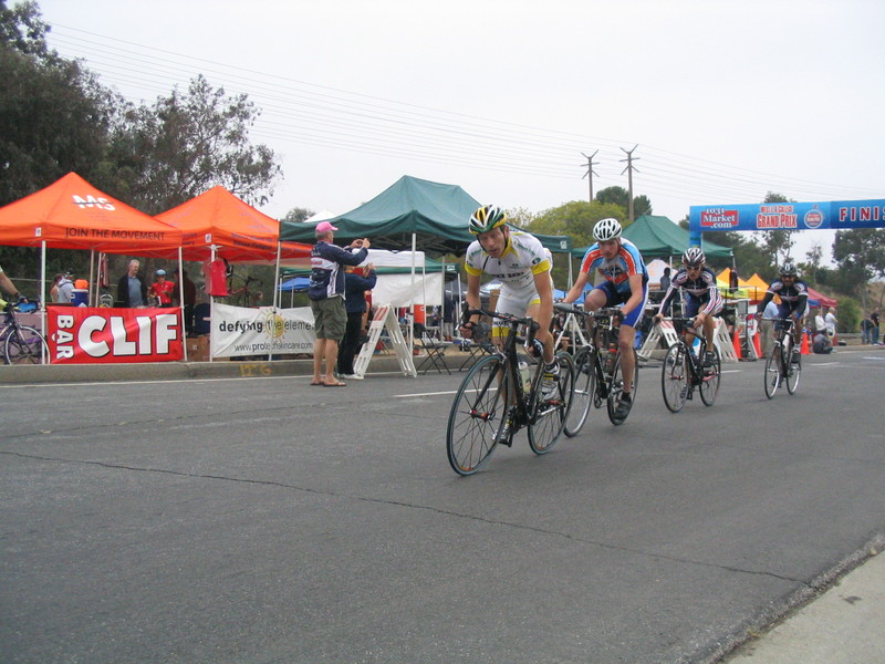
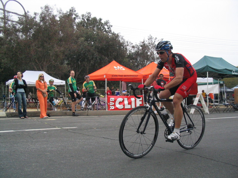
When we got to the race, the Category 5 men were lined up and ready to go. I saw Philippe in the “A” group. Apparently, there is a rule that they are not allowed to have more than 50 Category 5 riders in a single group. This race got so many entries that they split it into two groups, which started a half-lap apart. I went up to the stand to see about donating a prime for them, but they said that there was a rule that Category 5 races could not have any sort of prizes. So that was out. And the other races were completely full of primes. So oh well. I saved my $20 to fight another day.

The race was pretty good. A breakaway formed pretty early on. Then the two strongest riders dropped the rest of the breakaway. Philippe finished the race, but he was one of the last finishers. Still, it was a good effort for a first-time racer.

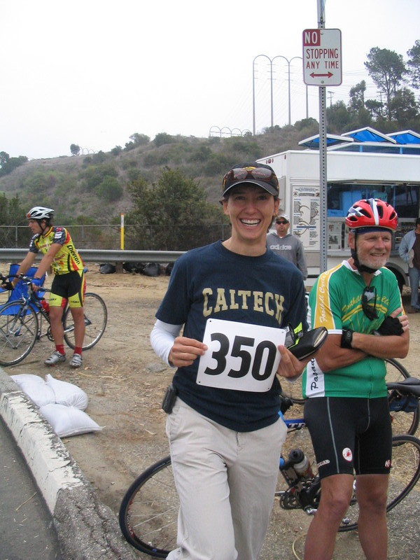
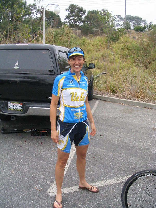
We saw Vikki there, but we couldn’t stay for her race. When we were leaving, she was just getting on her trainer to start warming up.

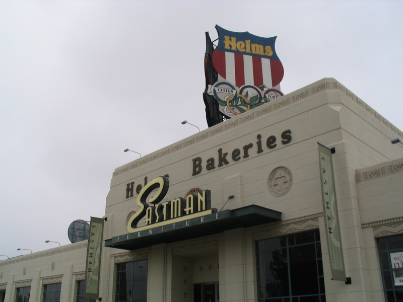
The ride back went up Venice Blvd. Along the way, we passed the old Helms Bakery, which was a big piece of L.A. history. The building sat empty for many years before it was turned into stores some years ago.

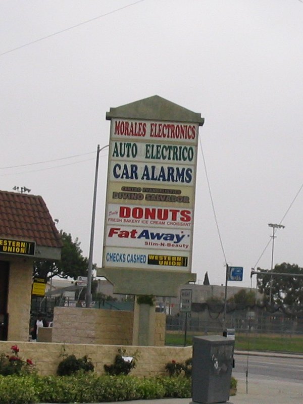
When we got near downtown, I saw the mini-mall with “Donuts” and “Fat Away” right next to each other. That was a funny one. Then we turned left on Hoover and headed north. On one of the side streets, we saw an abandoned couch. When I went to get a close look at it, I noticed another couch up the block.

When we got to Wilshire, I realized we’d missed a turn. We were supposed to turn off on Benton Way, but it turned out to have a different name that far south. So we went up the street that was to become Benton Way, and in a few blocks, it did. That was where I saw the third couch.

Benton Way is a good street for riding because it is nice and quiet, but it still has a bridge to cross the Hollywood Freeway. Then it goes up a short but steep hill and we come out on Silver Lake Blvd at the top of the hill. From there, we rode down to Glendale Blvd and over to Fletcher to get back to Eagle Rock.

At the north end of Eagle Rock, we took Yosemite across and then up the Colorado Hill. Then straight home on Orange Grove. Just before we got back to the park, the sun finally came out. It was a nice ride.

*Addendum: I heard from Vikki that she got 3rd place in her race. There’s a small picture here: womenscyclingchallenge.org/blog/index.php/news

52 miles.
cycling

5/13/2007

Seven Dwarfs, Three Couches, and One Flat Tire

Filed under: — stan @ 8:12 pm

Route map

Today’s bike ride was the classic “Toluca Lake” route. This takes us out to Toluca Lake, just past Burbank so we can go to Priscilla’s. And today, we also got to sightsee the burned edges of Griffith Park on the way back.

We headed west, straight across Eagle Rock and Glendale, and then south to the edge of Griffith Park. We passed the Bette Davis Picnic area and the Los Angeles Equestrian Center. Then we took our first sightseeing detour. We went up to Alameda and Buena Vista to see the Seven Dwarfs on one of the big Disney buildings.

Continuing west on Alameda, we got back on the route at Hollywood Way. Then we rode just a few more blocks to get to Priscilla’s. We stopped there for snacks and drinks.

After the stop, we headed back to the park along Forest Lawn Drive. This passed the area on the north side of Mt Lee that burned last month. Then, when we got to Griffith Park, the road leading into the park was blocked with police tape. We turned left and rode along the edge of the park to get to the L.A. River bike path.

Riding along the bike path, we got some good views of the east and south sides of the park where the fire was last week. In particular, in the second picture, you can see how close the fire came to the houses on the hillside in Los Feliz.

We got off the bike path at Fletcher and rode back up to Eagle Rock Blvd. That was where we saw the first abandoned couch. It was leather and had been tagged with gang graffiti.

Going north, we took a right at El Paso and headed over the small hill to Ave 50. That was where we found the second abandoned couch. This couch was so beat up that I didn’t even recognize it as a couch at first. But when realized what it was, I circled back to get a picture.

Continuing on Ave 50, we found the third abandoned couch. I stopped for a picture. Then we got stopped at the Gold Line crossing, so I got a picture of the train there.

We took Ave 60 across to Monterey Road, and then headed back into South Pasadena. That was where Gene got a flat. It was a very loud and emphatic flat. So I immediately got out my camera for the obligatory picture for the Flat Tire Gallery. The gash in his tire was quite impressive, so I got a closeup of that, too. He managed to put a boot on the cut and get the tire inflated, so we were soon under way again.

We rode across South Pasadena and San Marino, and then back north to Pasadena. Overall, it was a fun ride.

44 miles.
cycling

4/30/2007

Point Loma

Filed under: — stan @ 8:36 pm

Route map

Today I was in San Diego to visit with my father while he has knee-replacement surgery. The doctor said that the total time I’d have to wait would be around four hours, so I brought my bike along. I figured that I’d have my phone along, and riding would be more entertaining than sitting in the hospital waiting room, doing the a jigsaw puzzle with missing pieces. Besides, I lived in San Diego for a year in 1984-85, and I was curious to see how much it had changed since then.

I started out from Thornton Hospital and rode up La Jolla Village Drive to get to Torrey Pines Road. Then I rode down the hill into La Jolla. I used to just ride straight through downtown La Jolla, but today I took the scenic route by the cove. I saw a big sea cave, lots of seals lounging on a beach, and another ’stick-man in peril’ warning sign. That was all amusing.

Heading straight down the coast on Mission Blvd, I went through Pacific Beach, which was where I used to live. Then down through Mission Beach to the roller coaster. Back in 1984, it was shut down and falling apart, and a campaign was just starting to renovate it. Apparently they succeeded. The coaster was fixed up and had a new coat of paint, and it’s running again.

Next, I rode across the mouth of Mission Bay on Sunset Cliffs to get to Ocean Beach, and then up a hill to Catalina Blvd for the ride out to Point Loma and Cabrillo National Monument. On the way up the hill, I took a picture of a very striking house with the largest cantilevered balcony I’ve ever seen.

The road out to Point Loma is quite nice. About the only bad thing about it is that it goes through a Navy installation, and they insist on closing the gate at 5:00 every day. That was my pet peeve with living in San Diego. It seemed like everywhere I went, there were gates that said “Restricted Area” on Navy installations.

So I rode out to Point Loma. I used to just go to the lighthouse and get a drink, but I thought I’d sightsee a bit. So I rode down the hill on the ocean side to see the tide pools. At the bottom, I met another guy who was also out riding, so we rode out to the end of the road, which ends at the gate of the sewage treatment plant. It was kind of refreshing to see a “Restricted Area” that had nothing to do with the Navy.

Back up at the top of the hill, I got a souvenir picture in front of the lighthouse. I also got a picture of a submarine cruising out of San Diego Bay. I remembered walking along the downtown waterfront. They used to have coin-operated binoculars there, and I always thought that they should have had slots for ruble coins for the convenience of the KGB agents who were no doubt there.

Then we rode back down Catalina back into the city. We took a short ride on Nimitz Blvd, which sort of summed up my impression of riding in San Diego. A lot of the bigger streets are like riding on the freeway, and it’s not a Freeway of Love.

We split up again by Sea World, and I headed up the east side of Mission Bay. This part of the ride was quite pleasant. I rode up back to Pacific Beach and the got on Santa Fe St, which goes up the east side of the 5 freeway to the Rose Canyon bike path. The bike path was pretty nice, and it bought me up to La Jolla Colony. I stopped at a construction site for a picture of a machine called the “Putzmeister“. I thought this was funny name. Then I took a few other streets and came out on Regents Road, which bought me back to the hospital in time to change and have lunch. Then I went back in and got to my father’s room just before they brought him in from recovery.

42 miles.
cycling

4/29/2007

CSI: Foothill Cycle Club

Filed under: — stan @ 7:46 pm

Route map

Today’s ride was Gene’s “Noodling: 3″ ride. It was a cool and overcast day, but the sun was promised to come out later.

We set out from Victory Park and headed south in to San Gabriel. Then we turned and made a partial loop around to get to South San Gabriel. For some reason, everybody had had their Wheaties this morning, and they were going quite fast. So I found a “FUNERAL” sticker on the street and stuck it on my bike. Then I said something like, “Now will you guys slow down?”

We rode down to the 60 freeway, and then up and over the hill on the south side of it, coming out below Whittier Narrows Dam in Montebello. Then we rode up Lincoln Ave, which is always a big dumping ground. I expected to find an abandoned couch or two, but instead, we found a mermaid statue.

After getting a picture of the mermaid, Philippe and I were quite far behind the group. But Philippe had a solution. He said something like, “let’s catch them” and put his head down and started to motor. I just got on his wheel. In the old days, I would have taken turns pulling, but now I’m lucky just to be able to hang on. He did a fine job of riding very fast and towing me back up to the group.

Next, we rode around the hill in Commerce and headed into West Covina. Then straight north into Irwindale and west back to Myrtle Ave, which brought us into Monrovia. Our snack stop was at Planet Cookies there.

When we got to Planet Cookies, the sidewalk in front was blocked off with police tape. There were two crime-scene investigators there, and there was blood on the sidewalk. They said that there had been some sort of fight ending in murder there last night. This was kind of disturbing, but we went ahead and got our pastries anyway.

While we were sitting there, I saw my old tattoo friend Nikki walking by. I haven’t seen her in over a year, so I flagged her down and we got to visit a bit right there. I also got a souvenir picture, which she insisted should be in front of the crime-scene tape. Nikki’s an interesting character, and I like her a lot.

The way home was a somewhat roundabout route that involved going up and down several unnecessary hills. This was nice. We got back to the park at 44 miles. At that point, I rode down to Incycle with Ben so he could buy a new pair of cleats. So by the time I got home, I had 49.8 miles. I rode around the block one extra time, just to make it a nice round number:

50 miles.
cycling

4/25/2007

Crown Ave

Filed under: — stan @ 7:07 pm

Route map

Today’s lunchtime bike ride was a special trip up Crown Ave in La Cañada. Vikki didn’t feel up to riding, so I just went with Eric from the Seismo Lab.

We rode straight up Wilson to Mountain, and then over to near the Rose Bowl. Then up Arroyo to Oak Grove and into La Cañada.

When we took a right off Foothill, the fun began. We headed up the hill, ending in the very steep pitch up Crown Ave to Starlight Crest. Eric said he had some choice words for me regarding the route at that point, but I couldn’t hear them because he was too far ahead of me. I even had to say ‘uncle’ and shift for the last bit up to the crest. Then we rode along the ridge to where the road came out on Angeles Crest, where we went left and headed back down the hill.

We came down off the hill and rode back into Pasadena, down Linda Vista and the west side of the Rose Bowl. Then up Holly to get to Green St and back to the office.

It was a perfect day for riding.

18 miles at lunch, 26 for the day.
cycling

4/18/2007

A Very Blustery Day

Filed under: — stan @ 7:56 pm

Route map

Today was a Very Blustery Day. The wind was blowing hard from the northeast all day. It made for an interesting lunchtime ride. It was blowing hard enough that it knocked me off balance several times while I was trackstanding at red lights, so it was actually quite remarkable that I was able to do the entire ride without ever putting my foot down.

Vikki wasn’t in the office today and Piglet was nowhere to be found, so I went riding alone this time. I headed out east on San Pasqual, and then took California into Temple City Blvd. The wind was at my back most of the way, so I was able to cruise at 20-22mph the whole way with very little effort. This was nice, but I knew that it meant that coming back was going to be somewhat harder.

On Camino Real on Arcadia, I saw an abandoned couch, which I collected for the Abandoned Couches Blog.

I came back by way of Highland Oaks up to Grand View. Then Grand View and Sierra Madre Blvd back to Pasadena. This time I managed to not run over any nails on the way back, so I made it back to the office with both tires still fully inflated.

It was a nice ride for such a blusterous day.

In other trivia, I rode my old bike today, since this week marks 30 years that I’ve had it. The first race I rode it in was the National Capitol Open on The Ellipse in Washington, D.C. on April 17, 1977. That race was extremely fast, since there were no corners. The only thing I remember about it was on one lap where I was on the inside trying to move up. Suddenly, a big pothole appeared in front of me. There was nowhere to go, so I bunny-hopped it. And then I heard a loud BAM as the guy behind me rode into it. Bummer for him.

18 miles at lunch, 27 for the day.
cycling

4/15/2007

Noodling1 again

Filed under: — stan @ 3:43 pm

Route map

Today’s ride was Gene’s “Noodling 1″ ride. We’ve done this ride before, and it never ceases to please.

We started out from the park and headed east to Sierra Madre, and then south to Huntington Drive. Then we took Huntington down into El Sereno, where the noodling began in earnest.

We rode up Mercury Ave, which was a nice short hill. The next hill was on Roberta, and it had a nice steep pitch at the end. Then we went left on Montecito for the trip down. Along the way, we saw some of the famous L.A. houses on stilts. I noticed that one of them had bars on the window. That window had to be at least 20 feet off the ground, and the ground underneath was a steep slope. Just how tough is that neighborhood if that window needs bars?

At the bottom, we got on the bike path down in the arroyo. We had to portage the bikes over a small barrier to get on, but it was a pleasant ride. We had a little rain last night, so there was actually some water flowing down there.

The park at Ave 60 was where we got off the bike path. Then we took Monterey Road up another nice hill before turning left on Via Marisol for yet another good climb. Following Via Marisol, we came back down the hill to Ave 60 again. There, we went right and took that up into South Pasadena.

Ave 60 turns into Hill Dr, and that is the one that has the very steep pitch at the end. The last bit is close to 20%, and at that point I said ‘uncle’ and shifted. That doesn’t happen often.

At the top of the hill, we rode down the other side and then back up the same hill on yet another street, all the way up to the water tower at the top. Then down, coming out on Monterey Road yet again.

Monterey Road took us back into South Pasadena, where we stopped at Kaldi’s for a snack and rest. This time, they had both Twinkies and Ding Dongs on the counter. I had a bran muffin.

After the stop, we continued east through South Pasadena and San Marino, getting on Duarte Road and riding out to Arcadia. Then we turned north, passing the old San Gabriel Mission dam and back into Pasadena.

At this point, we had only gone about 34 miles, so a couple of us rode out to Arcadia again, just to pad it out a bit.

It was a good day for riding.

44 miles.
cycling

4/11/2007

Arcadia at lunchtime

Filed under: — stan @ 4:49 pm

Route map

Today’s lunchtime bike ride went out to Arcadia and back. Vikki is racing this weekend, so she wanted to do a relatively flat ride today. And ‘flat’ it was. I got a flat on the way back.

We headed out straight east on San Pasqual and California to get on Temple City Blvd. Then we took Camino Real out to 5th St in Arcadia and turned north. We took 5th to Santa Clara and then cut over to 1st and went up Highland Oaks to Grand View.

Coming back, we took Grand View through Sierra Madre. We got a look at the progress of the topiary rocking horse there. Then we got on Sierra Madre Blvd and rode back into Pasadena.

To get back to the office, we took the ’scenic route’. When we were passing under the 210 freeway on Sierra Bonita, I heard a funny noise, and then my back tire started clicking. So I stopped and saw that I had a big nail stuck in the tire. The nail was hitting the frame as the wheel went around, and that was the source of the clicking.

I sat down to fix the tire, while Vikki took the obligatory picture for the Flat Tire Gallery.

After that, we finished the ride back to the office. Aside from the flat, it was a perfect day for riding.

18 miles at lunch, 26 for the day.
cycling

Page 27 of 35« First...1020«2526272829»30...Last »

Powered by WordPress