Stan’s Obligatory Blog

3/15/2015

Update on the NoHo Barrel
Filed under: — stan @ 1:17 pm

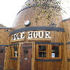
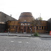
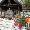
Today’s bike club ride was another trip to North Hollywood to check out the barrel-shaped restaurant. We’d gone to see this in January when it was being renovated, but I’d read recently that it was finished and open for business. So it was time to go see it again.

There’s a spot on Riverside Drive where businesses park their trucks as advertising while they’re not being used. There’s the “Hot Topless Maids” van, and today there was also a junk-hauling truck. And thanks to reality TV, apparently now “Extreme Hoarding” is a thing.

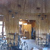
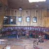
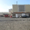
When we got to NoHo, the barrel was all out in the open and nicely refinished. We were able to peek in the windows and see the inside, and it really looked pretty good.

After looking at the barrel, we continued on up Vineland Ave to Chandler, where we stopped for snacks at the Panera across the street from the Metro Red Line station. That was where we’d caught the train home three weeks ago when the ride was rained out.

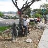
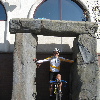
Heading back on the Chandler bikeway, we came across a big group of people running around in circles carrying medicine balls. I guess that’s one of those fitness boot camp things. I think riding the bike is just more fun. And we get to cover a lot of ground. And today, I finally got my photo-op riding the shaggy dog sculpture in Burbank. That makes for a companion to the time I got to ride the rattlesnake sculpture in Rattlesnake Park or when Lucinda was a little kid and like to ride the little fox sculptures in the park downtown.

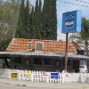
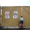
On the way back on Riverside Drive, we saw that apparently Rene Magritte has a hamburger stand now. It must be, because the sign clearly says “Not a Burger Stand”.

44 miles.

Here’s the route map and elevation profile.
6/8/2014

The Gold Line Extension tour

Filed under: — stan @ 1:54 pm

Route Map

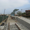
Today’s bike ride was a repeat of our tour of the Metro Gold Line Extension. It’s been four months since we last did it, so we wanted to see how the construction is coming along.

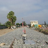
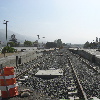
The first stop was the new Arcadia station. They have made visible progress, although the tracks are not yet built there. They’re put in the tracks down the center of the freeway, though. And they’ve started construction on the big parking structure next to the station.

The Monrovia station is coming together. The tracks to the east of it to Duarte are in, and they look like they’re almost finished ballasting and leveling the new tracks there.

Heading east on Duarte road, we were stopped at the light at California when Metro bus pulled up alongside us and the driver proceeded to harass us. He said we were not ‘sharing the road’. I snapped a picture of the bus as he pulled away to document the time this occurred and the bus number. We caught up with the bus down the road, but the driver was nowhere to be seen. Still, I got the numbers on it, and I told every one that I felt a letter coming on.

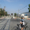
The far point of the ride was when we rode through Azusa and a bit of Glendora. We saw the two Azusa stations under construction. The first one is pretty far along, while the second one seems to still be just a sign saying it’s coming.

On the way back, we saw the site of the Irwindale station. There’s still not a lot there, but it’s definitely more than last time.

Addendum, June 17:
After we got home, I spent some time reviewing the relevant sections of the Vehicle Code. I even found a “Bike Pocket Guide” on the Metro web site that explicitly says that what we were doing was proper and appropriate. Then, I contacted the City of Pasadena Bicycle Coordinator to find out who I should contact a Metro about this incident. He supplied me with a name and address. So here is the letter I wrote to Metro about their jerk driver who harassed us: metro-harassment.pdf

44 miles.

5/11/2014

Overtaken by events

Filed under: — stan @ 4:56 pm

This week, I saw an article about an old house here in Pasadena with a swastika-shaped pond in front. Of course, being that I like going to see odd things, I immediately looked up where it is, and made a route to ride there.

We made our way up the hill on Sierra Madre Villa. And the house was pretty high up the hill. But when we got there, it was very obvious. The swastika is big, and right off the street. The article said that the house was built at least 20 years before the rise of the Nazis, and the swastika was taken from an Indian design. The article implies that the swastika, being Indian, is backwards from the Nazi symbol. But a quick image search shows that this swastika is oriented the same as the Nazi one. In any event, the front-lawn decor of this very old house has obviously been overtaken by events.

From there, we went back down the hill. The route I’d made just made a big loop, not really going anywhere, since the two sightseeing stops were at the beginning and the end of the ride.

When we got to Encanto Park in Duarte, John got a flat. We stopped and fixed it, and the continued on. We made it about two or three miles before it went flat again. This time, Jeff had a close look at the tire, and found a small chip of glass embedded in the tire tread. After taking that out, we fixed the tire again, and we were off.

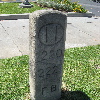
We skipped our usual snack stop, since we’d had a lot of stopped time fixing the flats. The final sightseeing stop was something odd I’d found on Atlas Obscura. It is an old milestone dating back to the early 1900s from the first Foothill Boulevard that was built from downtown Los Angeles to the San Gabriel Valley. It’s just standing by the curb on present-day Colorado Boulevard, in front of a McDonald’s. It’s just very odd that it’s still there.

After that last stop, we headed home. It was a pleasant ride.

39 miles.

Route Map

2/23/2014

The Metro Gold Line Extension

Filed under: — stan @ 3:00 pm

Route Map

Today’s bike club ride was yet another sightseeing ride. This time, we toured the San Gabriel Valley to visit the construction sites where Metro is building the Gold Line light rail extension from Pasadena to Azusa.

The first stop was the Arcadia station being built at 1st Ave and Santa Clara St. On the way there, we saw the new bridges they built for the tracks to go over Colorado Blvd and Santa Anita Blvd. The station is coming along pretty well.

Continuing on to Monrovia, we saw the beginnings of the Metro station there. It’s right by the old Santa Fe depot, but there’s not very much built yet. We also saw the beginnings of the maintenance yard for the light rail line that they’re building in Monrovia.

The station for Duarte is right across the street from City of Hope, and it’s looking pretty close to being finished. This is just before the tracks cross over the San Gabriel River, so we turned north to get to the bike path bridge by Encanto Park. We took that across the river and into Azusa.

The big Santa Fe railroad bridge over Foothill Blvd is being rebuilt. The old bridge is a single track, so they are building essentially two more bridges on either side of it. This is because the part of the Santa Fe line from Irwindale and east is still an active freight line. The freight track is being relocated to the side a bit to make room for the double-track light rail line.

I stopped for a photo-op at the little Stonehenge-like thing on the corner behind the CVS store. Then we went up a block to where they are building the first of two stations for Azusa. This one is being built next to the old Santa Fe depot. The second Azusa station is the last one being built for this phase of the light rail line. It’s right on the border with Glendora, and it’s right in between Azusa Pacific University and Citrus College. I guess that was the idea. There’s a big sign there, but not a lot of activity yet.

Our snack stop was at the Corner Bakery in San Dimas. We’ve been by there a hundred times and never even noticed that it was there before. But it was right by the road we ride on a lot, so we’ll probably be stopping there again in the future.

We rode Gladstone St all the way back to Irwindale, where we took one little side trip to see the site of the Irwindale Metro station. There wasn’t much there, but the big stacks of concrete railroad ties indicate that they’re going to be laying track there soon.

That was the whole of our Metro light-rail adventure tour. We’re going to go on this ride again in a few months to have a look and see how much progress they’re making.

44 miles.

1/19/2014

The Mt Lee Vineyard

Filed under: — stan @ 6:01 pm

Last week, I read an article in the L.A. Times about a guy who owns some of the land on Mt Lee, near the Hollywood sign. And how he’s planted a vineyard there. The article said the grapes were planted in 2001, and given the number of times we’ve been up that way, I was surprised that we never noticed it before. So this Sunday’s ride was to go see it.

It was a nice day for riding, and we headed out by our standard route to get to Hollywood. We rode up the hill in Beachwood Canyon, and stopped at the Hollywood sign, and then we headed down toward the reservoir. Then, looking back up the hill, we saw the vineyard. It was big and obvious. And it looks like a tremendous amount of effort went into planting it, and maintaining it. We stared at it slack-jawed for a few minutes. And that was that. We continued on our route, going up and over the hill into Burbank. We stopped for snack at Priscilla’s, and then headed home. It was a pleasant ride.

40 miles.

Route map

1/12/2014

Another urban oil field story

Filed under: — stan @ 3:23 pm

Today’s bike ride was yet another installment in our continuing series of rides to explore the urban oil fields of Los Angeles. This time, it was to go see the Allenco Energy oil drilling island near USC. We were near there on our ride to see the Doheny Mansion and the location of the first oil well in Los Angeles. This time, we just wanted to go see the oil drilling operation there, since it’s been in the news recently. In particular, there were some stories in the Los Angeles Times about how people in the neighborhood complained about fumes from the oil field, so the EPA sent an inspector out to see, and the inspector became ill from the fumes. Oops.

The day started out with nice sunshine in Pasadena, and we headed south, on our way to downtown Los Angeles. And we promptly rode right into a fog bank. The fog persisted all the way to downtown, and it made for a nice picture of the Bunker Hill towers sticking up into the fog. Unfortunately, looking at the downtown skyscrapers is a bit sad for me right now. Since about Thanksgiving, I’ve been having back problems severe enough that I have trouble walking. Which is not good for climbing the stairs up 50-60 story buildings. The only good thing I can say is that it doesn’t hurt when I ride my bike, so at least that’s still good.

We came out of downtown and found the oil field on 23rd St. Like all oil fields in Los Angeles, it’s out of view, in this case, behind a high wall. The gate was closed, and it was basically impossible to see inside. But then I noticed that there was little hole so that someone with a key could reach inside to unlock the gate. It wasn’t possible to see in through this hole, but it was big enough that I could stick my and and camera inside and take a few pictures. So that’s how we got a view of the inside.

Continuing on, we passed the other oil drilling location on West Adams. Like the Allenco field we’d just seen, this one is also part of the Las Cienegas oil field. The fence around it had been recently raised. Maybe after all the bad publicity surrounding the first oil field, the owners of this one wanted to try and make it even harder to see inside.

Our snack stop was at Noah’s Bagels in Larchmont. After that, we headed home by was of 7th St, and then north through Echo Park and Silver Lake. It was a pleasant ride, even though the sun never really did come out again, and the oil field did in fact smell a bit sulfur-ish.

Here’s the route map: http://www.1134.org/routemap.php?xmlfile=allenco-oil-field

43 miles.

4/6/2008

San Dimas on a gloomy Sunday

Filed under: — stan @ 9:32 pm

Route map

Today’s ride was the “San Dimas South” route. It’s a ‘flattish’ route. There are a few hills, but nothing really big. This was good, since I was still feeling the effects of the 78 miles yesterday.

The weather forecast said, “June gloom in April”, and that was about it. It was gray and overcast. No drizzle, but just gray and gloomy. But it was cool, so it was all right for riding.

We headed straight east all the way to Covina, and then south in to San Dimas. We went close to Bonelli Park before turning back west. There were a couple of small hills there, but soon we were back on the flat land and heading for our stop at Panera across the street from the mall in West Covina.

After some bagels and such, we mounted up and headed for home. There really wasn’t anything remarkable on this ride, but we had a nice time anyway.

46 miles.
cycling

12/2/2007

Mt Hollywood

Filed under: — stan @ 7:34 pm

Route to Griffith Observatory
Route back from Griffith Park

Today’s ride was a new variation on the route over Mt Hollywood. In the past, we’ve done it from north to south, but today we went the other way. This was largely so we could stop for bagels at Priscilla’s in Toluca Lake. We had 12 people on the ride today, which is a fairly big group for us.

We rode down through South Pasadena to Highland Park. And our first sightseeing stop was to see Chicken Boy. Truly a cultural landmark.

Continuing down Figueroa, we crossed the L.A. River and got on Riverside Dr. We took a short side trip on Oros St. to see the tiniest house in Los Angeles.

When we turned on Fletcher to head over to Griffith Park, we came to a roadblock. It was the City of Angels Half Marathon. Who knew? Fortunately, the people at the barricades were very nice, and they let us ride through as long as we stayed out of the way of the runners.

At Hillhurst, we turned north and started up the hill. We rode past the Greek Theater and up to Griffith Observatory. The climb up to the observatory is reasonably steep, and Om set a pace where I had to really work hard to keep up. We regrouped at the top and I took a souvenir picture of the group there. Then we headed down the other side to Mt Hollywood Drive.

The road over Mt Hollywood has been closed to cars for years. So it’s nice and quiet for riding, but the road surface is sometimes pretty bad. Still, it’s a nice ride up to the top. The road was closed to bikes for several months after the recent fires, and it was only recently reopened. On the way up, we saw that the fire had come very close to the road in some places.

We regrouped again at the top before doing the winding downhill into the Valley. I stopped a couple of times to take some ‘action shots’ of riders rounding the turns. When we got to the bottom, we headed off to Priscilla’s.

Sadly, the outdoor tables at Priscilla’s are pretty much all on the north side of the building. The shade is nice in the summer, but it’s cold sitting outside in winter. We had our bagels and such, and then we headed for home.

We took the mid-route home, taking Glenoaks to Chevy Chase, and then up to Linda Vista to go over one more hill. Then down Lida to the Rose Bowl. From there, we went down to Orange Grove and headed straight back to the park.

It was a pretty fun ride, and we got to see Chicken Boy.

45 miles.
cycling

11/25/2007

The Mountain Lion Ride

Filed under: — stan @ 9:06 pm

Route to Oven Fresh
Route back to Victory Park

Today’s ride was number 8 in Gene’s “Noodling” series. This is the one that we test-rode last summer. The high point of the ride is the steep hill on Pinecrest Drive in La Crescenta. There is a sign there warning us that mountain lions have been seen in the area. So ever since then, we’ve always referred to this route as the “Mountain Lion Ride”.

Since Gene is out of commission for a while, I agreed to lead the ride today. I went down to the park to meet the group, and we set out.

The first part of the ride was to climb up into Altadena, and then across before dropping back down to Woodbury Road to get to La Cañada. Then we started the real climbing.

We rode up and across La Cañada before going down all the way to Foothill Blvd. Then we went west for one block and rode back up the same hill on Briggs St. At the top of that hill was where we got on Pineglen Road and rode up Mountain Lion Hill. That was as much fun as the first time. I even said ‘uncle’ and shifted all the way down to my 39×22 for the steep part. I still reserve the 39×24 for the really steep hills.

After climbing Mountain Lion Hill, we headed down into Tujunga. We rode through there until we got to the Viking House. I’d put horns on my helmet today in honor of this house. So James took my picture in front of it. Then we continued on. We took Apperson all the way down to the end. Then we came back on Day St and McGroarty, which basically parallel it. We stopped for water at a park along the way, and we also stopped to take pictures of some peafowl and an abandoned couch. Finally, we came out on Tujunga Canyon Road and took the long downhill back into Montrose and our snack stop at Oven Fresh bakery.

After the snack stop, we headed straight back to Pasadena and the park.

42 miles
cycling

10/14/2007

Glendale hills and a pirate ship, too

Filed under: — stan @ 8:01 pm

Route map

Last week, I saw an item on Curbed L.A. about a house in Burbank with a pirate ship in the back yard. So I mailed Gene and said we should go see it. So today we did the Glendale hills route, which goes right by there. We’ve done this ride before, and it’s always great fun.

It was a bit chilly when we started out in the morning, but it turned into a very nice day. And there was a lot of climbing on this route, so we warmed up pretty fast. And the sheet of bubble wrap I was wearing helped, too. I recently read that it’s the 50th anniversary of the invention of bubble wrap. It’s an amazing thing. Besides cushioning, it’s also a great insulator, and it even has other (Not Safe For Work) uses.

We had to pass through the part of Altadena Drive where they have the road closed for sewer repairs, so it was a bit of a bushwhack. But then we got past that and headed up the hill. Then Ben got a flat. I circled back to get a picture, but some moisture had gotten in the camera, and the picture was just a purple smear. So he missed his chance to be in the Flat Tire Gallery this time.

On the way up the hill, Om led the charge. I recently have been remembering my racing days, and I’ve been trying to again be King of the Hill. So we had some fun racing up the hill. Then we regrouped at the top and headed down the big hill on Mountain Ave. I find this downhill to be frankly terrifying. I guess I’m getting old.

At the bottom, we crossed Verdugo Wash and headed up the hills on the other side. More nice climbing, with some pitches up to 12%. We rambled through the hills and looked at the views before coming down into Glendale.
We rode out into Burbank a bit and then doubled back on Kenneth. Then we turned off on Angeleno to see the pirate ship. And it was impressive. Sort of like a playhouse gone mad.
Our stop was at Paradise Bakery. I had my usual chocolate éclair. And when we left, I saw two different abandoned couches right around the corner.

The route back went up and over the Lida hill back to Pasadena. By this time, I was pretty tired. Newton beat all of us to the top. Then we rode down to the Rose Bowl and up Washington to Arroyo.

We took a small detour to see the house with the cone in front. There is a house on Arroyo where the owner has apparently decided that he doesn’t like bikes riding in the bike lane. The city has gone to the trouble of painting and signing a bike lane on that street, and this particular homeowner places a traffic cone out at the bike lane line and wants us to go around it. It is unclear why he thinks we should not be riding in the space that the city has provided for us. The man in front of the house claimed to know nothing about the cone, but it was pretty obvious that it was his. So perhaps a letter to the city street department is in order.

By the time I got home, I was pretty tired and moving slowly. But it was a fun time.

42 miles.
cycling

Powered by WordPress