Stan’s Obligatory Blog

10/11/2023

More Space Shuttle

Filed under: — stan @ 5:08 pm

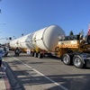
Back in 2012, one of our regular Sunday bike club rides went to see the space shuttle Endeavor as it was being moved to the California Science Center. And in 2016, we rode to Exposition Park to see the external fuel tank for the shuttle, on display next to the building where the shuttle is. I recently read that they have started construction of the new Samuel Oschin Air and Space Center, where the shuttle will be on display in the full vertical ‘stack’, with two solid rocket boosters, the external tank, and the orbiter, all mounted as if ready for launch. So today, the bike club did a special ride to Exposition Park to see the two solid rockets, which were on a pair of very large trucks for transport into the museum.

30 miles.

Route map and elevation profile

9/24/2023

John Waters on Hollywood Blvd

Filed under: — stan @ 3:02 pm

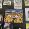
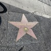
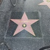
Last Monday, I read that John Waters was going to be getting a star on the Hollywood Walk of Fame. I watched the livestream of the unveiling ceremony, and then I said, “I know where the Sunday bike club ride is going this week…”

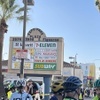
We rode out by our usual route across Highland Park and Silver Lake to get to Hollywood. We stopped briefly to see Carol Burnett’s star, just because there’s a funny story associated with it. (you can read it here) John Waters’ star itself is in front of Larry Edmunds Bookshop at 6644 Hollywood Blvd. As we were about to cross the street to get there, I noticed that Leonard Nimoy’s star is right there on the corner of Hollywood and Cherokee Ave. We’ve been out to visit his grave at Hillside Memorial in Culver City before.

Leaving Hollywood, we rode to Larchmont Village and had snacks at Noah’s Bagels. Then we headed home by way of downtown L.A. and the Arroyo Seco.

43 miles.

Route map and elevation profile

9/11/2023

Star Garden

Filed under: — stan @ 4:48 pm

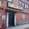
A few weeks ago, I saw an article about Star Garden in North Hollywood. This is a topless bar that recently reopened after being closed for some time, and it now has the distinction of being the only unionized strip show in the U.S.

https://abc7.com/north-hollywood-strippers-union-los-angeles/13697889/

So of course I figured this should be a bike club ride. I made up a route, and here it is. It was kind of wet and misty this morning, but after a little while it cleared up. Of course, that meant that it was like 100 degrees by the time we got back, but it was still a nice ride.

42 miles.

Route map and elevation profile

10/23/2022

Halloween

Filed under: — stan @ 4:09 pm

It’s almost Halloween, so this Sunday was time to do one of our Halloween-themed rides. It was a trip through downtown Los Angeles and nearby areas.

We rode into downtown by our regular route, and then did the short side trip to 5th St and the firehouse where a good bit of “Ghostbusters” was filmed. Then we rode down to follow the Metro Expo line for a bit, where we saw car number 1003 again. This car is special, since it’s the one that Carla and I got our pictures taken on in 2015 when we went to the open house at the new Metro Operations Campus in Monrovia.

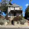
Next up was a visit to Angelino Heights to see the house that was in the “Thriller” video. Apparently, even though it only appears briefly in the video, the neighbor across the street told us it’s a pretty big tourist draw.

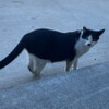
Next, we rode back to downtown for drinks and snacks at Chimney Coffee. That was where we met the very friendly little cat that lives there, and just happens to look like Hitler.

The final sight was in South Pasadena, where we rode by Michael Myers’ house from “Halloween”. We’ve been to see it before, and pictures are there.

47 miles.

Route map and elevation profile.

9/4/2022

Santa Monica

Filed under: — stan @ 3:16 pm

This week has been brutally hot, at least by Los Angeles standards. And today was forecast to be about 110F again. So the Sunday bike club ride was a one-way trip to Santa Monica. It’s mostly downhill to the beach, and the beach is slightly less hot than here in Pasadena. So that was the plan.

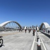
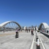
In the past, we’ve done this route by taking Huntington into downtown L.A., but today I modified this so we started out by going down to East L.A. and Boyle Heights. This is also mostly downhill, but pads it out slightly to make the route longer. We also got to go over the new 6th Street bridge. After that, we went through downtown and down to USC before following the Metro Expo Line west. We stopped at Western Ave and got a couple gallon jugs of cold water to refill all our water bottles.

Continuing on, by the time we got on the Ballona Creek bike trail, we could feel it was getting to be slightly less hot, since we were just a few miles from the ocean at that point. In Marina Del Rey, we were all enjoying the (relatively) cool ocean breeze. The locals weren’t enjoying it, since it was still pretty hot by beach standards, but we thought it felt good. We rode by the canals in Venice, and then up Main St to our snack stop at Dogtown Coffee. We found out today that the coffee shop has a patio out back that we didn’t know about. So that was nice. After that, we rode the final mile or so to the Metro Station at 4th and Colorado in Santa Monica. The we got on the train to come home.

43 miles.

Route map and elevation profile

7/10/2022

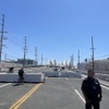
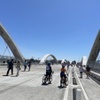
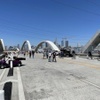
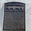
The New 6th Street Bridge

Filed under: — stan @ 4:41 pm

Back in 2015, we took a bike ride to go see the 6th Street Bridge over the Los Angeles River. The old bridge had just been closed, and was going to be demolished and rebuilt. The demolition process led to a bike ride to see a closed-down section of the 101 freeway. Ever since then, every time we’d pass through the Arts District east of downtown, we would stop and see how the construction of the new bridge was coming along. And this weekend was the grand opening of the new bridge.

There was also a CicLAvia going on today on Western Ave in south L.A., so the plan was to go there first. Then we’d head back into downtown for the chance to ride over the new bridge, starting at 11:00.

We rode downtown by our usual basic route down Huntington Drive. Then out on Exposition to Western, where we picked up the CicLAvia route. We rode to the far end of that, and then headed back to downtown. We got to the bridge a few minutes before the 11:00AM opening. We rode across the bridge to Boyle Heights, and then back. All told, they did a pretty good job on it.

We stopped for drinks and snacks at Chimney Coffee outside downtown. Then we came home by way of the Arroyo Seco.

48 miles.

Route map and elevation profile.

7/3/2022

Turnbull Canyon

Filed under: — stan @ 1:52 pm

Today’s bike ride was a trip up and over Turnbull Canyon in Whittier. We haven’t done this one in a while, but today was supposed to be a nice day, and not hot. So it seemed like the thing to do.

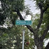
For some reason, we had big group today, so we took the short side trip in Pico Rivera to go see Dork Street. And we were pleasantly surprised to see that the street sign that was stolen years ago has been replaced. So we were all set for the obligatory photo-ops with the street sign.

After that, we rode across Whittier and up and over the canyon. Our snack stop was at Merengue in Monrovia, and then we headed home.

43 miles.

Route map and elevation profile

6/5/2022

The 40th Anniversary of E.T.

Filed under: — stan @ 3:41 pm

June of 1982 was 40 years ago, and that was when “E.T. the Extra-Terrestrial” was released. At the time, it was just a nice little movie, but over time, it’s taken it’s place in our culture. We’ve been to see Elliott’s house from the movie before, but not for some years. So it was time to go again.

I pared the route down a bit from last time to cut down on the amount of climbing. It was still an impressively steep hill to get up to the house, but we made it.

36 miles.

Route map and elevation profile.

5/29/2022

The Berlin Wall

Filed under: — stan @ 7:30 pm

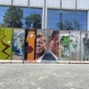
Today’s bike club ride was a visit to the Berlin Wall on Wilshire Blvd, across the street. It’s there because of the Wende Museum, and it’s the largest piece of the Berlin Wall outside of Germany.

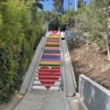
This morning, I read that the city of Los Angeles had arranged for the original artist to come back and repaint the Micheltorena Stairs, after they had been painted over by unknown vandals a few weeks ago. So we decided that we’d also take the short side trip to see them on the way out to the Berlin Wall. The stairs look good, and apparently the city has arranged for them to treated with an anti-graffitti coating so that if they are vandalized again, it can be washed off easily.

We made it out to the Berlin Wall and took in the sight. We also saw that the main building for the Los Angeles County Museum of Art across the street has been completely demolished. I’d heard that they were rebuilding it, but I didn’t realize that that meant it was going all the way to bare ground.

We went for snacks at the Curson Cafe in Park La Brea. We’ve been there before, and it’s nice sort-of-hidden place.

On the way back, we were about halfway back to downtown Los Angeles when I broke a spoke. Of course it was on the back wheel, and of course it was on the gear side. I took out my spoke wrench and managed to tune the wheel enough that it wasn’t dragging on the brake or the frame, and we continued on until we got downtown. Then I said ‘uncle’ and we got on Metro Rail to go back to Pasadena.

34 miles.

Route map and elevation profile
5/8/2022

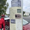
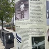
Holiday Bowl

Filed under: — stan @ 2:35 pm

I was watching an episode of “Lost L.A.” the other day about how the Crenshaw neighborhood was a mixed Black and Japanese area after the Japanese came back to Los Angeles after the war.

https://www.youtube.com/watch?v=y9TyxQy57Q4

After seeing the part about Holiday Bowl, I figure that was going to have to be the Sunday bike ride for this weekend. So here we are. We rode out to Crenshaw to see the building that used to be Holiday Bowl.

45 miles.

Route map and elevation profile.

Powered by WordPress