Stan’s Obligatory Blog

2/23/2020

Ciclavia South Los Angeles

Filed under: — stan @ 2:42 pm

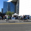
The latest Ciclavia is a six-mile trip down Central Ave in Los Angeles, from Adams Blvd to 103rd St. Usually, we tend to avoid Ciclavia, since they tend to be very crowded. But the last time they had one in Watts, it wasn’t too crowded. So we figured this would be similar. And besides, we could go see the Watts Towers, which is always a bit of a treat.

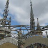
To get there, we rode down our usual route into downtown L.A., and then down along the river through the Arts District, where we stopped for a moment to look at the new 6th St bridge under construction. After crossing over the railroad yard south of downtown, we picked up the Ciclavia route. We rode straight down Central Ave to the end, and then we took a couple blocks side trip to the Watts Towers. The big towers are being renovated, so they had scaffolding and netting around them, so we couldn’t see them that well. But that was all right, since we’ve seen them before.

For the route back, we took Main St all the way up through downtown, and then the Arroyo Seco bike path.

48 miles.

Route map and elevation profile

2/16/2020

And her little dog, too!

Filed under: — stan @ 6:59 pm

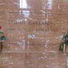
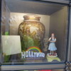
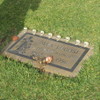
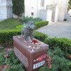
Last week’s ride was to Hollywood Forever to see Judy Garland’s grave. Since only two of us were there, we did the same route this week. The weather was much nicer, and I also remembered that there is also a memorial to Toto at Hollywood Forever. So that was the ride for today.

We stopped for snacks at La Colombe in Frogtown. I particularly like that they have sparkling water on tap there. Overall, it was a nice ride.

41 miles.

Route map and elevation profile

2/9/2020

Somewhere over the rainbow…

Filed under: — stan @ 4:10 pm

I recently read that Judy Garland is now buried in Hollywood Forever. For a long time, she was at a cemetery in Westchester County, New York. But apparently, a few years ago her family decided that it would be more appropriate for her to be interred in Hollywood. Since celebrity graves are a good ride theme, Hollywood Forever was the destination for today.

The day started off with a slight threat of rain, but this route tracks close to several Metro Rail lines, so we have bailout options. Still, there were only two of us today. We rode through downtown L.A. and then out to Larchmont Village and then to Hollywood Forever, which is located right next to Paramount Studios. When we got there, we ended up having to ask the guy at the information booth where Judy is located. But once we found her, it was pretty obvious.

Continuing on, we headed for home by way of Frogtown. We got as far as crossing the L.A. River and starting up Figueroa St when it started raining. So we turned off on Ave 26 and got on the train at the Lincoln/Cypress Metro station. When we got back to Pasadena, it was raining lightly, but it was all right to ride the two miles home from the station. Then, about five minutes after I got home, the sky opened up, and we had pouring rain. So that was lucky good timing.

32 miles, counting the two miles home from the Allen Metro station.

Route map and elevation profile

12/15/2019

Dollface

Filed under: — stan @ 9:06 pm

A few weeks ago, when we were out riding, I saw an ad for a new series on Hulu called “Dollface“. I made a note to look this up, since it’s Kat Dennings, who I’m a huge fan of ever since she was Norah in “Nick & Norah’s Infinite Playlist“. For reasons I can’t quite explain, “Nick & Norah” is one of my most favoritest movies of ever.

So I watched the series when it came out, and I liked it a lot. There are a lot of little surreal bits in it, and in particular, two of my most favorite ones were the beginning of episode 2, when Jules got into a fight with the fitness app on her phone, and also episode 9, where they made their own version of “The Wizard of Oz”. So going to see a couple of these locations became the theme for today’s ride.

The scene with Jules fighting with the app on her phone was shot at the Micheltorena Stairs in Silver Lake, just off Sunset Blvd. I worked out a reasonable route to get there, including riding through downtown L.A., which was the scene of the women’s march in sort-of-Oz in the “Feminist” episode. And we were off.

It was a bit windy when we started out, but we figured it would be all right. By the time we got to downtown L.A., it had reached the point of being windy enough that it was getting unpleasant to ride in. On the other hand, that also made for another tie-in with the show, since the “Feminist” episode began with a crazy windy day in L.A.

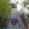
We rode out to Hancock Park and stopped for bagels at Noah’s there. The wind had gotten bad enough that people walking were having trouble with it. But we pressed on. We rode back into Silver Lake, and then down a very steep hill to get to the bottom of the staircase. The lower part of it has been painted with hearts, and is known for being the most Instagrammed staircase in L.A. The actual scene from the show was shot on the upper part of the staircase, so I walked up there, carrying the bike. I got my photo-op, and at that point, I said “uncle” and decided to bail out and take Metro home. The nearest Metro station was the subway at Vermont and Beverly, so we headed over there. Just before we got there, we saw a homeless tent colony on fire. That was kind of scary, and the smoke was very thick. But we made it to the subway and rode the train back to Pasadena.

33 miles, including the two miles from the Pasadena Metro station back to the park.

Route map and elevation profile
11/24/2019

The Doo Dah Parade

Filed under: — stan @ 7:10 pm

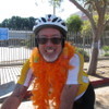
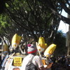
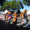
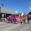
Last week, I found out my friend Sue from the office was going to be one of the Grand Marshals for the Doo Dah Parade. So that was the plan for the Sunday ride today. I made a slightly shorter route, so we could make it back by 11:00. When we got there, I rode around to the staging area to find Sue and her crew. When I got there, Morgan wrapped a feather boa around my neck, and I got to be an honorary Seismo Sistah. We did two laps of the parade route, dodging a hail of flying tortillas. It was a weird and entertaining experience.

33 miles.

Route map and elevation profile
11/3/2019

The Little Free Pantry

Filed under: — stan @ 2:38 pm

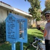
A few weeks ago, I read an article in the L.A. Times about a church in Burbank that had set up a Little Free Pantry. Sort of like a Little Free Library, but with food instead of books. I brought along a can of turkey chili to contribute, since it fit in the water bottle cage on the bike.

The route was basically our regular Burbank and NoHo route. We stopped for snacks at Priscilla’s before heading home. The only real change was that we rode a different route through Griffith Park on the way back.

42 miles.

Route map and elevation profile
10/27/2019

Down for the Count – 2019

Filed under: — stan @ 3:05 pm

Today’s bike ride was the annual “Down for the Count” ride to Culver City to visit Bela Lugosi’s grave. We first did this in 2007, and we’ve done this every year since 2009. It’s one of only two rides we do on the same weekend every year.

We rode out by the usual route through downtown and along the Expo Line to Culver City. As always, when we got there, someone had been there to decorate Bela’s headstone for Halloween.

After we left the cemetery, we rode to La Dijonaise in the old Helms bakery complex. While we were there we saw some women walking some dogs. They said one of them was a Labradoodle, but I think it was really a Poobrador.

On the way back, we passed a couple of new cannabis shops on Venice Blvd. We got a good laugh from Hollyweed and The Pottery.

55 miles.

Route map and elevation profile
10/6/2019

Ciclavia downtown

Filed under: — stan @ 4:53 pm

Today was the latest Ciclavia. The “Heart of L.A.” route from East L.A. and through downtown. We rode down by way of San Gabriel to pad the route a bit. Then we picked up the route at Mariachi Plaza in Boyle Heights. After going through downtown, we went off the route briefly to see the firehouse where the original “Ghostbusters” was filmed. Then we went back on the route to near MacArthur park, when we turned north to Echo Park. We went through Angelino Heights to see the house from the “Thriller” music video, and also the house from “Charmed“. The route home went up the Arroyo Seco, where we ran into a closed gate. We had to pass the bikes over the gate and crawl underneath it. Just like old times when I did spelunking in Texas. Our final bit of sightseeing was to see Michael Myers’ house from “Halloween“.

All around, it was an entertaining ride.

46 miles.

Route map and elevation profile
9/29/2019

The George Harrison Tree

Filed under: — stan @ 5:14 pm

Today’s bike ride was a trip to Griffith Park to see the George Harrison Tree. Then we did the ride over Mt Hollywood and then the other way through Griffith Park before coming home by way of Highland Park.

47 miles.

Route map and elevation profile.

9/22/2019

The Fake McDonald’s

Filed under: — stan @ 5:08 pm

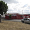
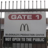
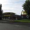
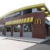
Many years ago, I read once that McDonald’s has location in City of Industry that is never open. It’s just a studio where they film McDonald’s commercials. So that’s been on my sightseeing list for some time, and I recently found out where it is, so that was the destination for this week’s bike ride. This route is slightly longer than ones we usually do, but it’s also comparatively flat.

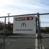
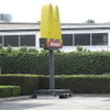
When we got there, it was closed up, complete with a sign announcing that it was “Not Open To The Public”. It’s pretty big, which I guess may have to do with the logistics of lights and cameras and so forth involved in filming things. And I thought it was funny that they had a smaller golden arches sign on wheels, so they can move the outside sign around.

On the way back, we stopped off for snacks and drinks at Panera in West Covina.

48 miles.

Route map and elevation profile
Powered by WordPress