Stan’s Obligatory Blog

6/30/2013

Oil!

Filed under: — stan @ 5:12 pm

This week, I heard that there is talk of fracking in the Inglewood oil field here in Los Angeles. I used to go through that oil field every day on my way to and from work back in my Hughes Aircraft days in the late ’80s. That got me to remember how I’d done a bike tour a few years ago to see some of the disguised oil wells that are scattered around Los Angeles. And just to add to that, my friend at work made up a map of all the oil drilling spots that he knew of in L.A., overlaid with all of the earthquakes in the basin for the last 30 years. It was interesting to see how there were some obvious clusters of small earthquakes around some of the oil fields. We’re having a heat wave this weekend, and heading west towards the coast meant it would be somewhat less hot for us. So I thought it was time to take the bike club on an oil field tour.

That is, of course, different from “a three-hour tour”. That’s a different 1960s TV show. This one is about the guy who struck oil and got rich. The funny thing is, Jed Clampett struck oil and got rich, so he moved to Beverly Hills, which sits on top of large oil field. Go figure.

Back in the 1960s, Standard Oil put out a brochure for homeowners in the west Los Angeles area to explain how they could be living on top of an active oil field. And through the magic of the Internet, we can read it today: http://www.scribd.com/doc/16684123/beverly-hills-oil-field-chevron-brochure

We started off by riding to downtown Los Angeles. Passing City Hall, we saw the preparations for Mayor Garcetti’s inauguration later in the day. Our first stop was the St. James Oil Company’s drilling yard just south of downtown. This is the only drilling island for the downtown oil field. We had visited this place once before, on the Tour de Oozing Oil in 2006.

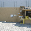
We continued south out of downtown, and then headed west on Adams Blvd. Along the way, we passed a wall that we all thought looked like another oil island. I looked it up when I got home, and it was indeed one. It was the Adams and Gramercy drilling island, which is one of four on the Las Cienegas Oil Field, which goes roughly from about USC to somewhere west of Crenshaw. There are three other islands that work this field, so I see another oil field tour in our future.

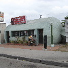
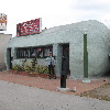
The second official stop was the Pico and Genessee drilling island. This is the easternmost drilling site that taps the Beverly Hills Oil Field. The building looks like it could be a county administration building, complete with a big glass lobby in front, but it’s enclosed by a locked fence.

Continuing west, we came to the Cardiff well site at Pico and Doheny. This is a two-part site, with one building having a tall tower to enclose the drilling rig, and then a second building across the street that looks like a 1960s-style bank, where the storage tanks and so forth are kept.

It was about this time that I was talking to the group. We were talking about oil, thinking about oil, smelling oil. And I said, “this whole ride is about oil, so whose chain is squeaking?!?”

Our next sightseeing stop was the drilling center next to the Beverly Center. This one taps the Salt Lake Oil Field and the smaller San Vicente Oil Field. It’s so unobtrusive that most people who go to that mall don’t even notice that it’s there.

Heading east again, we passed Fairfax Ave and the exploding Ross Dress For Less store. Then we rode up the back side of The Grove to see one more drilling site that was recently shut down. That concluded our oil field tour, and we headed east to Hancock Park and bagels at Noah’s in Larchmont.

The trip home was pretty uneventful. Both John and GT got flats. By this time, it was pretty hot. and the last part of the ride began to resemble the Retreat from Moscow, but hot instead of cold. In Eagle Rock, Stewart took a detour on the sidewalk just to ride through some sprinklers. Still, we made it home all right. And it was a fun time.

52 miles.
6/16/2013

Playgrounds Again

Filed under: — stan @ 4:34 pm

Being a member of AAA, I get their monthly “Westways” magazine, and a recent issue had a little feature about unusual playgrounds in the Los Angele area. So that got me thinking that it was time to do the Playgrounds bike ride again. And today was the day.

It was a perfect day for riding. Cool and overcast at the start, with the clouds burning off and having some nice sunshine by the time we finished.

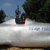
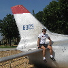
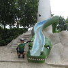
We rode down to San Gabriel to see La Laguna de San Gabriel at Vincent Lugo Park. We’d been there recently on our way to East Los Angeles to see the giant tamale. Then we headed east across the San Gabriel Valley, out to West Covina to see the F-86 Sabre jet at Puente Park. The article said that it’s a real airplane under there, and that it’s just been filled and coated with concrete. I was knocking on it, and I suppose there might be an actual airplane under there, but for all practical purposes, it feels like a solid cast-concrete model of a airplane.

Our snack stop was at Panera in West Covina. After that, we headed home. In Arcadia, I found yet another house where the mailbox was decorated as a miniature of the house. I like seeing those.

It was a nice ride.

43 miles.

6/9/2013

Glendora – Times Change

Filed under: — stan @ 5:20 pm

Today’s bike club ride was our old route out to Glendora. There’s not much to see along the way, but I did notice one thing different. The house of the number-one railfan is for sale. That’s kind of sad. So here’s what the house used to look like:

37 miles.
6/2/2013

The Grade-F Streets of Los Angeles

Filed under: — stan @ 1:46 pm

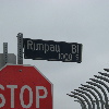
A few weeks ago, there was an article in the L.A. Times about how many of the streets of Los Angeles are in really bad shape. In particular, they mentioned Rimpau Blvd in Hancock Park. I had a look at the interactive web map showing all the streets in the city and their grades, and I saw that part of Rimpau was repaved last year, and graded “A”, and then the section just a few blocks away was graded “F”. So I thought this might make for an amusing sightseeing trip.

The route out was our usual route through downtown Los Angeles, and then out on West Adams. We took a short side trip to Lafayette Square to look at the old mansions. Then we headed up into Hancock Park.

The grade “A” section of Rimpau was indeed very nice. Smooth pavement, no cracks. Then, when we crossed 3rd St, I saw the original builder’s stamp in the street’s concrete. The street had not been repaved since being built in the mid-1920s. And it showed. There were big cracks, holes, ruts, and it was rough. So that’s what a grade of “F” looks like.

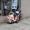
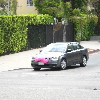
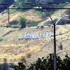
After looking at the failed street. we headed up to Larchmont and Noah’s Bagels. We sat outside and had some snacks. Then we headed home. Along the way, we saw a police car kiddie ride, a car with a pink moustache, people getting ready to go kayaking in the L.A. River, and a sign on the hillside above Glassell Park that said “GLASSELLLAND”.

It was a nice ride.

44 miles.
5/26/2013

Claremont

Filed under: — stan @ 2:11 pm

It’s the last Sunday of the month, and we’re still not having our usual summer heat. So for the ‘slightly longer than usual’ ride for this month, we rode to Claremont. If it were hot, going inland like this would be very unpleasant, but today was just perfect.

The ride out there is pretty straightforward. Almost no hills, and not a lot of sightseeing along the way. But we did pass the L.A. County Fairgrounds. I’ve started development on a new set of recipes to enter in the baking contest at this year’s fair.

When we got there, we went to Le Pain Quotidient. We sat outside on the patio, near the fountains and sculptures.

All told, it was a pleasant, and pretty uneventful ride.

57 miles.
5/19/2013

Monsters

Filed under: — stan @ 6:05 pm

Last week, there was an article in the L.A. Times about how Chris Brown had painted cartoon monsters on the wall in front of his house, and how his neighbors were upset about that. And of course, my first thought was that we should go on a ride there to see them. So that’s what we did today.

His house is almost at the end of a cul-de-sac in the Hollywood Hills, just below Lake Hollywood. So I recycled the ‘Atomic Age Houses‘ route for most of the ride, and we headed out.

We rode the normal way across Eagle Rock to get to Hollywood. And then we turned off Franklin and headed up the hill. The streets there are typical Hollywood Hills streets. Narrow, winding, and steep. But then we came around the last bend, and just after the ‘ROAD ENDS 600 FT’ sign, we saw the monsters. There were several painted on the wall in front of the house, and more on the house itself on the upper levels. I really don’t get what the neighbors are complaining about. After all, they say that the monsters scare their kids. But how many of them also have DVDs of “Monsters, Inc” for their kids to watch?

After looking at the monsters, we had to backtrack down the hill a bit before we turned and headed up the main hill to the top, near the Hollywood sign. We passed Wolf’s Lair Castle, and then rode down the hill, past the dog park, and then up the big, steep hill behind the reservoir. And after all that, it was time for snacks at Priscilla’s.

The last part of the ride was a direct route home, across Glendale and Eagle Rock. It was a nice ride.

40 miles.
5/13/2013

For the most part…

Filed under: — stan @ 7:43 pm

I ride my bike to work every day, and I’ve done that for all of the over 18 years I’ve been at my job. And for the most part, Pasadena is a pretty pleasant place to ride. I’ve worked out a route that avoids most of the busy streets, and it’s one that is such that both going in in the morning and coming home in the evening, the last part of the ride is downhill. So it’s pretty good.

Just one minor problem. In recent years, the city has gone to putting vehicle detector loops on most traffic lights in the city. And not all of them work correctly. And since it’s Bike Week in Pasadena, and the city is trying to encourage more people to ride bikes, I need to go on a bit of a rant here.

CVC section 21550.5 says:

(b) Upon the first placement of a traffic-actuated signal or
replacement of the loop detector of a traffic-actuated signal, the
traffic-actuated signal shall, to the extent feasible and in
conformance with professional traffic engineering practice, be
installed and maintained so as to detect lawful bicycle or motorcycle
traffic on the roadway.

I’ve corresponded with the city traffic light maintenance people about this issue, and they’ve gone and adjusted some of the sensors. This has helped in some cases, and the lights will work correctly for a time. But in each case, after about a month, the fixed lights go back to not working correctly.
Looking again at the CVC section 21800, we find:

(d) (1) The driver of any vehicle approaching an intersection which has official traffic control signals that are inoperative shall stop at the intersection, and may proceed with caution when it is safe to do so.

So this is going to have to be my policy now. For signals that do not function correctly, I’m just going to have to treat them as if they were stop signs.

Just for the record, here are the intersections with lights that I go through on my way to the office:

  • Cooley Pl and Altadena Dr: Signal used to work. It worked from when they put in the detectors in 2003 until last year. I put in a request to fix it in October, 2012. They fixed it, and it stopped working again in April, 2013. It currently does not work. And there is no way to activate the left-turn arrow manually. The button for the ‘walk’ signal only activates the ‘walk’ sign, and it does not trigger the left green arrow. So if there is not a car here to activate the signal, I have no option but to cross illegally.
  • Mountain St and Allen Ave: This used to be on a regular timer, but they changed it a few months ago. Neither direction works for me.
  • Sierra Bonita Ave and Maple St: The northbound light works correctly. The southbound light never worked in the past. I put in a request to fix it in March, 2013. They adjusted it, and it worked for about a month. It no longer works correctly.
  • Sierra Bonita Ave and Corson St: The northbound light works correctly. The southbound light has always worked, until the last time they came out to adjust the southbound light above. Now it no longer works.
  • Sierra Bonita Ave and Walnut St: The detectors at this intersection have never worked for me.
  • Sierra Bonita Ave and Colorado Blvd: The detectors here do not work, and they never have.
  • Bonnie Ave and Colorado Blvd: The northbound left-turn detectors here work correctly. This is fortunate, since Colorado is a very busy street, and it would be very difficult to cross without the protected left turn. And there is no other way to activate the left-turn arrow.
  • Bonnie Ave and Del Mar Ave: The detectors both north and southbound have never worked at this intersection.
  • San Pasqual St and Hill Ave: This light is still on a regular timer, so it is not a problem.

Now that I wrote it all down, it seems that the list of signals that work correctly is much shorter than the list of ones that do not work.

<Sigh>

Anyway, if I get a ticket for running any of these non-functioning lights, I will at least have a record of the issues I’ve filed with the city that I can use to argue that the lights are defective.

5/12/2013

Glendale Vistas

Filed under: — stan @ 6:51 pm

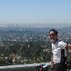
This week’s bike club ride was a ‘normal’ ride, in that we just went riding to no place in particular. There was no cultural sightseeing or anything like that this time. It was just a ride around Glendale, and up through the hills there. The most remarkable thing that ever happened on this route was when I broke my cassette back in 2007

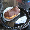
It was a very nice day for riding. We headed out and up through La Cañada, and then down through Glendale. We stopped at Paradise Bakery, and I got one of their chocolate eclairs. They have the best eclairs there. Then it was time to ride up some hills.

I got one picture from the apex of the ride, and then we headed down the other side. We rode back by way of La Cañada, which added some more hills. And when I got home, I rode around the block once, just to add another half-mile. It was a nice ride.

40 miles.

5/5/2013

Sea monsters and a giant tamale

Filed under: — stan @ 5:03 pm

Today’s bike ride was a sightseeing trip to see some odd landmarks. First was the Laguna de San Gabriel in Vincent Lugo Park, with its sea-monster playground, and second was the giant tamale on Whittier Blvd in East Los Angeles. The tamale is a prime example of programmatic architecture, right up there with Donut Hole and other odd buildings around Los Angeles.

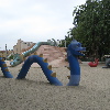
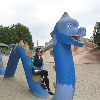
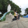
It was a cool and overcast this morning, and the forecast said it might rain a bit later on. We headed south toward San Gabriel. We turned down Wells St to get to Vincent Lugo Park and the Laguna de San Gabriel playground. The last time we went to see this, it was closed for renovation, but it’s open again now. And it comes complete with a sign warning us that the historic playground “predates modern playground standards”. Good to know, I guess. Carla and I got some pictures with the sea creatures on the playground.

Leaving the playground, we continued south, crossing the 60 freeway and coming out on Whittier Blvd in East Los Angeles. There, just down the block was the giant tamale. It was built back in the 1920s, and it was originally a tamale shop. Now it’s half a hair salon and half a dental lab. But it’s still a prime example of odd architecture.

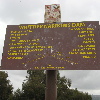
From the tamale, we headed east through Montebello to the Rio Hondo bike path. We went north, over Whittier Narrows Dam. I’d never noticed the sign at the top before. So now we know what the dam is made of, and the slopes of the sides of it. Again, good to know, I guess.

On the San Gabriel River bike path, we came across a bike accident. Another bike club group had had some sort of mishap, and the L.A. County Fire paramedics were on the scene. I’d never thought about it before, but apparently they can get the ambulance on to the bike path. One more thing to put in the “good to know, I guess” file.

Since we’d not done this particular route before, my estimate was that it was going to be about 42 miles when we were done. But by the time we were on top of Santa Fe Dam in Irwindale, I could tell it was going to be close to 50 by the time we got back. We rode up the bike path to Encanto Park, and then into Monrovia. We stopped for snacks at Merengue, and then headed home. When I got home, I had 49.4 miles. So I rode around the block a couple times, just to make it:

50 miles.

4/28/2013

A ride to nowhere in particular

Filed under: — stan @ 12:53 pm

Today’s bike ride is a route we haven’t done in several years. I call the the Ride to Nowhere in Particular. The route just sort of meanders around, but there are no sightseeing stops or points of interest along the way. About the only unusual thing we saw was the dog skull on Lincoln Ave in Montebello. Still, it was nice day, and a pleasant ride.

46 miles.

Powered by WordPress