Stan’s Obligatory Blog

7/6/2014

Glendora Mountain for the 4th of July

Filed under: — stan @ 1:21 pm

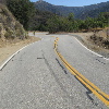
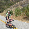
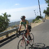
It’s become traditional that they close Glendora Mountain Road for the 4th of July weekend. I guess that’s to keep people from driving up there and setting the mountain on fire with fireworks. But in any event, it makes for a nice place for bike riding on that weekend. So we were going to take advantage of it.

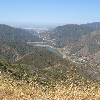
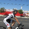
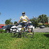
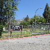
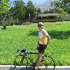
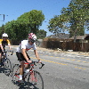
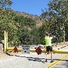
We rode out the Glendora and headed up the road. At the gate, we just lifted our bikes over and started up the hill. The ‘hill’ in this case is about 8-9 miles of about a 5% grade. Not terrible, but enough that we gain a lot of elevation by the time we reach the top. It was pretty hot today, and for the first time in a long time, I ran out of water. Fortunately, Pat knew where there was a park with a drinking fountain at the bottom of the hill. So we all stopped there and refilled our bottles before heading home.

It was a nice ride, and we weren’t the only ones taking advantage of it. We met one guy on the road who had ridden his bike from Huntington Beach just to ride the mountain while the road was closed.

55 miles.

6/29/2014

Another San Fernando Earthquake tour

Filed under: — stan @ 1:59 pm

Today’s bike club ride was a tour to see some sights related to the 1971 San Fernando Earthquake. It’s a slightly longer ride than usual, but that’s all right since it’s the last Sunday of the month. And we had a nice treat today, with Vikki joining us for the first time in a long time. After all these years, she’s back working in the earthquake business, so she wanted to come on the earthquake-themed ride.

We headed out across Eagle Rock and Glendale, and up through Burbank. Basically, we got on Glenoaks and just kept on going. We rode through the auto-wrecking ghetto of Sun Valley, all the way to San Fernando, and the McDonald’s there. There is a little hill in between the drive-through lane and the parking lot. That little hill was part of the mapped surface rupture from the 1971 earthquake. When they built the McDonald’s, they just smoothed it over and planted grass on it. It’s one of the nicer-landscaped fault scarps around.

Just beyond the McDonald’s, we turned and headed toward the mountains. The old VA hospital was essentially destroyed by the 1971 earthquake, and it was never rebuilt. The functions done there were all moved to the newer facility in Mission Hills. That’s the place we visited last year, since one of the buildings there was used to play the American Embassy in Tehran in the movie “Argo“. And the old VA hospital grounds in San Fernando were turned into a county park. It’s a pretty big and very attractive park, and there’s really no sign of what used to be there.

Coming back, we headed back down Glenoaks, and then turned up La Tuna Canyon. As always, the five-mile uphill ride was a joy. Sort of. Still, it was a fun ride, and I’ve finally seen where the old VA Hospital was.

56 miles.

6/8/2014

The Gold Line Extension tour

Filed under: — stan @ 1:54 pm

Route Map

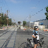
Today’s bike ride was a repeat of our tour of the Metro Gold Line Extension. It’s been four months since we last did it, so we wanted to see how the construction is coming along.

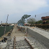
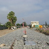
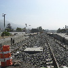
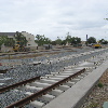
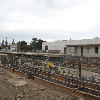
The first stop was the new Arcadia station. They have made visible progress, although the tracks are not yet built there. They’re put in the tracks down the center of the freeway, though. And they’ve started construction on the big parking structure next to the station.

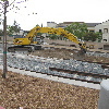
The Monrovia station is coming together. The tracks to the east of it to Duarte are in, and they look like they’re almost finished ballasting and leveling the new tracks there.

Heading east on Duarte road, we were stopped at the light at California when Metro bus pulled up alongside us and the driver proceeded to harass us. He said we were not ‘sharing the road’. I snapped a picture of the bus as he pulled away to document the time this occurred and the bus number. We caught up with the bus down the road, but the driver was nowhere to be seen. Still, I got the numbers on it, and I told every one that I felt a letter coming on.

The far point of the ride was when we rode through Azusa and a bit of Glendora. We saw the two Azusa stations under construction. The first one is pretty far along, while the second one seems to still be just a sign saying it’s coming.

On the way back, we saw the site of the Irwindale station. There’s still not a lot there, but it’s definitely more than last time.

Addendum, June 17:
After we got home, I spent some time reviewing the relevant sections of the Vehicle Code. I even found a “Bike Pocket Guide” on the Metro web site that explicitly says that what we were doing was proper and appropriate. Then, I contacted the City of Pasadena Bicycle Coordinator to find out who I should contact a Metro about this incident. He supplied me with a name and address. So here is the letter I wrote to Metro about their jerk driver who harassed us: metro-harassment.pdf

44 miles.

5/18/2014

This was much harder than I’d expected

Filed under: — stan @ 6:19 pm

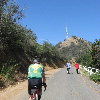
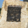
Over the years, we’ve ridden our bikes up to just below the Hollywood sign many, many times. The spot we go to is pretty close below the sign, but I recently found out that there is an actual road up to the summit of Mt Lee, just above the sign. Actually, I’d know that the road existed for a long time, but what I just found out is that there is a small gate to allow hikers through. I figured it would be interesting to carry our bikes through and try riding it.

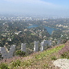
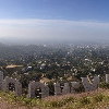
As always, the ride up to the top of the Hollywoodland neighborhood was very steep, but we got to the top just fine. We walked our bikes through the gate, and started up the road. At first, it was a pleasant enough winding mountain road. And then it got steep. And there was sand on the road. It turned out to be a very difficult climb. Pat later told me it was 500 vertical feet from the gate to the top of the mountain. I guess it’s sort of deceptive. Looking at the sign, one doesn’t realize how high the hill is, since it’s not obvious that the letters themselves are 45 feet tall.

We finally made it up to the top. The view was great, and we spent a few minutes looking at it before heading back down. Between the hikers and the steep hill and the sand on the road, I thought it prudent to go very slowly down the hill. But we made it down all right. And then we had to make our way to the other side of the canyon to get to the road to Burbank. And as it turned out, that involved dropping halfway down the canyon and climbing back up the other side. Which was yet another ridiculously steep hill. Sheesh. But we made it across, so we could go down past the dog park and around the reservoir, which meant we had to climb up the hill on Lake Hollywood Drive. By this time, even I’d had enough of the hills.

We stopped for snacks and drinks at Priscilla’s. And they were nice enough to refill our water bottles, too. We dropped a few extra dollars in the tip bucket, since they were very nice about it.

On the way home, we stopped to see the site of an oil pipeline break this past week. The article talked about how the oil sprayed out on the walls and roof of The Gentlemen’s Club, which was right next to the break. No word on whether or not they sent dancers out to wrestle in it. But the cleanup crew was hard at work scooping up the sand that they’d put down to contain the oil. And the smell of oil was quite strong. Sort of like the time we did the Tour de Oozing Oil, back in 2006.

From there, we took the straightest and flattest route home, straight across Glendale and Eagle Rock. We groaned up the Colorado hill back in to Pasadena, and then we were done.

42 miles
5/11/2014

Overtaken by events

Filed under: — stan @ 4:56 pm

This week, I saw an article about an old house here in Pasadena with a swastika-shaped pond in front. Of course, being that I like going to see odd things, I immediately looked up where it is, and made a route to ride there.

We made our way up the hill on Sierra Madre Villa. And the house was pretty high up the hill. But when we got there, it was very obvious. The swastika is big, and right off the street. The article said that the house was built at least 20 years before the rise of the Nazis, and the swastika was taken from an Indian design. The article implies that the swastika, being Indian, is backwards from the Nazi symbol. But a quick image search shows that this swastika is oriented the same as the Nazi one. In any event, the front-lawn decor of this very old house has obviously been overtaken by events.

From there, we went back down the hill. The route I’d made just made a big loop, not really going anywhere, since the two sightseeing stops were at the beginning and the end of the ride.

When we got to Encanto Park in Duarte, John got a flat. We stopped and fixed it, and the continued on. We made it about two or three miles before it went flat again. This time, Jeff had a close look at the tire, and found a small chip of glass embedded in the tire tread. After taking that out, we fixed the tire again, and we were off.
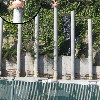
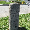
We skipped our usual snack stop, since we’d had a lot of stopped time fixing the flats. The final sightseeing stop was something odd I’d found on Atlas Obscura. It is an old milestone dating back to the early 1900s from the first Foothill Boulevard that was built from downtown Los Angeles to the San Gabriel Valley. It’s just standing by the curb on present-day Colorado Boulevard, in front of a McDonald’s. It’s just very odd that it’s still there.
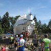
After that last stop, we headed home. It was a pleasant ride.

39 miles.

Route Map

5/4/2014

The Back-Yard Boat

Filed under: — stan @ 1:45 pm

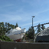
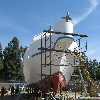
Last Sunday, there was an article in the L.A. Time about a guy who’s building a 64-foot boat in his back yard in Sun Valley. Since 1977. And of course, I thought we should go see it. I figured that 64 feet is about three times the size of a car, so it should be pretty easy to spot in the Google Maps aerial view. I had a look, and it turned out to be very near Elmer Ave, the “green” street we went to see recently.
We headed out by basically the same route as usual to get to Burbank. In Eagle Rock, we saw that someone had placed a giant baby bird in a nest on top of one of the tall concrete posts at a construction site. It looked impossible, but I’d guess they probably were able to reach it with a pole from up on the hillside behind the post.

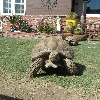
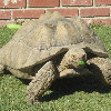
In Burbank, we took a few minutes to stop and see the tortoises again. They were very active today.

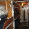
After passing the airport, we arrived at Arminta St in Sun Valley, and the boat was right there. We looked at it from the street for a few minutes. Then Mr Griffith came out to talk to us, and he offered us a tour of the boat. This was a real treat, and we all walked in and up the ladder to see the inside. He showed us the two big motors below decks, as well as the sleeping quarters. Up on the deck, there was a hatch to a refrigerated hold that he said would hold 10 tons of fish. He told us that he thought it would be finished by August or September this year. We all thanked him for the tour, and then we headed back down into Burbank and our snack stop at Priscilla’s.

It was a very nice day, and not terribly hot. On the way back, we went through Glendale, and then up and over the Chevy Chase and Linda Vista hill, coming down by the Rose Bowl. Not the easiest way back, but it’s something different from our usual route back up the Colorado hill in Eagle Rock.

44 miles.
Route map

4/27/2014

Turnbull Canyon again

Filed under: — stan @ 10:00 pm

Today’s bike club ride was our old route up Turnbull Canyon in Whittier. We’ve done this one many time before, so there’s not really anything new along the way. Just a few odd sight’s.

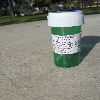
At the park where we meet, I picked up a potato chip bag that was on the ground. I took it over to a trash can, and I noticed a prescription bottle on the picnic table next to the trash can. I thought that was bit odd, so I had a look at it, and it was a medical marijuana prescription bottle. That was a bit odd, and it was certainly something I never would have thought I’d see just a few years ago. But it was empty, so I tossed it.

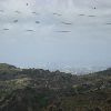
The ride was pleasant enough, although it was kind of hazy, so the view of downtown Los Angeles wasn’t very good from the top of Turnbull Canyon. I couldn’t even point out the Wilshire-Figueroa building and tell everyone how I’d climbed that building 101 times!

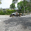
We headed down the other side, and then rode back home by way of Monrovia and Merengue. And then back to Pasadena, where we saw some guys cruising the neighborhood in an antique car.

As always, this route is longer than I think it is. But it’s a nice ride.

49 miles.

4/20/2014

Earthquakes, old and new

Filed under: — stan @ 9:47 pm

This week, I saw an article about how the city is finally going to demolish the remains of the former state office building that stood on 1st St between Broadway and Spring St in downtown Los Angeles. The building was heavily damaged and later torn down after the 1971 San Fernando earthquake. The site has been sitting unused ever since, but now they say they are going to turn it into a park. Why that took over 40 years is a mystery, but whatever…

The route was almost exactly the same as the Metro Rail Tour we did a few weeks ago. The only difference was that we weren’t doing it this time with the intention of bailing out and taking the train home, since the weather was really quite nice, and there was no chance of rain.

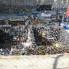
We rode into downtown and stopped to look at the foundation of the former building. The article had said they’d started demolition on it, but it looked about the same as it’s looked for the last 30-mumble years since I first saw it. Still, there was a new sign about how it was going to become a park, so I guess that’s a good thing.

After that, we rode over to the site of the new Wilshire Grand hotel. We’d stopped by there recently to see the foundation that they’d made for the new building, so we were curious to see what it looked like now. The building is supposed to be very tall. Almost as tall as the tallest building in Los Angeles. (They keep saying it’s taller, but that’s just because the architect put a spire on the roof. It really doesn’t count unless you can stand on it.) They say it’s supposed to be engineered to withstand the strongest earthquakes here. I suppose we will see. Someday, it will be tested.

The rest of the ride was just our normal route through Koreatown, Larchmont Village, and then home through Chinatown and Lincoln Heights. It was a nice ride.

Route map

43 miles.

4/13/2014

The Public Nuisance

Filed under: — stan @ 1:54 pm

Today’s bike club ride is our old route out to Glendora. Nothing special, but a chance to look in on the construction of the Metro Gold Line extension in Azusa, and also to go by the Huy Fong Foods hot-sauce factory in Irwindale. The city council in Irwindale is thinking of declaring the factory to be a public nuisance, since a few of the people in the neighborhood don’t like the smell of the factory.

It was a cool spring morning, just about perfect for riding. We headed out to the east. When we got to Azusa, we took a short detour to go see the construction of the new Metro station. They are making good progress since we went to see this in February.

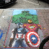
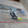
We stopped for coffee and snacks in Glendora, and we had a look at the chalk art drawn on the sidewalks there. Then we headed back, passing by some giant inflatable rabbits in front of the the same house that had the giant candy canes and Christmas ornaments in the past. Then we rode by the enormous Huy Fong Foods hot-sauce plant. Then we took in some more of the Gold Line construction in Duarte and Monrovia. All told, it was a pleasant ride.

42 miles.

4/6/2014

The “Green” Street

Filed under: — stan @ 1:42 pm

Last month, when Kathleen and I took the tour of “The Crappiest Place on Earth“, there was a display in the visitor center about the Los Angeles “Green Streets” program, with some photos of their demonstration project on Elmer Ave in Sun Valley. And of course, my first thought was that we were going to get a bike ride out of this. I looked it up, and it’s just a bit northwest of Burbank Airport. And we’ve ridden there before to see the World War II bombers, among other things.

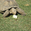
On the way out there, we stopped by to see the desert tortoises in Burbank. The guy who owns the house came out to feed them and talk to us. He was feeding them some small squashes and a head of cauliflower, and they seemed pretty excited by that. Sort of like when I saw the slow-motion feeding frenzy at the Caltech turtle pond. He also said that the tortoises sometimes mate, and that’s apparently a sight to see.

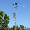
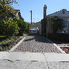
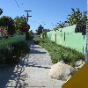
Continuing on, we went by Burbank Airport and on into Sun Valley to Elmer Ave. And yes, it looks like a demonstration project. Solar-powered street lights, basins to catch runoff, permeable driveways, and barrels to catch rainwater. I made me want to join up for the Pasadena Turf Removal Program.

After that, we headed down to Priscilla’s for snacks. The route home went across Glendale. We were going to take the pedestrian bridge over the Glendale Freeway, but at the last minute, we decided to try going across the freeway on Round Top Ave. I thought it might be a bit shorter, and that it might avoid the hill that we have to ride up after crossing the freeway. It did avoid that hill, but only at the cost of us having to ride up an even bigger hill. So that route experiment was kind of a dud. But at least it was a nice day for riding.

45 miles.

Route Map

Powered by WordPress