Stan’s Obligatory Blog

1/28/2018

Cookies L.A.

Filed under: — stan @ 4:58 pm

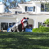
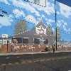
This past week, I saw an item in the L.A. Times about another cannabis store opening up, making it the third one in Los Angeles County. I looked it up, and it turned out to be in Maywood, which is just the other side of Vernon, and about two miles south of the Farmer John hog mural. So that was our destination for today.

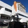
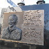
We got a late start today. John had just put new tires on his bike, and they were very hard to put on. So he had two pinch flats. I ended up putting two new tubes in the tires, and then we were able to get going. We took our regular route to downtown L.A., down Huntington Drive. Along the way, I realized that it was the 28th, making today the 32nd anniversary of the Space Shuttle Challenger disaster. So we made a short detour to go through Little Tokyo to see the monument to Ellison Onizuka there.

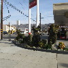
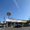
Leaving Little Tokyo, we took Santa Fe Ave south to get to Vernon. We turned off to pass by the Farmer John plant, and then continued on to get to Maywood. When we got to Cookies L.A., we were surprised at how big it was. The one we went to see in West Hollywood a few weeks ago was just a little storefront. But this one was a big industrial building. We didn’t think it would be open yet, but there were a couple of security guards by the door. It turned out that John’s flat tires had slowed us down just enough that the store had just opened. So we had to take a look inside.

The lobby area looks like a fancy doctor’s office waiting area. Apparently, since cannabis is still illegal on the Federal level, the shop has to be a cash-only business, so there was a little ATM in the waiting area. And that was also why there were three guards outside. They had a little booth with a guy who checked our IDs. Then he opened the door so we could go into the actual store. There were a pair of doors, almost like an airlock to get inside. The actual store area looked like a big, fancy department store cosmetics counter. There were probably seven or eight people working there. I talked to one, and she showed me around the counter, explaining what different things they had available. It seemed like a very well-run operation. The guards outside told us that they had only opened last Tuesday, and that they had had lines out the door since then. We managed to not wait in line just because we happened along just when they first opened.

Leaving the pot shop, we headed back across Vernon. We saw the Southland Box Company. I thought there ought to be a whole herd of cats hanging around outside there. We also passed by the six or so houses there. Vernon is famous for being an industrial city with a ridiculously small population of only 113 people.

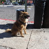
We rode back into downtown Los Angeles, and then out on 7th St to Bonnie Brae St, which brought us up to Echo Park. Out snack stop was at Chango Coffee there. I got a little artisanal breakfast sandwich there. And of course, there were several absurdly well-behaved dogs there.

At this point, my GPS hiccuped, and for some reason, it took no data on the trip from the coffee shop to Riverside Dr. Then it started up again, and recorded the rest of the ride. The route home took us through Highland Park, and then South Pasadena. It had turned into a very nice day, and it was a nice ride.

46 miles. Would have been maybe one mile more if the GPS hadn’t gone south.

Route map and elevation profile

1/21/2018

Airplanes

Filed under: — stan @ 4:15 pm

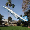
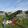
This week’s ride was the airplane-theme route to Burbank to see the F-104 on a stick in the park, and then to the airplane topiary at the entrance to Burbank Airport.

At the beginning, we had to take a little detour, since the Pasadena Half Marathon was today, and the Colorado Bridge was part of the course. The detour ended up taking us through the San Rafael Hills, and we were reminded of why we don’t usually go that way. Then we headed across Eagle Rock and Glendale to Burbank. When we got to Olive Ave, we turned off to the park where the F-104 is on display.

The topiary at Burbank Airport has filled out nicely. The bush inside it had died in 2013, and they replaced it with a new bush in 2014. After that, we headed south to our snack stop at Priscilla’s.

The route back send down the L.A. River, and then up the Arroyo Seco bike path. When we got to South Pasadena, I bailed out. We were running late, due to the detour at the start, and I needed to get home a little early. So I ended up taking the train back from South Pasadena.

40 miles, plus 2 more coming back from the Metro station

Route map and elevation profile

1/14/2018

West Covina

Filed under: — stan @ 2:55 pm

Today’s bike club ride was yet another visit to a filming location. In this case, it was The Lakes at West Covina, which was the little plaza and fountain that was the setting for the climax of the big “West Covina” musical number from the first episode of “Crazy Ex-Girlfriend”.

We took a kind-of roundabout route to get there, since the terrain out there is mostly flat. So this ended up being slightly on the long side for a regular Sunday ride. But that was all right.

47 miles.

Route mape and elevation profile

1/7/2018

The Pot Shop

Filed under: — stan @ 2:54 pm

This past week, I read about how the first recreational marijuana shops are set to start opening here in California. In particular, they said that right now, there are just two shops licensed for this in the Los Angeles area. They are both in West Hollywood, so today’s bike ride was to go see one of them.

We started out with our standard route to get to Hollywood. Then after riding across Hollywood, we crossed into WeHo, where we saw the Alternative Herbal Health Services store. It wasn’t open yet, and it looked to be locked up tight. I guess that’s to be expected, since it’s a cash-only business.

We went to Noah’s in Larchmont for some bagels and such, and then back home by way of downtown Los Angeles.

44 miles.

Route map and elevation profile
12/31/2017

Rose Parade Preview

Filed under: — stan @ 1:18 pm

Today’s bike club ride was a ride to Griffith Park, with the plan of making a loop and finishing the ride by riding down the length of the Rose Parade route in Pasadena. It’s New Year’s Eve, and people start camping out on Colorado Blvd early in the morning.

We started out by heading up through La Cañada, so we started out with almost eight miles uphill, followed by another seven or so miles downhill. Then, when we got to Griffith Park, we rode up and over another hill there. Then we headed down the L.A. River bike path to our snack stop at Spoke.

When we got back into Pasadena, we saw that the parade preparations were coming right along. There were people set up along the whole five+ miles of the parade route, even though the parade doesn’t start for something like 20 hours. The way the stores are boarded up, it looks like a hurricane is coming. We rode all the way to the end of the route, which is right around the corner from the park where we start.

40 miles.

Route map and elevation profile
12/24/2017

Christmas Eve Ride

Filed under: — stan @ 1:22 pm

Today’s ride was one we did a bit over a year ago, so it seemed like time to go again. And it’s a nice, flat route for the day before Christmas.

We rode straight south all the way to Downey. We stopped there for a few minutes at the oldest operating McDonald’s, and then continued on to the Wall of (Un)-Fame at the Metro Green Line station at the 105 freeway. Then we headed back north into Downey to 3rd Street Coffee. After some snacks and drinks, it was back up the Rio Hondo bike trail and home by way of Arcadia.

47 miles.

Route map and elevation profile

12/17/2017

It’s a Wonderful Ride – 2017

Filed under: — stan @ 12:21 pm

Today was the 2017 edition of our Christmas-themed ride, where we visit two sites associated with the 1946 film, “It’s a Wonderful Life.” We’ve been doing this ride every December since 2011, so it’s become something of an institution for us.

The actual route is pretty simple. I forgot to record it with my little GPS thingy this time, but if you want to see it, look at last year’s ride.

When I got up this morning, the wind was gusting pretty hard, and I was a bit apprehensive about the ride, but it calmed down by the time we actually left on the ride. It was still a bit windy, but not terrible.

We went to Forest Lawn in Glendale to pay respects to James Stewart for bringing George Bailey to life. As always, we made a point to stop at the information booth at the entrance to tell them why we were there. For some reason, the security people at Forest Lawn sometimes have some sort of emotional malfunction regarding people visiting the cemetery by bike. We’ve found that telling them why we’re there can defuse this.

After that, we headed over the Paradise Bakery for snacks. And then up the long grind up the hill to La Cañada and the Martini Family’s new Bailey Park home there. The house only appears in the movie for one brief scene, but it’s unique in that it’s the only scene in the entire movie that was shot on location, away from the studio and backlot.

The ride was a bit on the short side, but that’s all right, since I needed to get back a little early today.

36 miles.


12/10/2017

Ciclavia Wilshire

Filed under: — stan @ 2:44 pm

This Sunday was the last Ciclavia of 2017. It was the Wilshire Boulevard route, from 4th and Spring downtown, out to Wilshire and Western. The plan was to ride downtown, pick up the Ciclavia route and ride it out to Western, and then make a loop back through Hollywood, and then down the L.A. River.

We got there early, so there weren’t many people out on the route yet. That made it more pleasant, and we made good time out to Western. Then we continued on through Hancock Park, and then back up into the east end of Hollywood. We stopped for snacks at Spoke in Frogtown

41 miles.

Route map and elevation profile
12/3/2017

Whittier Again

Filed under: — stan @ 1:05 pm

Today’s bike club ride was our old Whittier route. It’s not a ride to anywhere in particular but it’s a nice, relatively flat route. Not a lot to see along the way. The only stops we made were for the photo-op with the sign for Dork Street in Pico Rivera, and for snacks at Merengue in Monrovia.

43 miles.

Route map and elevation profile
11/26/2017

Glen Haven

Filed under: — stan @ 3:00 pm

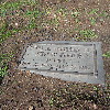
This past week, we were watching the 1954 movie, “White Christmas” again. This stars Bing Crosby, Danny Kaye, and Rosemary Clooney. All are big-name stars. Yet there were four major characters in the story, the fourth played by Vera Ellen. Since she had a large role in this movie with big stars, I was wondering why I didn’t know who she was. So I went looking. Turns out she was a dancer, and worked in a lot of movies with big-name stars in the 1950s, but she stopped making movies in 1958, and she died of cancer in 1981. And at the end of the trail, I read that she was buried in Glen Haven Memorial Park in Sylmar. I looked it up, and looked at the relatively short list of famous people buried there. And when I saw Jeffery Hunter on the list, I immediately knew we had a new bike ride in our future.

We headed out our usual route across Eagle Rock and Glendale, and then took Glenoaks all the way up to Hanson Dam. Along the way, we saw the van advertising the Hot Topless Maids, including a sign that they are hiring. Good to know. When we got to Osborne, we took that across the dam and then started up Kagel Canyon.

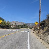
When I mapped out this ride, I knew we had to go up Kagel Canyon a bit, but I really didn’t pay attention to how far we had to go. It turned out to be about three and a half miles, all uphill. Yikes. And about two and half miles in, Carla got a flat. But we finally made it up there, and there was this little cemetery with a commanding view of the San Fernando Valley. We found Jeffery Hunter first. I had to explain to everyone his significance in the geek world. He played Captain Pike in the first “Star Trek” pilot episode, “The Cage“. So even though he was only ever in one episode, he still has a place in the “Star Trek” universe.

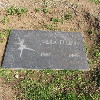
Then we went to find Vera Ellen. I’d made a map by hand showing her approximate location, but we had trouble finding her. In the end, John looked up the lat/lon coordinates, and then we walked around with my little Magellan GPS until we’d matched them up. And then she was right there.

Now it was time to head back down. That was a nice, long descent. The sort I would have loved in my racing days. Then we got on Foothill Blvd for the ride home.

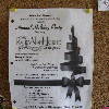
Along the way, we met up with another bike rider who lives in the area. He told us that the coffee shop that I’d found in Yelp was closed. He recommended the Back Door Bakery, so we went there. And it was quite good. While we were there, I saw a flyer on the bulletin board for a holiday party that was going to feature the Randy Van Horne Singers. We all know them, even if we don’t know that we know them. Here’s a hint:

Van Horne, Randy Van Horne
He’s piece of music history
He sang ’bout the Flintstones
In the song that we know from TV

Then we continued on up the hill through Tujunga until we passed Stan’s Liquor near the top, and then headed downhill into La Crescenta. From there, it was going to be mostly downhill all the way home.

In the end, the route turned out to be somewhat longer than I’d expected. Mostly because I didn’t measure how far up Kagel Canyon we had to go.

50 miles.

Route map and elevation profile
Powered by WordPress