Stan’s Obligatory Blog

12/31/2017

Rose Parade Preview

Filed under: — stan @ 1:18 pm

Today’s bike club ride was a ride to Griffith Park, with the plan of making a loop and finishing the ride by riding down the length of the Rose Parade route in Pasadena. It’s New Year’s Eve, and people start camping out on Colorado Blvd early in the morning.

We started out by heading up through La Cañada, so we started out with almost eight miles uphill, followed by another seven or so miles downhill. Then, when we got to Griffith Park, we rode up and over another hill there. Then we headed down the L.A. River bike path to our snack stop at Spoke.

When we got back into Pasadena, we saw that the parade preparations were coming right along. There were people set up along the whole five+ miles of the parade route, even though the parade doesn’t start for something like 20 hours. The way the stores are boarded up, it looks like a hurricane is coming. We rode all the way to the end of the route, which is right around the corner from the park where we start.

40 miles.

Route map and elevation profile

12/10/2017

Ciclavia Wilshire

Filed under: — stan @ 2:44 pm

This Sunday was the last Ciclavia of 2017. It was the Wilshire Boulevard route, from 4th and Spring downtown, out to Wilshire and Western. The plan was to ride downtown, pick up the Ciclavia route and ride it out to Western, and then make a loop back through Hollywood, and then down the L.A. River.

We got there early, so there weren’t many people out on the route yet. That made it more pleasant, and we made good time out to Western. Then we continued on through Hancock Park, and then back up into the east end of Hollywood. We stopped for snacks at Spoke in Frogtown

41 miles.

Route map and elevation profile

10/22/2017

P-22 Day

Filed under: — stan @ 5:01 pm

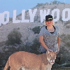
This morning, when we were riding through Griffith Park, I saw a sign for the P-22 Day Festival. This was in honor of P-22, the famous Griffith Park puma. So after I got home, Kathleen and I went back to the park to go see it.

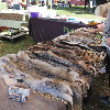
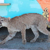
There were booths with exhibits about wildlife conservation, and mountain lions in particular. About plans to build a wildlife overpass over the 101 freeway, since crossing freeways is one of the most dangerous things that wild animals have to do. The had a stuffed puma that had been killed by poachers so we could see what it looked like up close.

It was an odd little event, but fun in its own way.

10/14/2017

San Andreas Fault with Atlas Obscura

Filed under: — stan @ 7:51 pm

Today was yet another edition of the Atlas Obscura San Andreas Fault Scavenger Hunt. This is the third time I’ve been doing this tour with Atlas Obscura, and it seems to be as popular as ever. This time, my partner for leading the tour was my friend Morgan from the office.

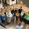
We all met at the Seismo Lab, and we started off with a quick tour of the lab. We saw the lobby exhibits about the history of earthquake study, the media center upstairs, and a small exhibit about Charles Richter and Beno Gutenberg, who started the Seismo Lab and systematic study of earthquakes back in the 1930s.

The first stop of the tour was the small fault scarp next to the McDonald’s drive-through in San Fernando. This is a small remnant from the 1971 Sylmar earthquake.

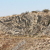
The next stop was the scenic overlook and the famous road cut along the fault in Palmdale. When we were walking up the hill to look at the road cut, we ran across a tour group of students from Long Beach State. They were apparently doing about the same tour as we were, but traveling in the opposite direction.

We stopped for lunch at Charlie Brown Farms, which is still a deeply weird place. This time, I noticed that they had camel meat in the freezer. I suppose it tastes like chicken…

After lunch, we had a pair of stops close together. One at the signs marking the fault, and then at the Pallet Creek trench site, which was where the science of paleoseismology was born. The signs are kind of a silly stop, but it’s a chance for a photo-op. The trench site is interesting from the standpoint of it being important to the history of science.

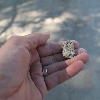
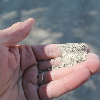
Now it was time to go into the mountains. We stopped at the road cut that has the fault gouge on one side, and we showed everyone how the rocks in the sand could be crushed by hand. That’s always popular. Then we continued on to Wrightwood.

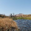
The last stop was at Lost Lake in Cajon Pass. Last year, it was suffering from three years of drought, and the lake had no water in it. But this time, it had some water, and was actually a lake.

And that was our tour.


10/1/2017

The Whittier Narrows Earthquake

Filed under: — stan @ 2:33 pm

Today is the 30th anniversary of the Whittier Narrows Earthquake. This was felt all over Los Angeles, and it caused some significant damage in nearby towns. So today’s bike club ride was to visit a few locations associated with the earthquake.

The first stop was at the San Gabriel Civic Auditorium. This building was damaged and later repaired. You can see a photo of the damage here:

http://scedc.caltech.edu/significant/whittier1987.html

We could see that the upper portion had been patched up, and there were still some cracks in the lower part of the building.

The next stop was the epicenter, which was just a few blocks southeast of the big intersection of Walnut Grove and Garvey in Rosemead. Not really much to see there, but that’s the place.

Next we rode to the Whittier Greenway Trail, where we saw a display of bricks and columns that were salvaged from a few historic buildings that were damaged enough that they had to be torn down. Then from there, we rode into downtown Whittier, and our snack stop at Mimo’s Cafe.

The last stop of the tour was at the Whittier Museum, which is hosting an exhibit about the earthquake. The building pictured on the banner outside was just a few blocks away.

Here are some more pictures from that day:

http://www.nbclosangeles.com/news/local/Whittier-Narrows-Earthquake-Puente-Hills-Fault-California-Seismology-Photos-Images-448452433.html

45 miles.

Route map and elevation profile

9/24/2017

East Valley Lines

Filed under: — stan @ 2:56 pm

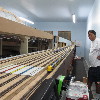
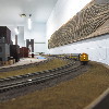
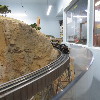
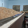
Today’s bike club ride was a visit to Travel Town in Griffith Park to see the East Valley Lines model railroad. I found out that one of my friends from the office is a member, and he was going to be running trains there today.

We took our regular route out, across Eagle Rock and Glendale, with a stop at Paradise Bakery for a chocolate eclair. Then we rode a loop out and back through Burbank before heading over to Travel Town. When we got there, Claude let us into the room with the layout. We were able to stash our bikes in the club workshop area. Then we got a good close look at the layout, which is of course under construction. We were there for about a half-hour watching the trains.

The route back took us down the L.A. River, with a quick stop at Spoke to get some ice water. Then back up the Arroyo Seco bike path to get back to Pasadena.

43 miles.

Route map and elevation profile

7/30/2017

“La La Land”

Filed under: — stan @ 5:55 pm
Screenshot
Screenshot
Screenshot
Screenshot
Screenshot

Today’s bike club ride was the “La La Land“-themed ride I’ve been putting together for a while. We rode around Pasadena, Hollywood, and Burbank to go by several of the locations where scenes from “La La Land” were shot. Some of them only appear for a few seconds, while a few were the locations for relatively long scenes. The pictures from the ride are here, and where it’s relevant, there is a screenshot of the location as it appeared in the movie.

The first stop was the Rialto Theater in South Pasadena. This was where Sebastian and Mia went to see “Rebel Without a Cause”. The theater has been closed for about ten years now, but there is still talk of renovating it.

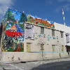
Next, we rode down through Silver Lake to find our way into Hollywood. The stop was at the “You Are the Star” mural painted on the side of a building at the corner of Hollywood and Wilcox. This was shot as the exterior of the restaurant where Mia first saw Sebastian playing the piano.

One novel thing about this route was that we went down a lot of streets we ride on fairly regularly, but in the opposite direction. So this time, we headed east on Hollywood Boulevard to get to Griffith Park. We turned up Western Ave, and then into the park at Fern Dell. That appeared briefly in the movie as part of the montage of Mia and Sebastian’s first dates. We were going to stop at The Trails Cafe in the park, but the line was too long.

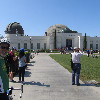
Continuing on up the hill, we ride up to the Observatory. This was where Mia and Sebastian went after the movie at the Rialto. The place was packed today.

The next stop was just over the other side of Mt Hollywood Dr. We rode up to the top, and then started down the other side, stopping at Cathy’s Corner. This was the scene of the song-and-dance “A Lovely Night”. This scene is a bit over four minutes long, and was done as a single long shot. And it was filmed right at sunset to get the nice lighting. I read that they were able to get two takes during a single sunset. No word on how many days they were up there doing their two takes before they got the one they wanted.

Heading on down the hill, we rode into Burbank, stopping briefly to see the Smoke House restaurant. That was used as the interior of the restaurant where Sebastian was grudgingly playing Christmas songs.

We stopped at Priscilla’s in Burbank to get drinks and snacks. Then we headed for home, straight across Glendale and Eagle Rock, and then up the Colorado hill. At the top, we rode across the Colorado Bridge, which also appeared briefly in Mia and Sebastian’s first dates montage.

48 miles.

Route map and elevation profile
5/14/2017

Where the Streets Have No Name

Filed under: — stan @ 2:01 pm

Today’s bike club ride was a visit to see a little piece of rock history. In 1987, U2 made a video for their song, “Where the Streets Have No Name” where they played a small show on the roof of a building in downtown Los Angeles:

https://beta.theglobeandmail.com/arts/music/u2s-where-the-streets-have-no-name-30-yearslater/article34932271/

Today’s bike ride was a trip to downtown L.A. to see the building and the corner where they did this.

We rode down through South Pasadena and Highland Park to get to the L.A. River and the new bridge there. We stopped for a minute to look at the “Faces of Elysian Valley” art installation in the traffic circle just before the bridge. Then we headed up the river trail to Fletcher, where we got off and headed into Hollywood. We had take a short detour between Bronson and Gower where there was something happening and Hollywood Boulevard was blocked off with fire trucks and police cars.

We rode across Hollywood, and I was slightly surprised to find that not only did U2 not have a star on the Hollywood Walk of Fame, but they don’t have a presence at the Rock Walk at Guitar Center on Sunset.

Our snack stop was at Noah’s Bagels in Larchmont. Then we headed back into downtown L.A. via 7th St. When we got to Main, we stopped and looked at the building. It was a liquor store back in 1987, and it’s a Mexican restaurant now, but the building looks essentially the same now as it did then.

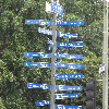
From there, we headed back up Main St, stopping to take a photo of the Car Freshener painted on the side of a building at 3rd St. As they say, “[you’ll] find one in every car…“. We also saw the signpost pointing to all of the sister cities that Los Angeles has around the world. Just in case you were wondering.

45 miles.

Route map and elevation profile
2/11/2017

The Santa Susana Field Laboratory

Filed under: — stan @ 2:22 pm

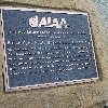
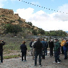
Some months ago, I ran across some information about Boeing giving tours of the old Rocketdyne Santa Susana Field Laboratory. This is the bit of rugged terrain in the hills west of Chatworth that I’ve seen lots of times from the window of an airplane on its way to landing at Burbank. But I didn’t know that they offered tours. So this was a chance to see some aerospace history, as well as an infamous bit of nuclear power history.

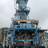
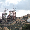
Rocketdyne built the engines for nearly all U.S. ballistic missiles, from the earliest ones with engine designs based on the German V-2 rockets, all they way through the Saturn V and on to the Space Shuttle. And most of them were tested on the stands at Santa Susana. They tested engines all the way up to the J-2, which powered the second and third stages of the Saturn V. The F-1 engines for the Saturn V first stage were tested out in the desert at Edwards Air Force Base.

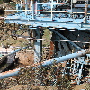
Not all of the test stands are still there, but the small one where they tested the engines for the Atlas missile, and the large one where they tested the J-2 were still there. At the first stand, we got a short talk by a Rocketdyne retiree who was there in the 1950s, and worked on the Atlas project. He told us about how they did the tests, and how they calculated everything on slide rules.

A lot of what goes on at the site now is related to cleanup from the old days. Apparently they used a lot of trichloroethylene to clean the rocket engines between test firings, and a fair amount of it got spilled on the ground. They told us that studies have shown that most of it soaked into the sandstone underneath the site. That’s good in that it kept it from going into the groundwater. But it’s bad in that it makes the solvent essentially impossible to clean up. So there’s that…
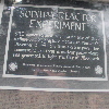
The other big piece of sightseeing was the site of the Sodium Reactor Experiment. That’s an infamous bit of nuclear history in that the reactor suffered a partial meltdown in 1959. For something that’s just over the hill from the San Fernando Valley suburbs, that’s a pretty terrifying idea. There’s basically nothing left of it on the site any more. Just a flat plain where the building housing the reactor used to be. In any event, it was interesting to see the site, and it’s appropriate in that I’m signed up to take a tour of the Nevada Test Site when we go to Las Vegas at the end of this month.
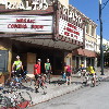
So all around, it was an interesting morning.


1/21/2017

Can you spot the theme here?

Filed under: — stan @ 2:08 pm

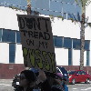
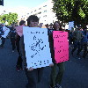
As I tell everyone, we’re really quite appalled by what’s happening in our country now. So we joined up with a few hundred thousand of our best friends and went to downtown L.A. to yell about it.

Powered by WordPress