Stan’s Obligatory Blog

9/11/2021

20 years…

Filed under: — stan @ 2:02 pm

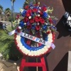
I don’t always go on the Foothill Saturday rides, but I generally make a point of going when they’re doing one of my routes. And since today is in fact September 11, it seemed appropriate to do the ride that visits two 9/11 memorials in the Los Angeles area.

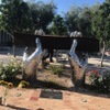
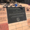
The first is in Rosemead, and it’s one I found through Roadside Americal. It’s thousands of little stainless steel doves, one for each person who died in the attacks, all welded together to form pair of hands, holding a bent steel girder from the World Trade Center towers. It’s simple and elegant.

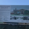
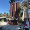
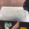
From there, we rode west into the city, going through East L.A. and downtown, and then up through Echo Park to get to just outside Dodger Stadium, which is where the fire department training center is. The gates there are usually locked on weekends, but they had them open today, and there were some firefighters there to answer questions about the memorial there. It’s a part of the steel exterior structure of the lobby level of the South Tower.

After that, we rode through Chinatown and stopped for drinks and snacks at Chimney Coffee.

44 miles.
Route map and elevation profile

9/6/2021

A bit of Disney History

Filed under: — stan @ 7:02 pm

This is the bike club ride from August 29, 2021.

I’d read recently that the city of Los Angeles had bought and was refurbishing the house that Walt and Roy Disney lived in when they first moved here from Missouri.

So, of course I said, “I know where we’re riding this Sunday.”

The house is in the Los Feliz area, and we’ve never been down that street, despite riding by a block away countless times over the years.

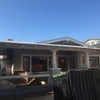
When we got near the house, we took a short side trip to see the “Snow White cottages”. The story is that Walt brought his animators over there to see those houses, and he told them that the house in “Snow White” should look that them. Then we headed over into Los Feliz to see the actual house. It’s a pretty typical house for the neighborhood, but now it’s special. And just a block or so down the same street is the building where Walt set up his first studio.

From there, we rode back into Griffith Park and then up to Burbank. We went down Alameda to see the giant imposing gate that is now the face of the corporate behemoth that Disney has become. They’ve planted trees that have grown quite large, so it’s difficult to see the main building with the Seven Dwarfs holding up the roof.

Anyway, no matter how you slice it, it’s an amazing success story. And a little piece of what makes living in Los Angeles tremendously entertaining.

42 miles.
Route map and elevation profile

12/27/2020

The Crapi Apartments

Filed under: — stan @ 3:51 pm

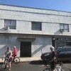
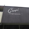
Today’s bike club ride is one we haven’t done since 2014. In the Palms section of west L.A., there is an apartment building called “Crapi Apartments”. It’s a real place. The first time I saw a photo of it, I thought it was a Photoshop gag, but it’s real. So we went to see it today. It was a relatively long ride for us, but it’s quite flat. The day started out cold-ish. It was cold enough that when I saw a shopping bag full of takeout container trash, I tore one side off the bag and stuffed under my jersey. And then I wasn’t cold any more. And by the time we were headed home, it was pretty warm, so it was a good day for riding.

52 miles.

Route map and elevation profile

11/29/2020

Cameron Woods

Filed under: — stan @ 2:47 pm

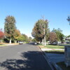
Today’s bike club ride is one we haven’t done in several years. It’s a visit to Orion Ave in Van Nuys, also known as the “Leave it to Beaver” street, and it’s reputed to be the most-filmed street in Los Angeles.

https://www.youtube.com/watch?v=D3DLxGQVv_0

53 miles.

Route map and elevation profile

10/25/2020

Down the for Count – 2020

Filed under: — stan @ 8:44 pm

Today is the Sunday before Halloween, so it’s time for the annual Halloween ride to Culver City to visit Bela Lugosi’s grave. We’ve been doing this since 2007. The route has evolved over the years, but it always comes in at about 55 miles. This time, we had a couple of flats on the way back, and the little cafe we usually stop at has apparently closed permanently. But it was a nice cool day, so we still had a nice time.

56 miles.

Route map and elevation profile

8/2/2020

Farmer John

Filed under: — stan @ 1:46 pm

Today’s bike club ride was a trip down to Vernon to see the big mural painted on the outside of the Farmer John meat packing plant. We’ve been to see this before, but this is the first time in a long time.

The route brought us through downtown Los Angeles. Along the way, we saw several large homeless camps in El Sereno. When we got to downtown, we took a short side trip to see how the construction is coming along for the tunnel entrance for the Regional Connector on 1st St. We also paused briefly to see how the new 6th St bridge is coming along.

In Vernon, we stopped to admire the hog mural. We tried to see inside the gate and see the mural of the big angels flying off to hog heaven, but there was so much stuff set up inside the gate, we couldn’t see it.

We rode back through downtown and then up to Echo Park. There was yet another big homeless camp next to the lake in Echo Park. There really seem to be more of them than ever before, which is disturbing. I was sort of glad that I didn’t have to check to make sure there wasn’t a Dodger game today, although that’s because of Covid-19, which is far from a Good Thing.

We stopped for drinks at Antigua Coffee, and then headed home up the Arroyo Seco bike path.

42 miles.

Route map and elevation profile.

6/7/2020

Remembering Rodney King

Filed under: — stan @ 2:48 pm

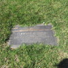
Watching the news these past two weeks has been surreal. Seeing protests and riots in cities around the world brings back the memory of the 1992 Los Angeles riots, and so, it seemed appropriate that we should go to Forest Lawn and pay respects to Rodney King. He was the original guy-beat-up-by-police-on-video.

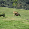
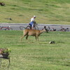
When we got to the cemetery, there was a deer wandering around. It was just strolling around and eating the flowers that had been left at graves. The cemetery is right next to Griffith Park, so I guess it’s probably not surprising that wildlife from the park would wander in.

After the cemetery, we continued on to Priscilla’s for snacks. Along the way, we saw a bit advertisement for “Wonder Woman 1984”. It said, “Only in theaters, June 5”, which seems a bit improbable, since all the theaters are still closed right now. I see in the entry for it in IMDB, the release has been pushed back to August.

Coming home, we did a route we haven’t done in some time. Up Verdugo and home through La Cañada. That was nice climb.

45 miles.

Route map and elevation profile

5/31/2020

The Glendora Bougainvillea

Filed under: — stan @ 2:16 pm

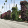
This has been a weird week. Protests erupting in the streets around the world. So it seemed appropriate that we should avoid going anywhere near downtown Los Angeles today. So the other direction took us east to go see the Glendora Bougainvillea. We’ve been to see it before, but this is the prime season for bougainvillea flowers, so it’s generally a good time to go see it. And it worked out well. We didn’t see any street protests along the way, and the flowers were nice.

43 miles.

Route map and elevation profile

5/22/2020

A Bit of History

Filed under: — stan @ 3:46 pm

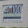
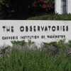
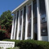
This whole retirement thing is still very novel. It means that I can go on weekday bike rides, and being on lockdown at home means I have time to watch a lot of TV and movies. Lately, I found a new PBS show called “Lost L.A.”. One of the episodes is called “Discovering the Universe”, about how the Mt Wilson observatory was the site of one of the single greatest astronomical discoveries. So while I was out riding with Carla today, we decided to go by and see the Carnegie building in Pasadena where they have the archive of the glass photo plates where Edwin Hubble figured out that the universe was far, far larger than the Milky Way galaxy. It was this bit of history that was why I was willing to fork over a fair amount of money to Atlas Obscura for a chance to go look through the 100-inch telescope.

30 miles.

Route map and elevation profile

5/17/2020

The Little Free Pantry

Filed under: — stan @ 3:20 pm

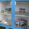
Last year, I’d read an article in the L.A. Times about a church in Burbank that adapted the Little Free Library idea into a Little Free Pantry for the community. Now that we’re on lockdown for the last two months, and millions of people are out of work, I thought we should go back there, since I guessed that it was probably pretty empty. I brought along two cans to donate, and several other people brought small backpacks with non-perishable food items in them.

When we got there, the Little Free Pantry was indeed pretty bare. We put all our items in it, and we pretty much filled up the top shelf. I hope that helps someone out there.

We went to Priscilla’s in Toluca Lake, but part of our group got separated, and I went back to look for them. It turned out they’d missed a turn, and just went there by a slightly different route. But that added a couple miles to my total.

Since my old Magellan GPS bit the dust a couple weeks ago, I decided to join the cult of Garmin. I got a Garmin Edge 130, and today was the first shakedown ride with it. Just looking at the data, it seems to do a very good job, and it seems that the altitude data looks better than what the old Magellan did.

44 miles.

Route map and elevation profile

Powered by WordPress