Stan’s Obligatory Blog

7/2/2015

The Griffith Park Tea House

Filed under: — stan @ 7:17 pm

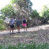
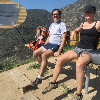
Yesterday, I read about how some unknown artists had popped up a little Japanese-style tea house on an old concrete pad on top of one of the peaks in Griffith Park. Apparently, it was done on the sly in one night, and from the pictures I saw, it looked like it was very nicely done. Since it was unclear how long it would be there, I figured it was something we should go see immediately. Fortunately, Morgan and Jason from my office were up for it, and we headed over there this afternoon.

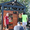
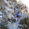
The instructions on how to find it from Modern Hiker were for starting out from the observatory, but parking there is always a problem, and coming from Pasadena, it’s just easier to start from the other side of the park, by the Old Zoo. We headed up the trail just like we did back in March, when we went to Mt Hollywood to see the marathon lights. When we got to the part of the trail that goes around just below Taco Peak, we looked up, and the tea house was there. Just a short distance up the trail, we came to the spot and saw it close up. There were quite a few people there to see it. I guess everyone had the same reaction to hearing about it.

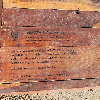
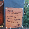
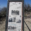
The artists had left pencils and little wooden chips to write wishes for Los Angeles on, but all the wood chips had been used. We went inside to see them all hung on the pegs and read what people had written. It was all very nicely done. The construction of the house was first-rate, and it really looked like it belonged there. It’s unclear what will happen to it, but at least we got to see it when it was still fresh.

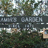
It kind of reminded me of Amir’s Garden, which is another place in the park that was built by one man with a vision. So on the way down, we took a route to go through there. It was nicely cool and shady there, as the garden is irrigated with what I can only assume is reclaimed water. But it was very nice there. Then we took a very steep trail down the end of the ridge to get back to the trail that would bring us back to our starting point. It was a good little afternoon adventure.

Route map and elevation profile

6/20/2015

Icehouse Canyon

Filed under: — stan @ 4:53 pm

Today was time for another hike. The plan was to climb Lookout Mountain. I was curious to see the remains of Michelson’s 1924 experiment to measure the speed of light. I’d done that same experiment in physics lab in college back in 1981, so I thought it would be an interesting piece of history.

We’d both read the writeup, and we paid close attention to the instructions of how to get to the start, but neither of us really paid close attention to the part about how to find the trail. Usually, it’s pretty obvious, and we didn’t expect that this would be any different. But when we got there, there were just two fire roads, and we walked some distance down both and didn’t see anything that looked like a trail going where we needed to go. So, after 2 1/2 miles of walking in different directions, and also seeing a cute little baby skunk, we gave up and went to Icehouse Canyon.

Icehouse Canyon was the starting point for the hike up Cucamonga Peak that we did last fall. This time, we just planned to go to the saddle and back, so it wasn’t going to be as long and as hard as Cucamonga was. But today was a hot day in June, rather than a cool day in November. There was no snow on the ground. There was water running in the creek, and there were millions of bugs.

At the top of the saddle, we sat for a bit and had lunch. There were a lot of people on the trail. That’s a good thing. Having the nice mountains in our back yard is one of the great things about Los Angeles, and I like seeing more people coming out to enjoy them.

On the way down, we walked into a huge cloud of bugs, which turned out to be some sort of ladybug convention. I’ve never seen so many ladybugs in one place. And near the bottom, people who were heading up were telling us that there was a rattlesnake next to the trail, so we paid attention. The rattlesnake was a relatively small one, probably only 2-3 feet long. It was coiled up on a rock next to the trail. We gave it an appropriately wide berth and continued on down. At the bottom, there was a big tour bus in the parking lot from a Korean hiking club in L.A. I guess that explains why there were so many big groups of Koreans on the trail today. Despite the heat and the bugs, it was a fun hike.

Route map and elevation profile

4/25/2015

Another attempt at Strawberry Peak

Filed under: — stan @ 2:26 pm

Today, Karina and I made yet another attempt at climbing Strawberry Peak. The last time we tried, we were stopped by the rock-climbing section on the trail up the ridge to the west of the summit. So this time, we were going up the trail from Red Box, which comes up the ridge on the east of the peak. For this trip, we were joined by Irving and Marie. We all met up at Red Box, and we started up the trail.

It was chilly and cloudy, but otherwise not bad for hiking. The trail description said that most of the climbing was in the last mile, and it didn’t lie. The first part was very easy, but it got kind of steep later on. And when we got higher up on the ridge, we walked up into the clouds.

Irving and Marie turned around after a while. They had plans to go see a movie that afternoon, and they wanted to get back in time. So Karina and I pressed on. It got colder, and it started to sprinkle a bit. We finally came up on top of what looked like the summit. The wind had picked up, so we decided to not look too hard through the clouds to try and see if there was more mountain. We just said, “That’s good enough” and turned around. In the end, though, GPS doesn’t lie. We were a little bit short of the real summit. But it was just too cold to be pleasant.

We tried to keep a brisk pace all the way down, since it was still getting colder. We never did find a sufficiently-sheltered place to stop for lunch, so we didn’t eat until we got back to the car. We had a nice time, but wow, it was cold. And it still means that I’ve still not made it to the actual summit of that mountain since 1986, despite three attempts since then. Sheesh.

The battery in my GPS went dead on the way down, so the map only shows the trip up. But up and back were the same trail, so it’s all right.

Route map and elevation profile

3/13/2015

The view from Mt Hollywood

Filed under: — stan @ 11:10 pm

A couple days ago, I ran across this article:

http://la.curbed.com/archives/2015/03/spotlights_los_angeles_marathon_route.php

The plan was to put up 27 powerful searchlights along the Los Angeles Marathon route from Dodger Stadium to Santa Monica, and have them turned on for about 90 minutes on Friday night. Of course, in their artist’s conception, it looked pretty cool. While it remained to be seen how good it would look in person, I was curious.

I figured that any suitably high overlook would be mobbed with people trying to see, so I thought that hiking up Mt. Hollywood in Griffith Park might be a good alternative. There’s usually a small crowd up there on any normal night, but regardless, I figured the fact of having to hike several miles to get there would ‘thin the herd’ a bit. So in the end, I went there with Karina, Morgan, and Jason from my office, and we hiked up the back side of the mountain.

This was my first time hiking this mountain since 2011. We went by way of the ‘anklebreaker trail’. I don’t know why they call it that, since it’s not a bad trail by any means. In any event, it was a fine way to get up the mountain, and we were at the top in just about one hour. At the top, there were a lot of people. More than on a regular evening, but still nothing like the crowds that had to be down below at the observatory. Looking down, I could see the road up to the observatory, and it was packed solid with cars, and nobody was moving. So I was glad not to be there.

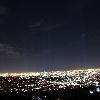
We broke out some snacks while we were waiting for the 8:40 to come around. I put my camera on the tripod and took some test photos of the city lights, just to get a feel for how different exposure times would come out. I started at 1/30 and went up to a full second, and I figured that the longer exposure would give the best results. Fortunately, between the tripod and the remote shutter release, I was able to keep the camera very still for the shots.

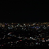
When they turned on the searchlights, it wasn’t as spectacular as the artist’s conception. If there had been more haze, it would have been better. But I started taking pictures, and with some more experimenting, I found that by pushing the exposure time up to 6-8 seconds, I could get the lights to show up pretty nicely. So I took several photos looking toward the marathon start near downtown, and several more looking toward Santa Monica.

We looked at the lights for a little while before we had to head back down so we could be out of the park before the closed the gates at 10:30. On the way down, I stopped and took one more picture of the lights, this time with the mountain blocking the city lights. For that shot, I put the exposure up to 15 seconds, since I didn’t have to worry about city lights being overexposed.

On the way down, we took the fire roads most of the way. It was a little longer, but very easy to follow in the dark. And I got to try out the uber-powerful little flashlight I got last November, after Karina and I got caught in the dark on the way back from Cucamonga Peak. It worked quite well, so I was happy. This was a pretty fun little adventure.

3/7/2015

Mt Lowe

Filed under: — stan @ 4:17 pm

I’ve been wanting to hike to the actual summit of Mt. Lowe for some time. I did it once, back in about 1985 or so, but that time, we started at Eaton Saddle, over by Mt. Wilson, so it was a very easy hike. This time, we were going to do it the harder way, starting at Lake Ave in Pasadena. Still, it turned out to be quite a bit harder than I’d anticipated.

The hike up to Echo Mountain was pretty easy. We’ve done that plenty of times before, and there’s not much to it. From there, we headed up the Castle Canyon trail to Inspiration Point. I’ve only done that once before, so I didn’t remember much about it. I didn’t remember that the hike from Echo Mountain to Inspiration Point is actually a bit harder than the hike to Echo Mountain. And it’s really quite steep at the end. But we made it just fine, and spent a few minutes looking at the view from up there before continuing on to Mt Lowe.

According to the map, it’s about 1 3/4 miles from Inspiration Point to the top of Mt Lowe. And as it turned out, it was reasonably steep, too. The trail wraps around the north side of the mountain, and there was even some snow on the trail there. But when we got to the top, there was a bench to sit on, and a very nice view in all directions. Looking down into the valley, I could see the Caltech campus, so the net time I’m stair-climbing at Millikan Library, I’ll have to take a minute to look up and see which peak is Mt Lowe.

On the way down, I fell once. It was the usual thing of slipping on some sand on a steep part of the trail. But this time, after slipping just about a foot, my foot caught on a rock, and I ended up rolling forwards. For a brief moment, I thought I might end up rolling down the hill, but I was able to stop the roll and avoid going over the edge of the steep slope. Still, my hat came off and rolled down the slope, where it ended up impaled on a yucca plant. I had to walk down to the next switchback, which was below the yucca plant, and then I was able to climb up on a tree and rescue my hat by knocking it loose with one of the hiking poles. Sheesh. But I figured that Indiana Jones never left his hat behind, either.

When we got back down, we had 12 1/2 miles, and I know I’m going to be sore from this. Here’s the route map and the elevation profile.

http://1134.ddns.net/routemap.php?xmlfile=MtLowe

2/16/2015

Jones Peak

Filed under: — stan @ 3:53 pm

Since it’s a government holiday, we have the day off, so I went hiking with Karina and Erin from my office. Our destination was Jones Peak, which is just a little mountain in the front range of the San Gabriels, just above Sierra Madre. The trail is not very long, but it is reputed to be much harder than it seems like it should be.

Like the trail up Mount Lukens, this trail didn’t fool around. It was steep from the start. There was just a short walk up into Bailey Canyon before it turned and started switchbacking up the side of the canyon, before coming out at the top of the ridge connecting Jones Peak and the main mass of Mount Wilson. From there, it was just a short, but very steep climb up to the actual top of the mountain. There wasn’t anything much on top, but the view was very nice.

On the way down, we took a look down a little side trail. It went to the ruins of a small cabin. Since it’s in Bailey Canyon, someone had taken the trouble to make a up a plaque proclaiming that the cabin had belonged to George Bailey from “It’s a Wonderful Life”.

A bit farther down the trail, we stopped at a scenic overlook with a couple of benches. One of the benches was very tall, and our feet didn’t reach the ground below it. That was when I noticed the small plaque on the bench saying that it “…meets or exceeds All NBA standards”. Heh. It was a nice hike.

1/3/2015

Another attempt at Strawberry Peak

Filed under: — stan @ 4:26 pm

The trail up Colby Canyon to Strawberry Peak was the first hike I ever did in the San Gabriels, back in 1983. I’ve been back a couple of times since then, most recently in 2007, when we didn’t make the summit because we had Lucinda with us, and she was only 8 years old at the time. Since then, Colby Canyon was within the burn area of the 2009 Station Fire, and the trail has been closed until just recently. So I wanted to try it again.

The trail up the canyon is fairly steep, but it was easy to follow. It looked as if some maintenance had been done on it recently. The canyon itself looked quite a bit worse for wear. Places that used to be groves of big trees were bare, with just a few blackened stumps. But it was a pleasant hike up to the saddle between Strawberry and Josephine Peak.

The trail from the saddle up to the peak basically follows the top of the ridge, and there are two short sections where it is necessary to scramble up the rocks. This was what I’d always liked about this mountain, since it made it more interesting. Also, it reminded me of when I was a kid and we climbed Mt Washington in New Hampshire by the Huntington Ravine Trail. When we got to the first rock section, I had a look to pick a route, and I started up, with Karina just a bit behind me. We got about 2/3 of the way up the section when she decided that she was not going to do this. She just sat down on a rock and wouldn’t move. There was another group coming up behind us, so I suggested we see how they went up. The leader, Bob, came up to where we were, and the rest of his group looked at the rocks and said they weren’t going to do this, either. At that point, Bob volunteered to help guide Karina back down. He went down ahead of her and guided her feet to the footholds and generally tried to keep her calm. We made it back down off the rocks, and we walked back to the saddle. We had lunch there, and then we headed back down. Even though we didn’t make the summit, it was still a good hike and a pleasant day to be outside.

11/22/2014

Cucamonga Peak

Filed under: — stan @ 10:38 pm

Last month, when we climbed Mt Baldy, Karina had mentioned that she thought that the hike up Cucamonga Peak was actually a bit harder than the Baldy hike. Given how hard Baldy is, I was a bit skeptical. Still, I’d always wanted to try Cucamonga Peak, since it’s one of the highest mountains in the front part of the San Gabriels.

We started up the trail at 9:23 in the morning. It was promising to be a nice day, although we thought that there might be a bit of snow up high, since it had rained a tiny bit a couple nights ago. Starting out up Ice House Canyon, we passed by several cabins, and several more ruins of former cabins. Judging by the size of the boulders in the canyon that had pretty obviously fallen from high up, it was not surprising to see that some of the cabins had been destroyed. As we got a little higher up the canyon, we could see that there was a thin layer of snow on the south wall of the canyon. The north wall was in sunlight, and the snow there had melted. There were just some small patches in the shade of trees or rocks.

At that point, the trail got steep, and we went up a series of big switchbacks to climb up out of the canyon. And then we came out in Ice house Saddle. At that point, there were trails going off in different directions to climb various nearby peaks. It was here that I realized how cold it really was, and I put on my sweatshirt and sweatpants.

The trail to Cucamonga Peak goes around the side of Bighorn Peak, and the first part of the trail is across the north side of the mountain. There was quite a bit of snow there. The side of the mountain there is very steep, and the trail is just a narrow path carved into the steep slope. With snow on it, it was really kind of scary. I got out both my poles to use for balance and stability.

As we came around to the saddle between Bighorn Peak and Cucamonga Peak, the snow went away, although the trail was still crossing some intimidatingly-steep slopes. When we got to the saddle, we stopped and had lunch. From the sounds we were hearing, it sounded like the wind was blowing pretty hard higher up, so we figured that it was probably better to stop in the relatively-sheltered saddle for lunch. While we were there, another group of three hikers passed us. We had passed them on the way up Ice House Canyon, so I said we should make it our goal to catch them before the summit.

Leaving the saddle, the trail started up some more steep switchbacks, including a couple of crossings across a big scree slope that kind of gave me the willies. Fortunately, it was on the west side of the peak, so there was no snow there. There was more snow farther up the trail, but the north-facing slopes there had a fair number of big trees on them, so it didn’t feel so exposed. We caught up with the other group just a short distance below the summit.

At the top, I made a point to climb up and stand on top of the highest rock, just, you know, because. We had a look at the view down into Cajon Pass, where we’d been on the office field trip last week. I was particularly impressed by how steep and rugged the south face of Etiwanda Peak was. After a few minutes, the other group came up to the summit, and we got them to take our souvenir picture with the view. I also gave them some of my water, since I wasn’t going to use all that I’d brought along.

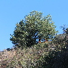
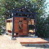
When we started back down, we made much better time than on the way up. It first, I thought we’d make it back before sundown, but we really missed that extra hour of sunlight that we had for Baldy last month. And sunset came when we were still about a mile from the end. At that point, i was glad that I’d thought to put a flashlight in my pack. It wasn’t a particularly bright one, but it helped. And we made it back to the end. On the way home, we wondered what had become of the group we’d seen at the top, since we didn’t see them at all on the way down, so they must have come down much later than us. Anyway, it was a fun hike, and yes, I agree now that it’s harder than Mt Baldy. I also think that a hike this long was perhaps a bit over-ambitious for this time of year. We really didn’t like walking that last mile in the dark. Still, it was a good time.
10/18/2014

Mt Baldy 2014

Filed under: — stan @ 7:33 pm

Last year’s government shutdown involved a good bit of hiking in the local mountains. Since there was no furlough-cation this year, we had to take a weekend day to go climb Mt Baldy. We wanted to do it before November, since it’s going to get cold up there, and there could be snow. So today was the last available day in October.

Like last year, I went with Karina from my office. We went up to Manker Flat to the trailhead. On the way up there, I collected a new animal crossing sign for my collection. When we started up the trail, we got a nice view of San Antonio Falls. Even with the drought, there was still a little bit of water going over the falls. Just hearing running water is such a novelty for us these days. We also heard a woodpecker, and we were lucky enough to see it going at the trunk of a dead tree.

Because it was Saturday instead of a weekday, there were a lot of people on the trail. That was all right. It was just strange, since last year’s hikes left me with the impression that all these trails are deserted. There was a small crowd at the hut about halfway up the mountain. And a very friendly Golden Retriever named Butter, who begged snacks from everyone there.

Leaving the hut, we walked across the bowl to the place where the trail climbs steeply up the ridge to the south of the summit. In the bowl, there is a big field of boulders, and it’s pretty obvious that they all fell from the crags at the top of the ridge. I couldn’t help but wonder what that must have sounded like.

The last part of the climb to the summit was hard. Just as hard as it was last year. But we made it, and we settled in for lunch on top of the mountain. Just us and about fifty other people. At least with that many people up there, there were lots of people for the bees to bother, so they didn’t bother us so much as when we were the only ones there.

On the way down, I stopped to take a picture of the waning crescent moon hanging just over the rocks below the summit. And I also got some pictures along the trail. I’ve decided that there are parts of the Devil’s Backbone trail that really give me the willies. But that’s all right. We made it down just fine. At the ski area, they were getting ready for ski season. There were some crews practicing rescuing people from the chair lift, and there were CPR dummies spread out on a blanket nearby. We went in the restaurant so I could refill my water bottle. And we got a picture, looking back up at the summit. Then we started down the service road back to Manker Flat.

Like last year, the service road seemed to go on forever. It’s long. But I was expecting that this time, so it was all right. And we made it back to the car just fine. According to my little GPS thingy, it was 4 1/4 miles from the start to the top, and it was 10.9 miles for the whole loop. Good fun.

10/11/2014

A lot of Nowhere

Filed under: — stan @ 6:49 pm

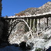
Last year, I finally got to do the hike to “The Bridge to Nowhere”. And today I got to do it again. The main difference this time is that it was a Saturday, rather than a Friday, and there was no government shutdown in effect. Last year when we did this, the place was deserted. We saw just a handful of people on the trail. But today, when we got to the trailhead, we had to park about a quarter-mile back down the road, since the little parking lot was completely full.

I’d gone up there with my hiking friend Kathy, and we were going to meet up with my stair-climbing friend Crystal and her boyfriend Barry. When I saw all the cars there, I thought it was going to be hard to find them. But when we parked, it turned out they were in the car right in front of us. That was convenient.

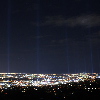
We started out down the trail. The first time, I didn’t really know what to expect, so it was easier this time. I knew the basic pattern for following and finding the trail, and we made good time. It only took us a little over two hours to make it to the Bridge. When we got there, the bungee-jumping people were out in force. It was a far cry from the deserted bridge I remember from last year. We crossed, and then followed the trail down into the gorge below the bridge so we could watch the bungee jumpers. Here’s a sample:
We had lunch down there in the gorge, and then we headed back. The hike back went pretty fast. It was a perfect day, and all around, it was a fun time.
Powered by WordPress