The St Francis Dam Disaster
 |
 |
 |
 |
 |
 |
 |
 |
 |
 |
 |
Back in 1978, I rode in the Bouquet Canyon Road Race, which was a bicycle race that went up Francisquito Canyon, across through Green Valley, and back down Bouquet Canyon. And at the time, I remember us riding up the canyon, and then, where the road went through a narrow spot, I saw great chunks of concrete next to the road. It was obviously the rubble from some great structure that had met an untimely end. So, years later, I looked it up and read about the St Francis dam and its collapse in 1928. And today, the Obscura Society was doing a tour of the site.
We met up at the fire station that is below the dam site, and next to DWP Power Plant #2. They had a small exhibit with photos of the dam both before and after the collapse. Our guide for the tour was Ann Stansell, who has studied the disaster, and who wrote her thesis about it. After looking at the photos and at the power plant, we all headed up the road to just above the dam site.
The old road through the canyon that I remembered riding on had been washed away in about 2005, and a new road was built around the washed-out section. So we met up at the top of the abandoned section of the road, and then we walked back down the canyon to the actual dam site. Along the way, we saw the foundations of a small hotel that had stood in the canyon before being flooded out when they started filling the reservoir.
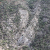
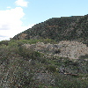
When we got to the dam site, we could see the big piles of concrete rubble that I’d seen in 1978. It was all more overgrown now, but still an impressive pile of rubble. While we were standing there, I had a look at the west wall of the canyon. That was the rock that was implicated in the collapse, as it is a soft rock that I was able to break apart with my hands. In the final report on the collapse, it was described as “a reddish conglomerate which, even when dry, was of decidedly inferior strength and which, when wet, became so soft that most of it lost almost all rock characteristics.”
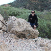
The group was going to climb up to the remains of the wing dike on the hillside above the west wall of the canyon, but before doing that, I followed Sandi down into the rubble field to see the big chunks of concrete.
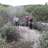
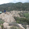
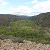
After looking at the rubble close-up, I headed up the hillside to catch up with the group. They’d said that it was steep, and kind of a hard climb. But I figured it couldn’t be much worse than climbing skyscraper stairs, and I was able to catch up with them. And at the top, we got to see the remains of the wing dike. We walked out to the end of it, and from there, we could look across the canyon and visualize what the dam looked like when it was still standing. It was really pretty large. Ann also pointed out that the trees growing in the part of the canyon that used to be the reservoir are much greener and thicker than the ones below the dam site. She said that during the few years that there was a reservoir there silt collected on the bottom, and apparently the trees like that.
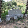
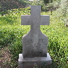
Leaving the dam site, we headed downstream a few miles to see the Ruiz family cemetery. A large number of the Ruiz family members were killed in the flood, and they were all buried there. The cemetery itself is on a small hill, so it was just above the level of the flood waters.


June 7th, 2017 at 1:37 pm
Nice pictures. I have been to the dam site several times, but hadn’t seen the graves at the ranch below. If you haven’t read Outland’s book, it’s very good. Also, see the paper done by J. David Rogers on the analysis of the failure investigations and his own analysis. Take care. DRL