Mt Lukens
 |
 |
 |
 |
 |
 |
 |
 |
 |
Mt Lukens is the highest point within the city limits of Los Angeles, and as such, it’s home to a lot of communications equipment for the Department of Water and Power, and other things like that. Since the seismic network uses some of the DWP network, we have a microwave link up there from the Seismo Lab. So I was curious to see it. I read a post on a hiking blog about climbing this mountain, and it sounded like a fun hike.
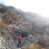
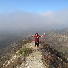
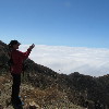
Karina is training for the New York Marathon, so she was busy going running, so Kathy and I did the hike. We started out from Deukmejian Wilderness Park in Glendale. The trail started out up the wash in the park, but quickly turned right and went up a steep ridge. The first couple miles were very steep, and pretty soon we were above the clouds. It was kind of gray and overcast down below, but it was a perfect day up on the mountain.
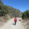
At the top of the ridge, the trail turned into a fire road for a bit along the top of the ridge before we met up with the Mt Lukens road. From there, it was an easy mile or so up the road to the top. At the top, we spent a few minutes looking at the view. To the south, it was just clouds, with some other mountains poking up through them, and to the north it was clear.
Going down, we took the Rim of the Valley trail, which came down a different ridge a bit west of the ridge we’d hiked up. The only really tricky part of the trip down was finding the turnoff, since the main trail goes down to Haines Canyon, and we needed to take the cutoff trail to get back to Deukmejian Park. The saving grace of the southern California mountains is that there are basically no trees, so it’s easy to see the different trails and where they go. So we turned off and headed down toward the park.
At one point, the trail went down into a canyon where there was actually a small stream. It was just a trickle, but it was actual running water. And there were big trees growing at the bottom of the canyon. From there, we had to climb up and out to get over the next ridge, and then we could see where we’d started. The last part of the route was an easy walk back down Dunsmore Canyon to where we started. In the end, it was nearly 10 miles in all, but it was a nice day, so it was a good time.
Here’s the route map: http://www.1134.org/routemap.php?xmlfile=mtlukenshike

