Limestone Canyon and The Sinks
 |
 |
 |
 |
 |
 |
 |
 |
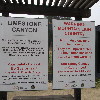
The May issue of the AAA “Westways” magazine had a short feature about things to do in Orange County, and one of them was to visit Limestone Canyon Nature Preserve, which is just off Santiago Canyon Road. I’ve been by there many times, and I never even knew there was something like that there.
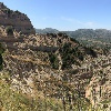
They spoke in particular about The Sinks, which is a place that people say resembles a small Grand Canyon. So of course I wanted to go see it. I recruited Jen from the office to come along, and we were on our way.
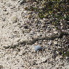
We hiked out by way of the Limestone Ridge trail. In the end, this turned out to have been a good choice. We had a nice marine layer in the morning, so it was overcast and cool for the first part of the day. That was where we saw the small gopher snake sunning itself on the trail.
We finally made it out to the first overlook point, where there was a small viewing platform to look into the Sinks. We looked and took a few pictures before starting back. We stopped at the spot of shade under a tree for a bit before we turned off on the trail to get to the viewing platform on the other side of the Sinks. Going to the second overlook added about a mile to the hike, but it was entirely worth it. The view from the second platform was clearly better than from the first one.
We came back by the trail through the canyon. By this time, the sun was out, and it was pretty hot. So it was good that we were down in the canyon for the trip back. There were a fair number of trees there, so there was some shade. The only bad thing was that I’d forgotten a hat, and I actually got a little sunburned on my neck. That was kind of shocking, since it’s only the fourth time in my life that I’ve ever been sunburned. I know that sunburn is just a normal hazard for most people, but it’s pretty unusual for me, so whenever it does happen, it’s pretty disconcerting. Still, it was a pretty nice hike, and a chance to visit a place I’d never heard of before.

