Stan’s Obligatory Blog

2/13/2016

Animal Tracks with Atlas Obscura

Filed under: — stan @ 5:31 pm

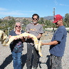
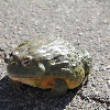
Today’s adventure was a visit to Animal Tracks in Agua Dulce with Atlas Obscura. Like the Working Wildlife tour last fall, this was another exotic animal tour. The tour started out with some smaller animals, including a tarantula, a scorpion, an African bullfrog, and a large albino Burmese python. After that, we walked up the hill to the main compound, where we met the other animals.

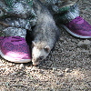
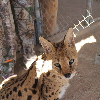
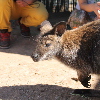
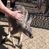
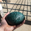
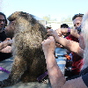
There was a fat little armadillo, some sugar gliders, a pair of ferrets, a serval, a kinkajou, and an enclosure with a wallaby and red kangaroo in it. The kangaroo had the softest fur I’ve ever felt on any animal. We also saw a pair of emus, and got to hold an emu egg, which looked a lot like a giant avocado. The last animal encounter was when they brought out a baboon, and the baboon walked up and down the long picnic table, letting us take turns grooming her.

It was a fun and entertaining morning.

2/7/2016

An Empty Freeway in Los Angeles is a Surreal Sight

Filed under: — stan @ 2:30 pm

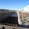
Back in November, we took a ride downtown to see the 6th St bridge close-up. At the time, it had been announced that it was going to be torn down and rebuilt, but the work had not started yet. But this weekend was when the actual work got underway. The plan was to demolish the section of the bridge where it passed over the 101 freeway, just east of downtown Los Angeles. As with the famous “Carmageddon” on the 405 freeway a few years ago, this was going to require closing a section of the 101 freeway for about a day and a half. The closure was supposed to start on Friday night, and run until afternoon on Sunday. So of course, I figured the Sunday morning Foothill Cycle bike club ride should go and see it. A closed and empty freeway is extremely rare in Los Angeles. In 30 years living here, I’d never seen one before.

I’ve only been on a freeway on my bike two times. Once was when I was about 12, and there was about a two-mile stretch of the then-future Mt Nittany Expressway that was built but not opened yet. My friends and I rode our bikes there just for the novelty of riding on it. The other time I was in 1977, when I was a bike racer. One day when I was out riding, I caught a flat-bed truck carrying a bulldozer on an uphill stretch. Somehow, that truck made the perfect draft*, and I was able to draft off it for a good 10 miles, doing 40-45mph the whole way. I knew that the road we were on turned into a freeway up ahead, and I wanted to see if I could keep up with it when it hit full freeway speed. When it got going, I was able to keep up, spinning as fast as I could in my top gear. We didn’t have bike computers then, so I don’t know how fast I was actually going, but it was fast. Fast enough that, even though I was 17, I somehow realized that this was probably Not a Good Idea. I figured I’d made my point and I should probably get off the freeway at the first exit. Still, that was an experience.

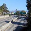
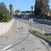
Our route took us straight south to Rosemead, and then west through Monterey Park to East L.A. and Boyle Heights. We got to where 1st St crossed under the 101 freeway. There was an on-ramp to the northbound 101 which did not say it was closed. Cars were getting on the northbound freeway there, but it was pretty obvious that there was none of the usual freeway sound coming over the sound wall. So we headed south a few blocks to 4th St, which crosses the 101 on an overpass. From there, it was easy to see the completely empty freeway. There was an off-ramp from the freeway up to 4th St, so I rode down it to see it close-up and ride a quick circle on the empty freeway. Wow, that felt weird.

Continuing on, we took the 4th St bridge across the L.A. River to downtown. Then we rode the bike lanes down Spring St and 7th St before turning north and heading up to Echo Park. We stopped for snacks at Chango Coffee. Our route home went up the Arroyo Seco bike path back to South Pasadena, and then home from there.

40 miles.

* Drafting a truck on a bike was tested by the Mythbusters, and they deemed it “Plausible”, but I can personally attest that it is “Confirmed”.

Route map and elevation profile

2/5/2016

My Pet Project Turns Ten

Filed under: — stan @ 11:00 pm

The USGS Earthquake Notification Service, also known as My Pet Project, went online to the public on January 31, 2006. It all started back in about 2000, when I was talking to someone from Caltrans, and he was asking if we could set up something where they could put in lat/lon coordinates of key freeway bridges and interchanges, and then be notified any time there was an earthquake within some distance of any of them. At the time, we couldn’t do anything like that. But then, fate intervened.

We have occasional cookouts at the office, and in 2003, I thought it would be nice if I could set up a web form for people to fill out online so that I knew who was coming and what food they wanted. I thought this would be sort of like a gift registry, so I went on Sourceforge and found a little gift registry program that someone wrote. I downloaded it, and I hacked it to make an online signup for our office cookouts. In the process of doing this, I learned a bit of MySQL. And then, when I was riding my bike in one morning, I realized that a database like MySQL could do something like what the guy from Caltrans had asked for. So I whipped up a simple database with some rudimentary geographic information, I plugged in the worldwide earthquake feed, and it started sending me earthquakes from all over the world.

I recruited a few ‘guinea pigs’ around the office to set up accounts in it for testing. They suggested other things they would like it to do. At first, it could only define geographic regions as lat/lon points defining a box. People asked for circles, and then arbitrary polygons. Drawing a polygon on the map and figuring out if a given earthquake fell inside it kept me thinking for a while, but I worked out a reasonable way to do it. And while all this was happening, my little system was being shown around to everyone, until the National Earthquake Information Center saw it and decided that it should be an official product of the Earthquake Hazards Program.

We had a few old-style mailing lists that were open to the public at that time. One for worldwide quakes M5.5 and over, and two for California quakes. One for M3 and higher, and one for M4. Those mailing lists formed the initial subscriber base. I wrote some scripts to port the mailing lists over, creating an account for each person with notification rules that would give them the same earthquakes they had been getting before. All told, this made for about 100,000 initial subscribers.

Now it’s been ten years, and it now has about 400,000 subscribers. Over ten years, that’s an average of about 80 new subscribers every day. Most days get about 30-35 new subscribers, but this goes way up after big earthquakes. The largest jump was about 75,000 new subscribers in the two weeks after the 2011 M9 Tohoku Earthquake in Japan.

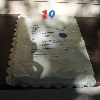
Because this all started from wanting to have an online signup form for the office cookouts, I thought we should have a cookout for the occasion. I made a cake, and we all gathered out on the patio behind the office. It was a nice time. And it’s still amazing to me that this thing I wrote that started out as a little Pet Project has turned into a thing. And that’s it’s used by 400,000 people. And in the end, I guess that’s the greatest satisfaction.
Powered by WordPress