Field Trip!
 |
 |
 |
 |
 |
 |
 |
 |
 |
 |
 |
A few weeks ago, Sue Hough sent an email out to the office to see who would be interested in a field trip to tour the San Andreas Fault in the Antelope Valley, a bit north of Los Angeles. The sights would be taken from her book, Finding Fault in California. As it turned out, there was quite a bit of interest. In the end, it was enough interest that we rented a 24-passenger bus and driver for the day so we could take the trip.
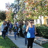
We met at the office early Wednesday morning, and then we headed out. We went past JPL, which is located right on the trace of the Sierra Madre Fault, and has a very nice, steep scarp right behind it. Our first real stop was the small fault scarp next to the McDonald’s at 1955 Glenoaks Blvd in San Fernando. This scarp was formed in the 1971 San Fernando Earthquake. I took the bike club there to see the scarp last June.
Continuing on up the freeway, we went through the 5/14 freeway interchange. This interchange fell down in the 1971 earthquake. It was rebuilt, and then fell down again in the 1994 Northridge Earthquake. Then we went up the 14 freeway, through the mountains, coming out in Palmdale. We went one exit farther up the freeway than we needed to, since that let us go through a somewhat-famous road cut on the freeway. It’s where the freeway crosses the trace of the San Andreas Fault, and in that cut, the rock layers look particularly jumbled and twisted from the motion of the fault.
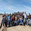
Heading east out of Palmdale, we went along the northern edge of the San Gabriel Mountains. We stopped for a photo-op at a place where some people put up signs on the road to mark the trace of the fault. Makes it really easy to find, when there’s a big sign pointing it out. This site was very near where Kerry Sieh did his first trenching studies on the fault, back in the ’70s.
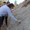
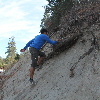
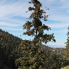
A little while later, the road started to climb into the mountains, still following the trace of the fault. We stopped at another road cut where the cut went right through the fault gouge. The side of the cut was basically packed sand and pulverized rock. Digging into it with our hands, there were some solid pieces of rock buried in there, but as Sue showed us, those solid pieces were actually shattered, and we could crumble them to sand in our hands. We also saw a tree there that was kind of bent at the top. There has been some research done on trees in that area that grow along the fault line. There are trees that show signs of having been broken off in past earthquakes.
In Wrightwood, we took one small side trip to look at some recent debris flows, and how the town has attempted to guide future debris flows to minimize damage to the town.
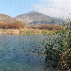
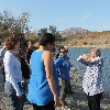
Coming down the east side of the mountain from Wrightwood, we ended up coming out by the 15 freeway in Cajon Pass. We took one more side trip to see Lost Lake, which is a small sag pond on the fault there.
This made for an interesting day of sightseeing. Have I mentioned lately that I really like my job?

