Pre-disaster sightseeing
 |
 |
 |
 |
 |
 |
Last Friday, I went to a talk at Caltech about debris flows, and how they are almost certainly going to happen this winter because of the Station Fire. The speaker made mention of one particular house in Sunland. She said that the house had been destroyed by debris flows in 1978, and that it was then rebuilt in exactly the same place. Because of this, it is expected to be destroyed again when the rains come. So of course, I immediately looked up the address and worked out a bike route to get there and see it.
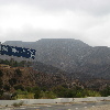
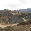
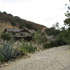
I took the direct route there, since I didn’t feel like riding through Burbank and Sun Valley on a weekday. And riding up Foothill Blvd through La Crescenta and Tujunga was no picnic, either. But I made it to the mouth of Big Tujunga Canyon and got to take in the charred mountain vista. It was impressive. Then I rode up into the little private neighborhood on the north side of the canyon. The fire had come down to within about 100 feet of the houses there, and the burned area looked pretty devastated. And when I found the house, I could see why it had been destroyed. There is a large drainage area above it, and it’s situated in a narrow part of the canyon. And there is no debris basin above it. Anything that comes down from that drainage gets funneled through the canyon where the house is. I suppose the owners know this. Aside from mud and rocks destroying the house every 30 years, it looks like a very pretty and idyllic place to live.
On the way out, I saw two news trucks parked at the mouth of Big Tujunga Canyon. The first rain of the season is predicted for tonight, so they may be setting up to see the first mudflows.
It was an interesting little sightseeing ride.
38 miles.
Addendum: Here’s the Google Maps view of the terrain there, and you can see that there are two big canyons north and northwest of the house, and both those merge into the narrow canyon where the house is. Check it out.

