Santa Fe Dam: aka Another bike ride to nowhere in particular
 |
 |
 |
 |
 |
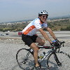
Today is the July 4th holiday. Lucinda is off at the Sierra Madre parade with her friend from school. And there’s no official bike club ride. So Susan and I made our own.
We started out from my house, and almost immediately, I got a flat.
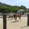
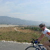
In Monrovia, we saw some people riding horses. The adults had big horses, and the kids had little kid-sized horses. Then we crossed the San Gabriel River and took the Santa Fe Dam bike path down around the top of the dam. We rode all the way to the far end of the dam just to see where the path went. Apparently, it just goes until the dam ends, and there’s just a little turnaround loop.
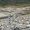
On the way back around the dam, we noticed the flood gauge on the inside slope of the dam. I guess the numbers indicate elevation above sea level.
We stopped for water at Encanto Park in Duarte on the way back. It was pretty hot. But it was a fun little ride.
37 miles.


July 5th, 2008 at 6:06 pm
The gauge indicates elevation in feet on the National Geodetic Vertical Datum.
Almost everything you’d want to know about the Santa Fe Dam is included in the project Water Control Manual, which is posted (with some annoying redactions) on the web site of the U.S. Army Corps of Engineers, Los Angeles District, Reservoir Regulation Section:
http://www.spl.usace.army.mil/resreg/htdocs/Publications.html
http://www.spl.usace.army.mil/resreg/htdocs/SantaFe/SnfeExternalDocument.pdf (10 MB PDF)