Columbus Day
 |
 |
 |
 |
Today is the Columbus Day holiday, which means a day off for government workers. So I went for a bike ride.
The ride was a sightseeing trip up into La Crescenta and Tujunga. In particular, I wanted to see Pine Cone Road, which figures prominently in John McPhee’s book, The Control of Nature. In the opening of the third section of the book, he describes a night of heavy rain and its resulting debris flow. The flow came down Pine Cone Road and buried the house at the bottom of the hill. But the house was no ordinary house. It had reinforced concrete walls and was nicknamed “The Fort”. It filled up with mud and rocks, but was otherwise undamaged. So I figured that this would make for a good sightseeing trip.
I rode up to La Cañada and met up with Erik. He works in my office, and so we both had the holiday off. We rode up to Rosemont and then turned up the hill.
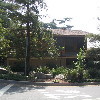
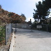
The sides of the Crescenta Valley are pretty steep. And they get steeper up near the top. This road was no exception. We took it all the way to where it ended, and then we turned to go west a bit to La Crescenta Blvd, which then went farther up the slope. Then, at the top, we saw Lower Shields Debris Basin. A quick right turn brought us to the base of Pine Cone Road, and to “The Fort”. The house looks pretty sturdy. In the book, McPhee mentions that when the owners rebuilt, they added a second floor and put the bedrooms upstairs. And the house is still there today.
In the book, McPhee also mentions the steepness of Pine Cone Road. He says it is “steep enough to stiff a Maserati”. Needless to say, I wanted to ride up it. It was steep, but not the steepest hill I’ve ever seen. It was probably about 20-25%. Still, it was a good climb up the top. At the top was Upper Shields Debris Basin, and also a commanding view.
Coming down off the hill, we rode up into Tujunga. This was for a quick side trip to see Elliott’s house from “E.T.” This house is also at the top of steep hill.
From there, it was all downhill. We took Tujunga Canyon down to where it turns into Honolulu. Incidentally, this is also where they had a temporary internment camp for Japanese-Americans in 1941 before they were shipped off to Manzanar.
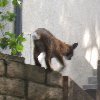
Continuing on down the hill, we went into Glendale, and then took a left on Chevy Chase to ride back up and over the hill. On the way up Chevy Chase, we saw a bobcat. This was the first time I’d ever seen one in the wild, if a suburban yard in Glendale counts as ‘the wild’. I took a couple of pictures of it to commemorate the occasion.
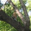
Continuing on Chevy Chase, we climbed the hill and headed down the other side, back into La Cañada. At the bottom, Erik headed for home, and I headed east, back into Pasadena. I took the ‘scenic route’ home, up to Mendocino and then home by way of side streets. Along the way, I came upon a hawk that had just killed a pigeon. It was standing on top of the pigeon carcass in the middle of the street. When it saw me coming, it picked up the pigeon and started to fly. It was apparently a pretty big effort to fly while carrying a dead pigeon, so the hawk just flew up into the first tree, and it just sat on a branch there. So I took a picture of it.
It was a fun ride.
43 miles.

